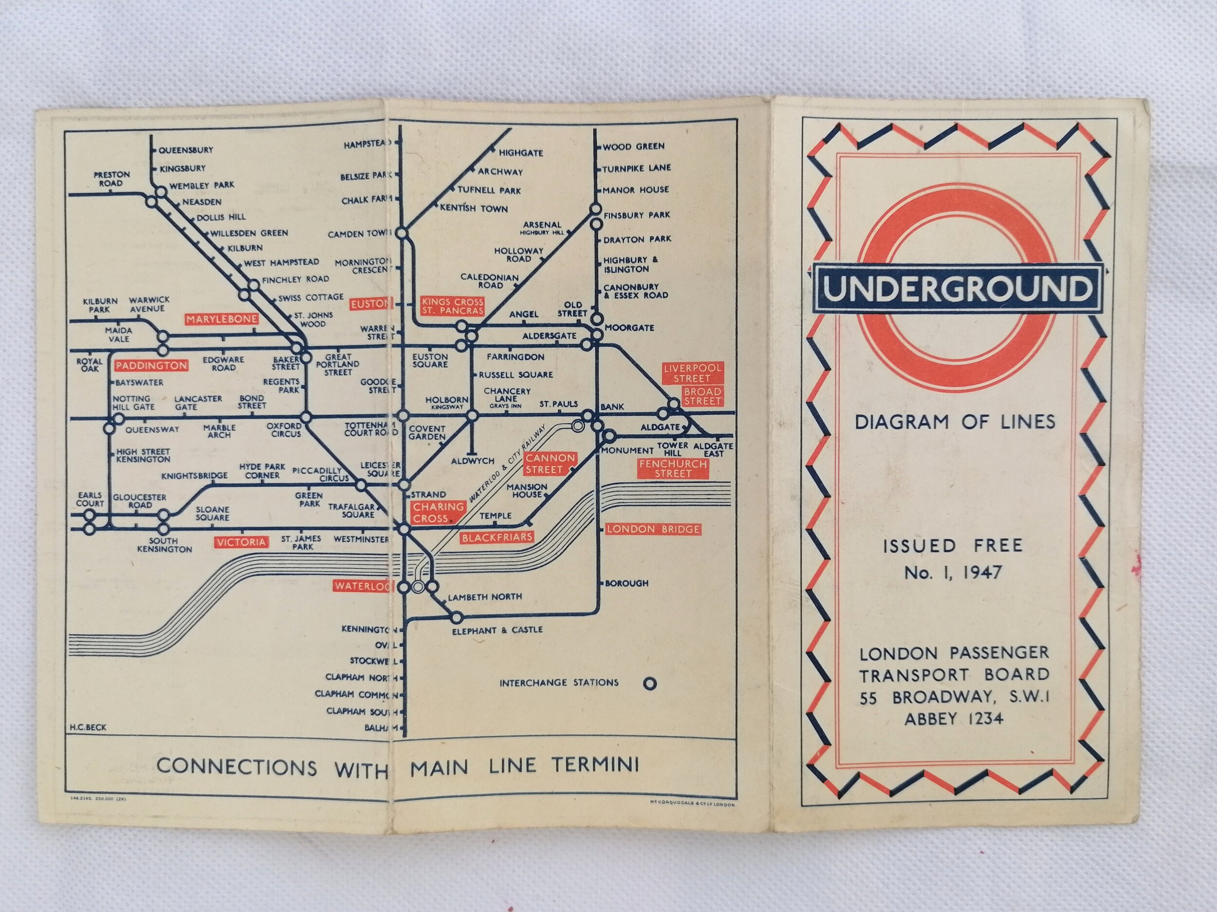
The First Underground Logo - 1913 London Underground Pocket Map
"Map of London - Underground Electric Railways - What to See & How To See it - Stations Everywhere" 1913
Printed by Johnson Riddle & Co Ltd for Underground Electric Railways of London (UERL). Paper pocket map folded as issued. Measures 36cm x 28cm when opened. Print Code 187 - 150M - 1-6-13. Lightly used in good condition. A few pencil annotations and a small 2cm separation at right edge along a fold. Some additional folding.
This colourful edition of the London Underground map bears a print code for June 1913 and sees an expansion in the geographical area compared with the 1908-1912 variants - which serves to include much more of the network including the East London Railway.
Planned extensions of the Bakerloo, Central and Hampstead tubes are shown as dotted lines. The latter two were, in fact, delayed by the onset of WW1 and not completed until the early 1920s. This edition also sees a change to the border colour, from green (1908-1912) to blue. The fainter background detail combined with the large geographical area achieve a much clearer map compared with the tiny and busy 1912 edition by George Phillip & Son.
This design saw 3 issues in 1913. From early 1914 the Underground map took on a much more sombre appearance, using fewer colours and poor quality paper on account of wartime restrictions. It wasnt until 1919 that separate line colours were reinstated and even later (1922) before the quality of the paper improved.
The cover features one of the first printed examples of the Underground Bullseye logo. This device was first conceived in 1908 for platform station name signs make them easier to see among the advertisements that covered the station walls. However, it wasn't until 1912 that the "UndergrounD" work mark was combined with the red disc to form one of the most enduring brand devices in history. The new logo first appeared on a 1912 poster by Charles Sharland. Maps and station signage followed in 1913.
FREE UK DELIVERY. Non-UK Delivery available, please request a quotation