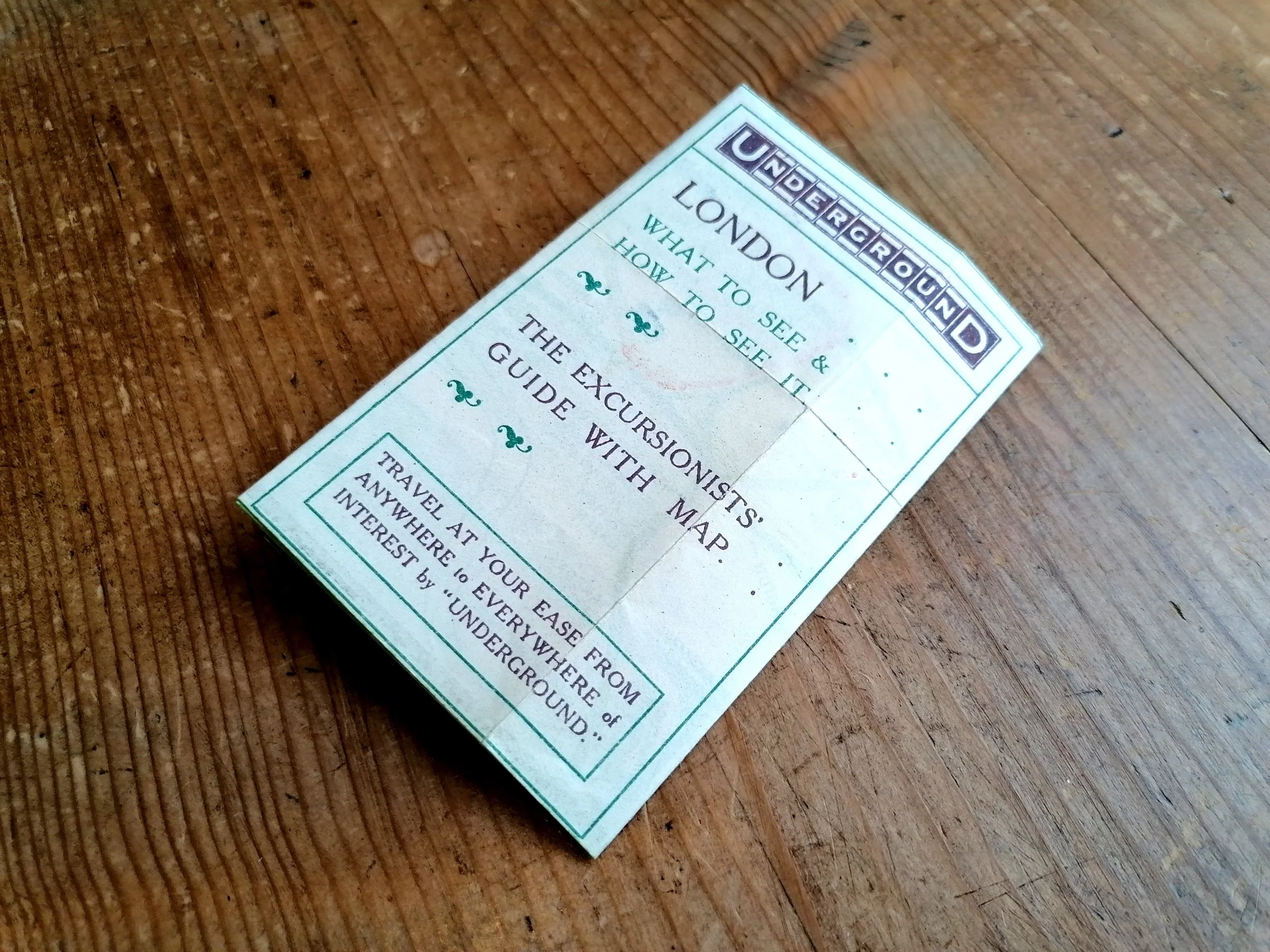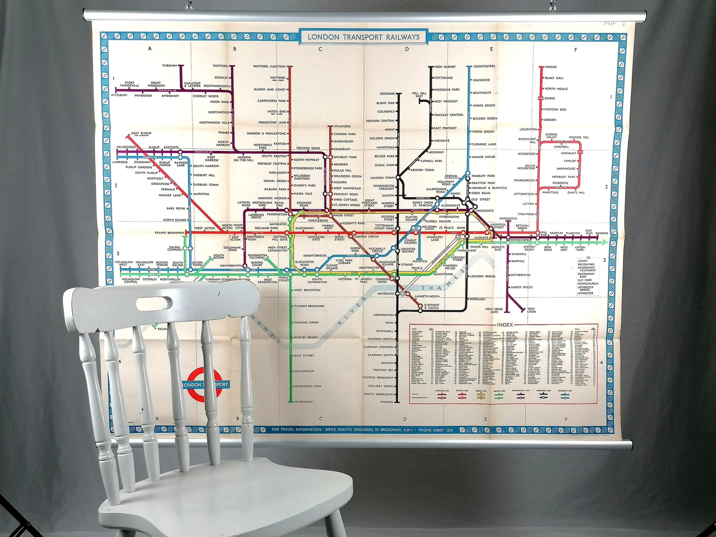


1952 London Underground Station Map - Quad Royal - By HC Beck
London Underground Station Map - Quad Royal - 1952
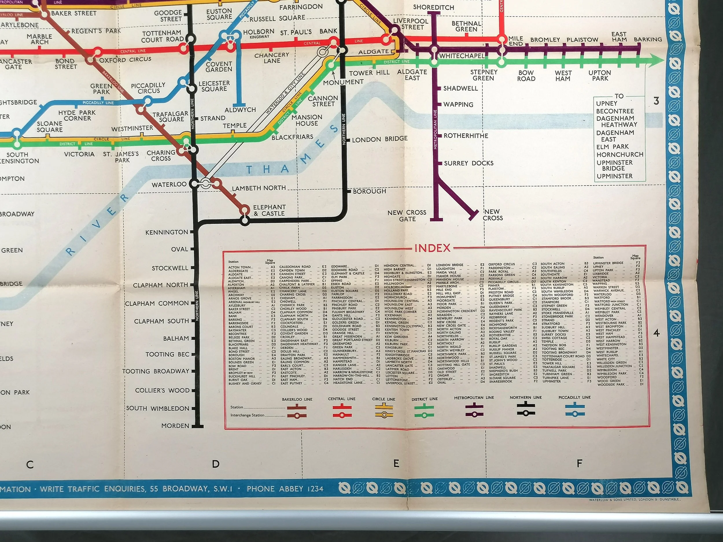
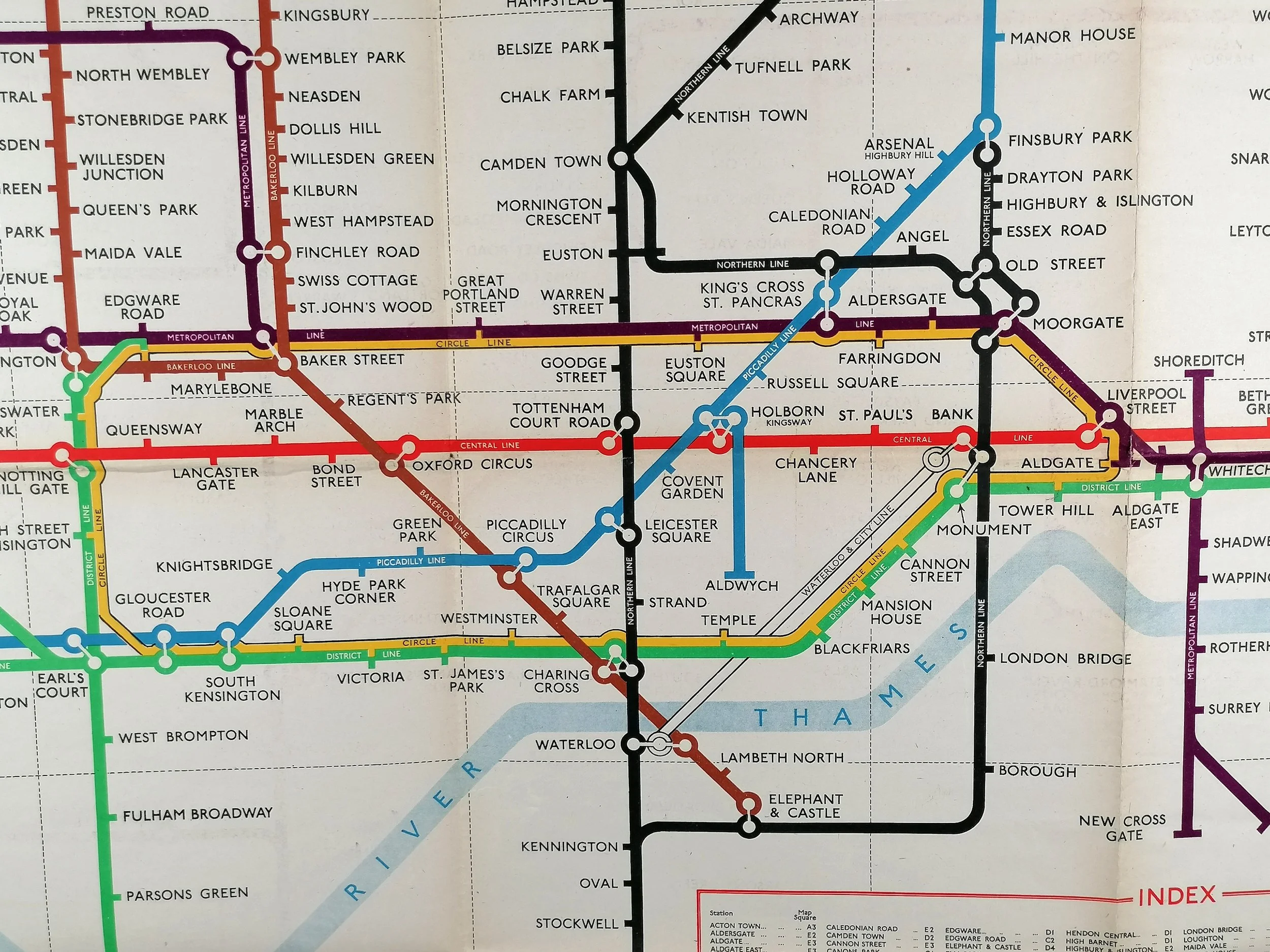
Designed by HC Beck. Printed by Waterlow & Sons for London Transport. Print Code: 252-319Z-5000. Quad Royal 127cm x 101cm (50 x 40 inches). Excellent used condition. Folded as issued. Some small holes at fold intersections. Some fraying at bottom edge.
This iconic London Underground ‘station map’ - as displayed on platforms and in ticket halls - is one of the most sought-after iterations of Harry Beck’s iconic London Underground diagram. Despite the print run of 5000 (as indicated by the print code), very few examples have survived, with most discarded upon the release of a new map.
Beck’s Favourite Design
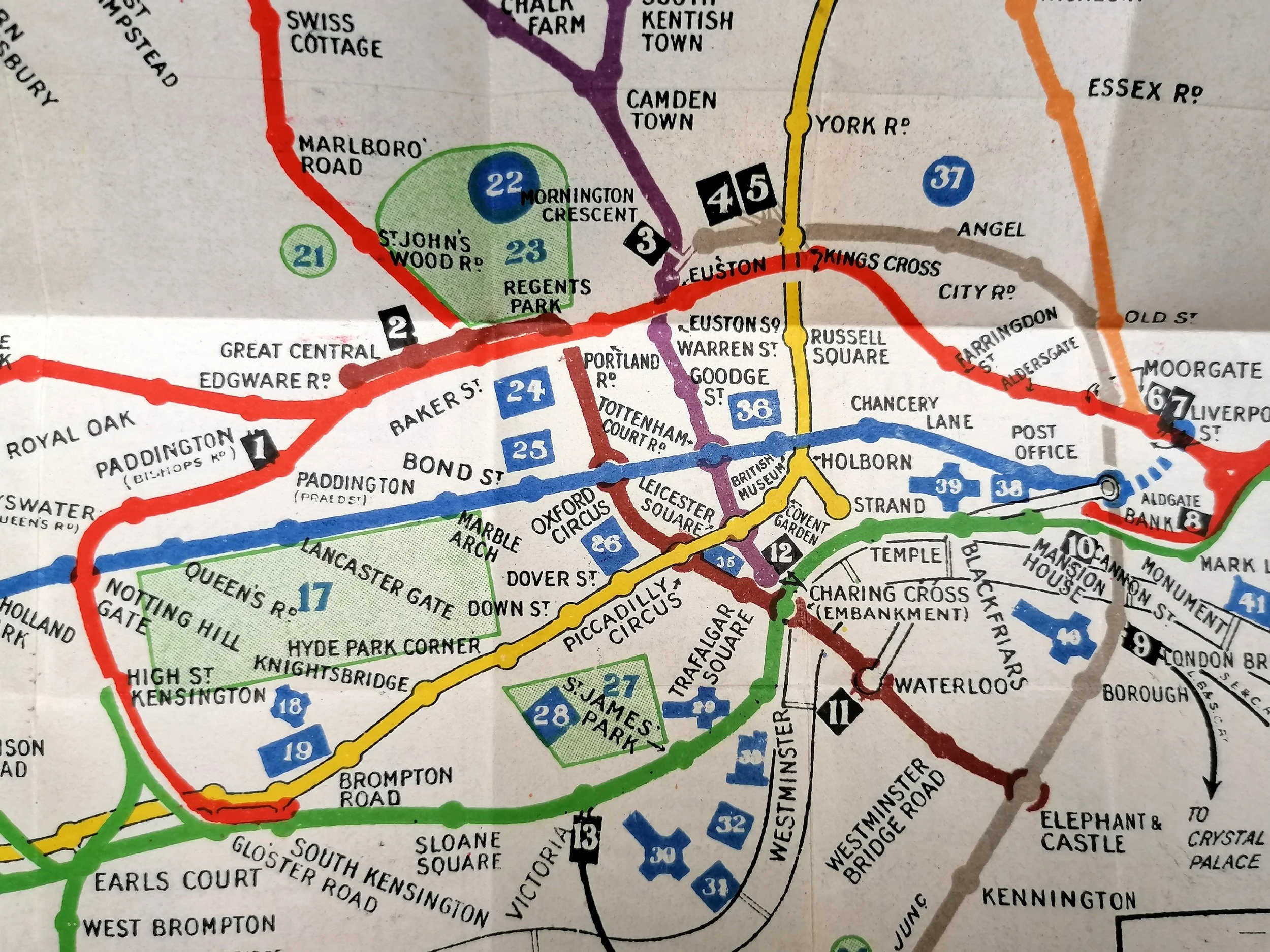
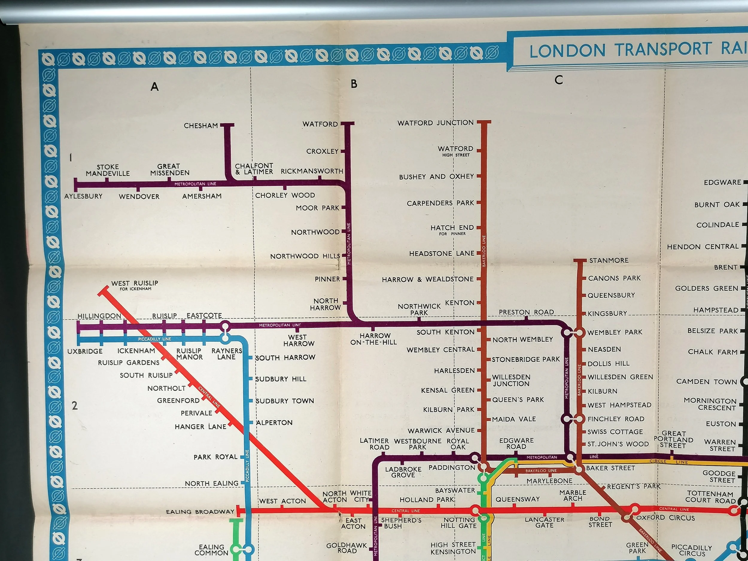
In the book ‘Mr Beck’s Underground Map’, Ken Garland writes about the 1949-1952 design “..He considered this to be perhaps the best of all versions of the Diagram, and it is not difficult to see why he thought so… At last able to eradicate all those features with which he had been unwillingly saddled by others. He had incorporated a most welcome touch of yellow for the Circle Line.. and achieved the degree of rectilinearity he believed appropriate to the Diagram as he had always conceived it.”
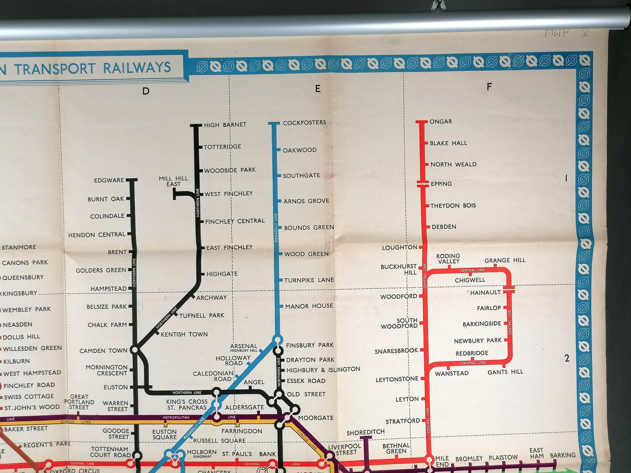
So Beck’s map was finally as he had always wanted it to look. Since 1937, the Metropolitan and District Lines shared the same colour (Green). The 1949-1952 design saw the Met’s original purple reinstated and, together with first appearance of the Circle Line in yellow, it makes for a much more attractive and vibrant map.
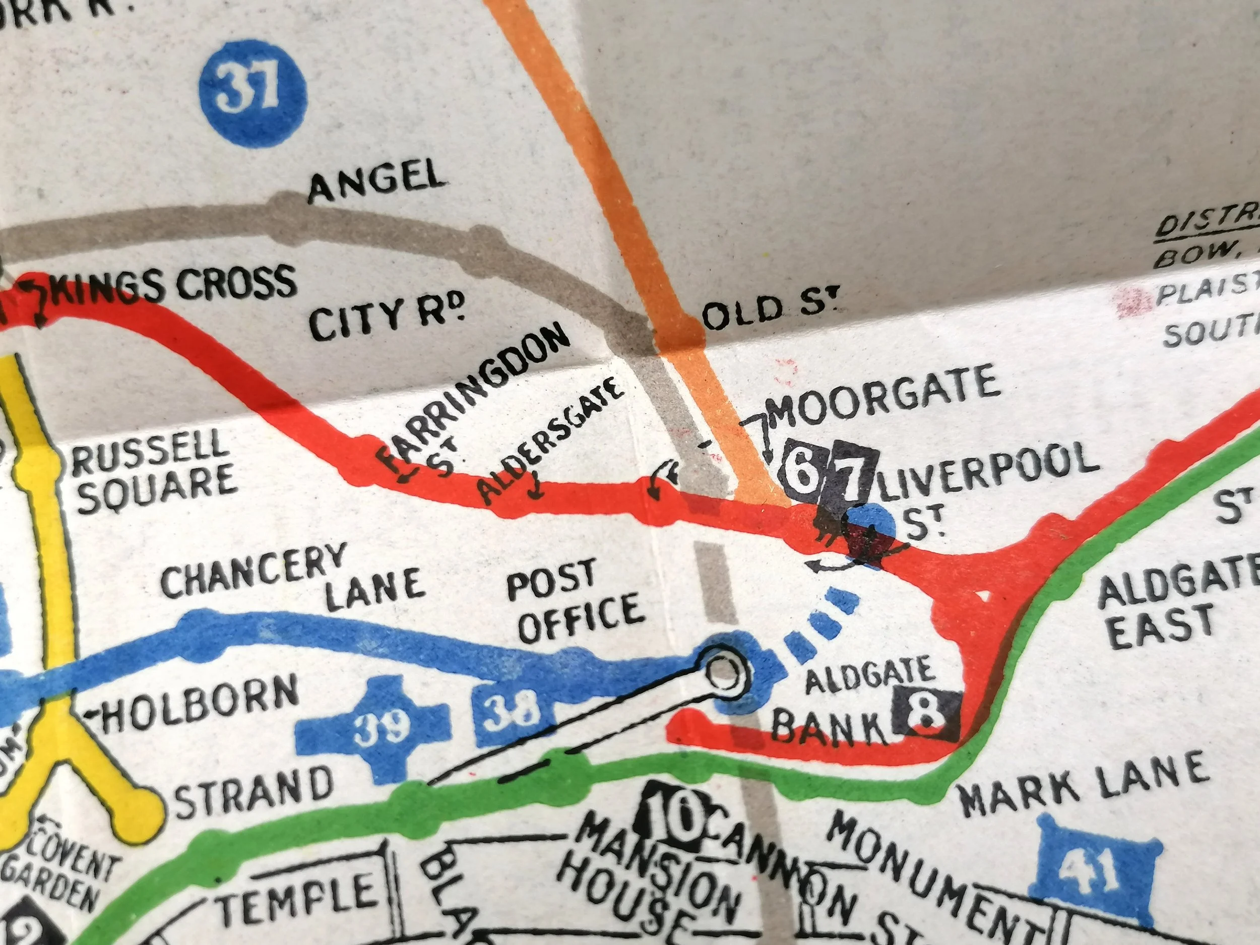
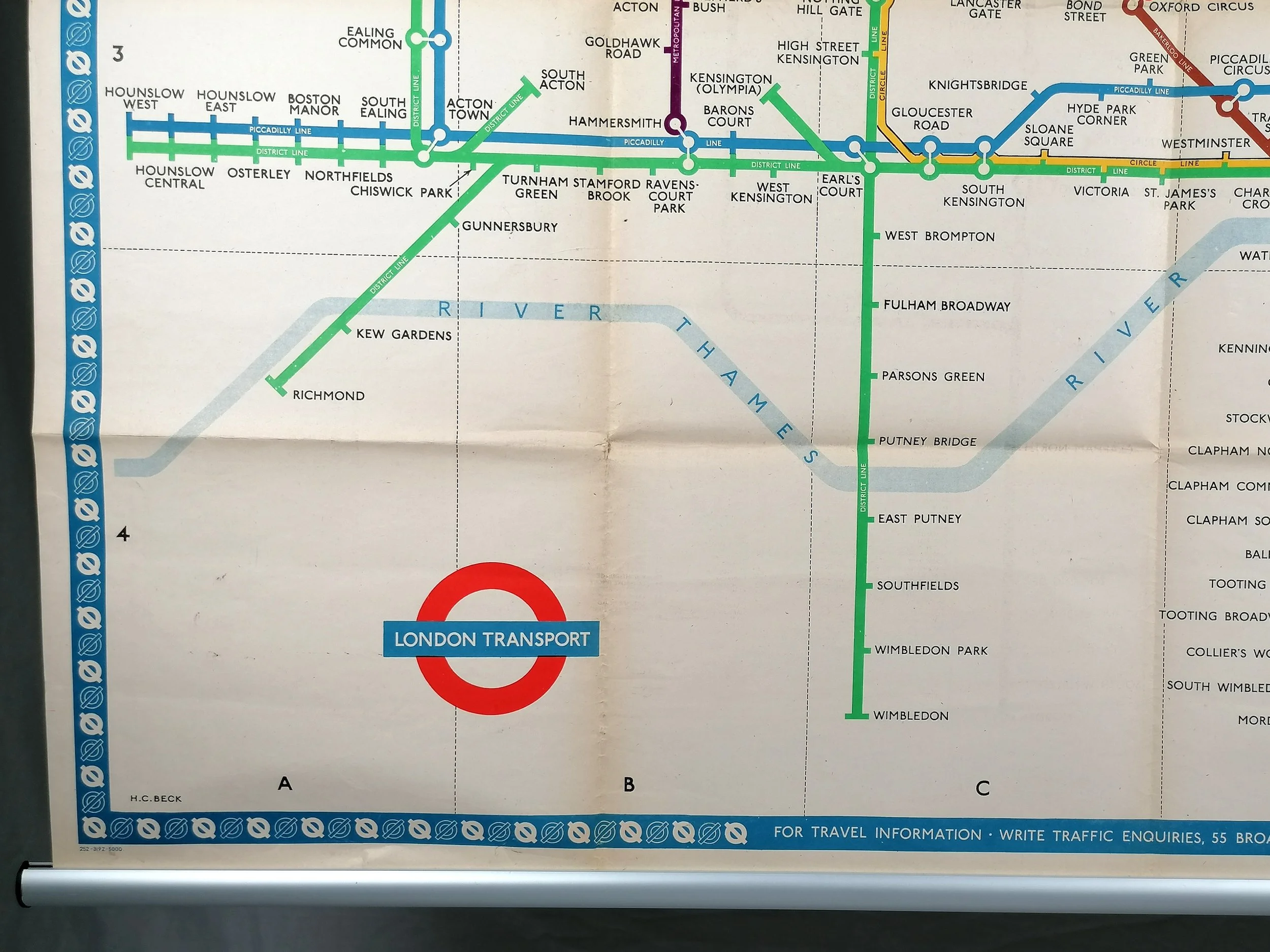
This example is a 1952 issue of the 1949 design. Whilst being almost identical, it benefits from the removal of the proposed Northern line and Bakerloo Line extensions. Contrary to his pursuit of the rectilinear, we also note Beck has redrawn a vertical back to a diagonal between Turnham Green and Richmond (District Line).
FREE UK DELIVERY. Non-UK Delivery available, please request a quotation
London Underground Station Map - Quad Royal - 1952
Designed by HC Beck. Printed by Waterlow & Sons for London Transport. Print Code: 252-319Z-5000. Quad Royal 127cm x 101cm (50 x 40 inches). Excellent used condition. Folded as issued. Some small holes at fold intersections. Some fraying at bottom edge.
This iconic London Underground ‘station map’ - as displayed on platforms and in ticket halls - is one of the most sought-after iterations of Harry Beck’s iconic London Underground diagram. Despite the print run of 5000 (as indicated by the print code), very few examples have survived, with most discarded upon the release of a new map.
Beck’s Favourite Design
In the book ‘Mr Beck’s Underground Map’, Ken Garland writes about the 1949-1952 design “..He considered this to be perhaps the best of all versions of the Diagram, and it is not difficult to see why he thought so… At last able to eradicate all those features with which he had been unwillingly saddled by others. He had incorporated a most welcome touch of yellow for the Circle Line.. and achieved the degree of rectilinearity he believed appropriate to the Diagram as he had always conceived it.”
So Beck’s map was finally as he had always wanted it to look. Since 1937, the Metropolitan and District Lines shared the same colour (Green). The 1949-1952 design saw the Met’s original purple reinstated and, together with first appearance of the Circle Line in yellow, it makes for a much more attractive and vibrant map.
This example is a 1952 issue of the 1949 design. Whilst being almost identical, it benefits from the removal of the proposed Northern line and Bakerloo Line extensions. Contrary to his pursuit of the rectilinear, we also note Beck has redrawn a vertical back to a diagonal between Turnham Green and Richmond (District Line).
FREE UK DELIVERY. Non-UK Delivery available, please request a quotation