

1910 London Underground Railways Map
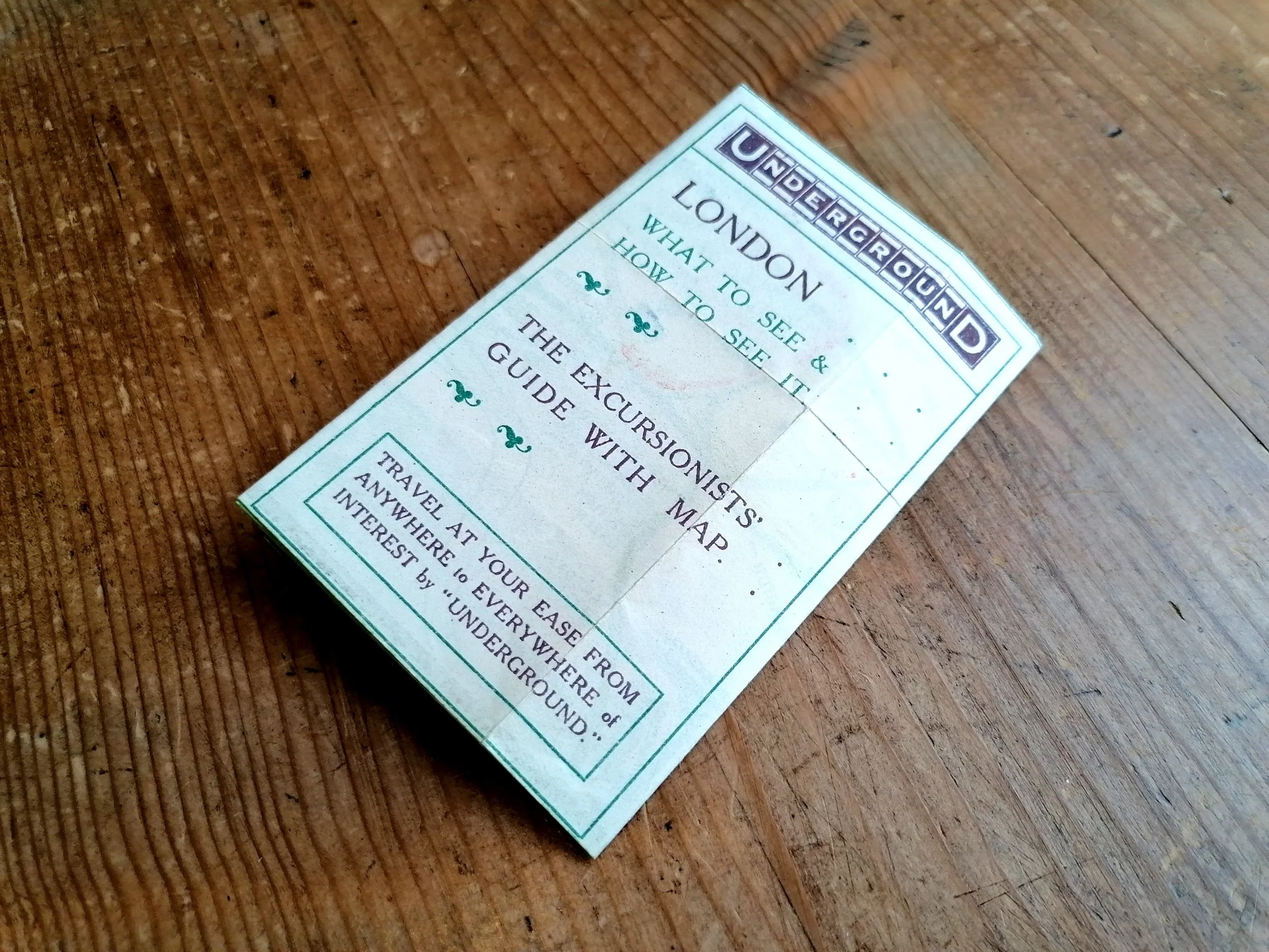
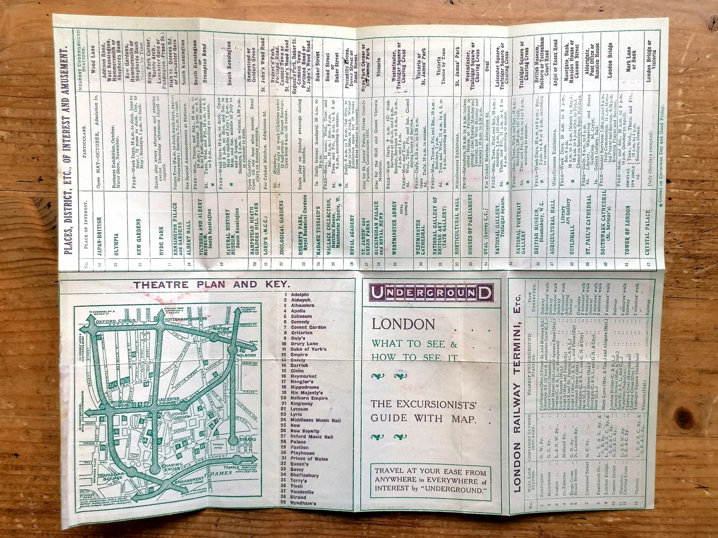
London - What To See & How To See It - The Excursionists' Guide with Map - Travel At your ease from anywhere to everywhere of interest by "Underground"
Printed by Johnson & Riddle for Underground Electric Railways of London (UERL). Undated circa 1910. Colour lithograph on paper. Travel and tourist information on verso. Size: 27cm x 22cm (unfolded). Condition: Excellent. Some additional folding (possible a guide book edition).
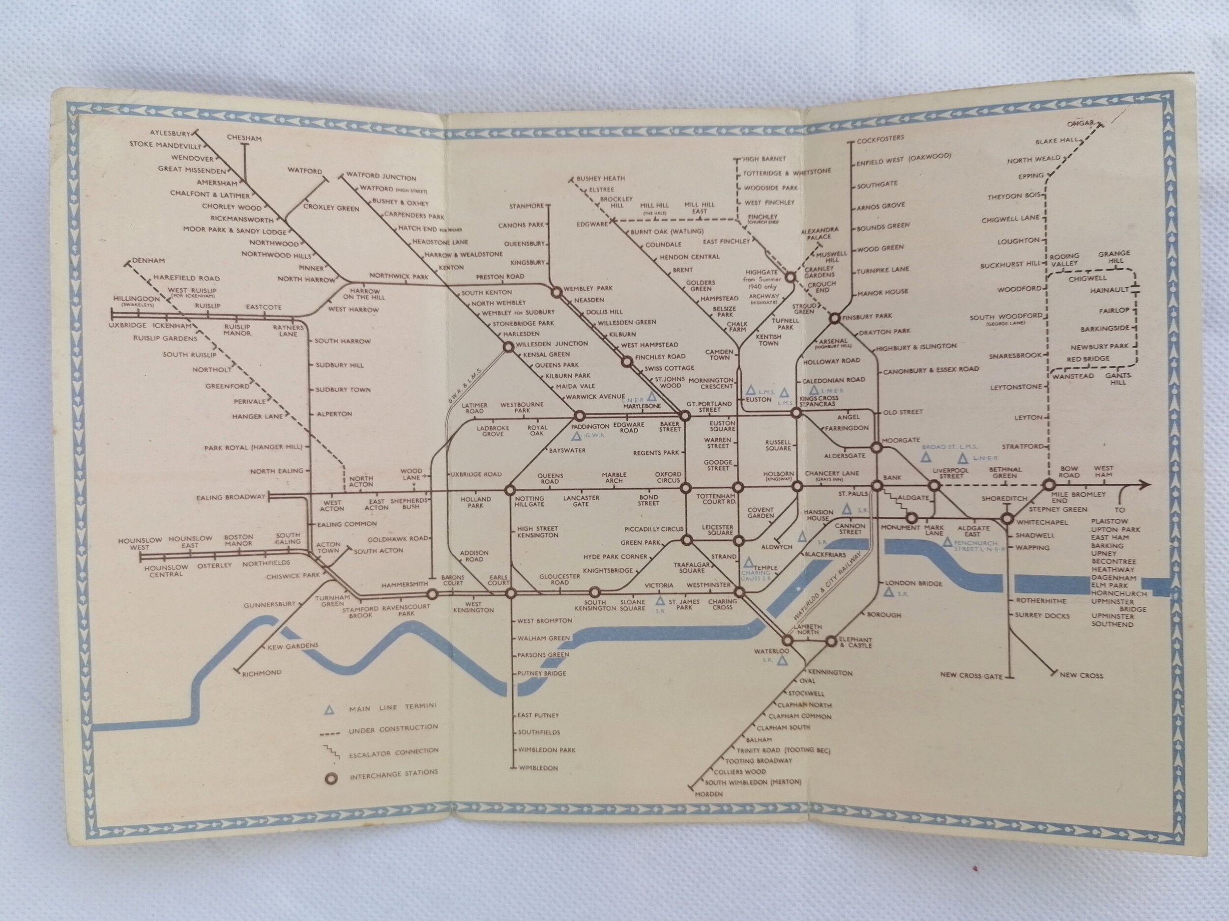
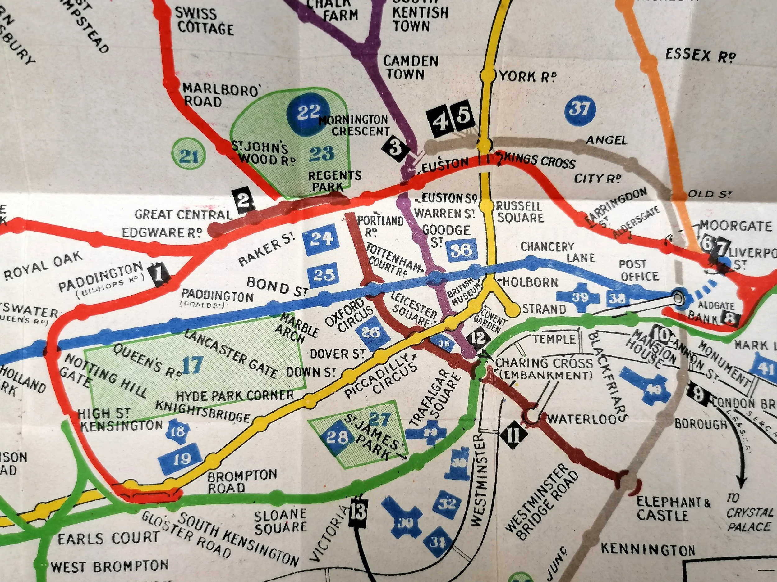
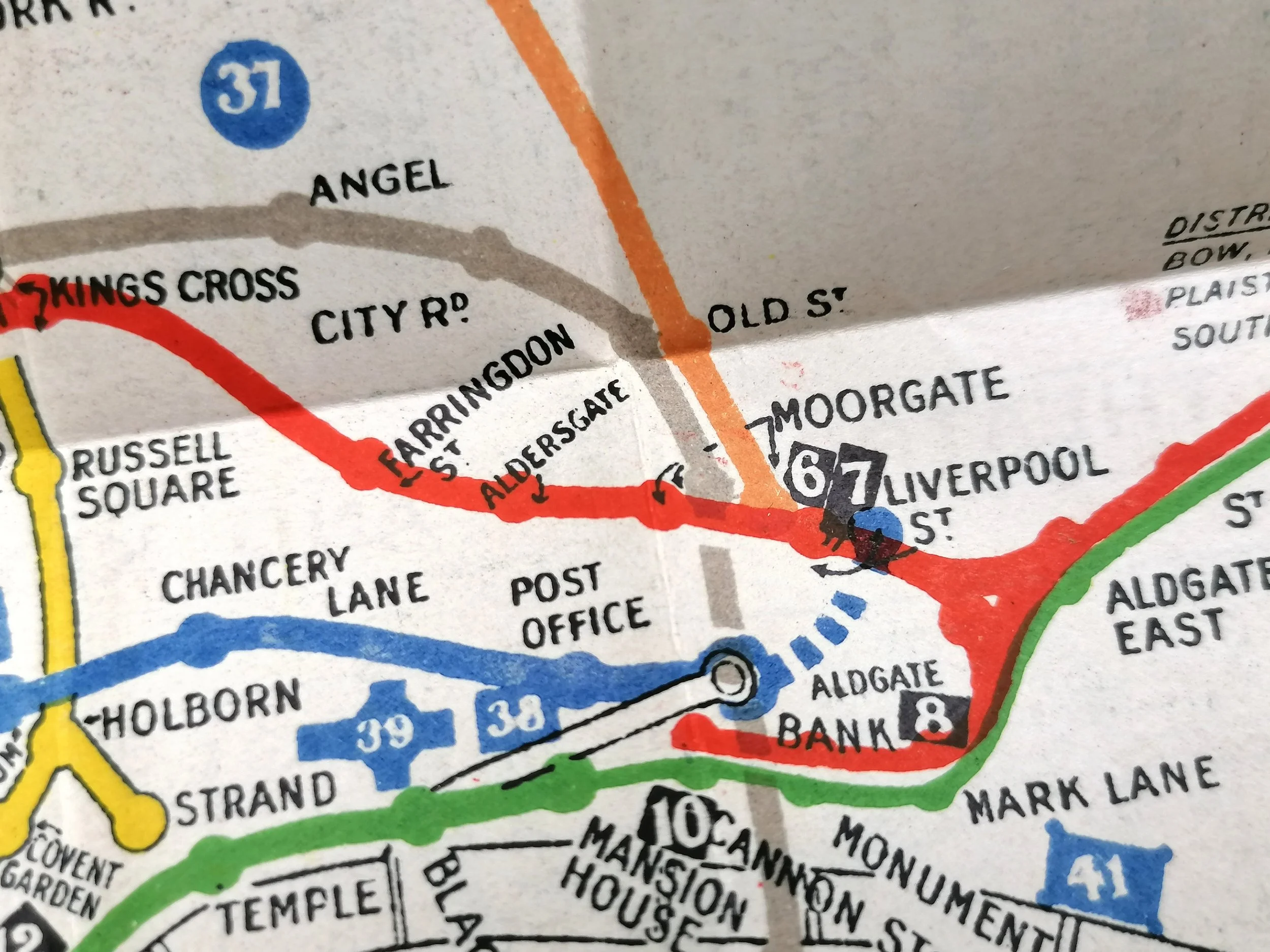
Whilst this map is strikingly similar to the first unified map of the London Underground, (issued in April 1908) this 1910 edition of the Underground map is a much cleaner design, with most street and background detail removed for clarity - leaving only the Thames and Parks. This edition was specifically aimed at the 'Excursionist' and has Theatres, parks, museums, mainline stations and other sights marked with number icons that are referenced on the rear. This issue is undated but Kingsbury & Neasden (Metropolitan) has yet to be renamed (late 1910) yet Aldersgate has been renamed (early 1910).
The early 1900s saw a rapid pace in the development of 'deep-level tubes' and by 1906, there were numerous Underground railway companies communicating with passengers in isolation to one another to the detriment of themselves and confused passengers. In 1907, the four main London Underground railway companies, unified by their dire financial situation, came together and agreed to promote their joint interests as a complete Underground railway system. In April 1908, the first all-inclusive map design of the London Underground was approved agreed to operate under a single brand - The first UndergrounD workmark was born.
London - What To See & How To See It - The Excursionists' Guide with Map - Travel At your ease from anywhere to everywhere of interest by "Underground"
Printed by Johnson & Riddle for Underground Electric Railways of London (UERL). Undated circa 1910. Colour lithograph on paper. Travel and tourist information on verso. Size: 27cm x 22cm (unfolded). Condition: Excellent. Some additional folding (possible a guide book edition).
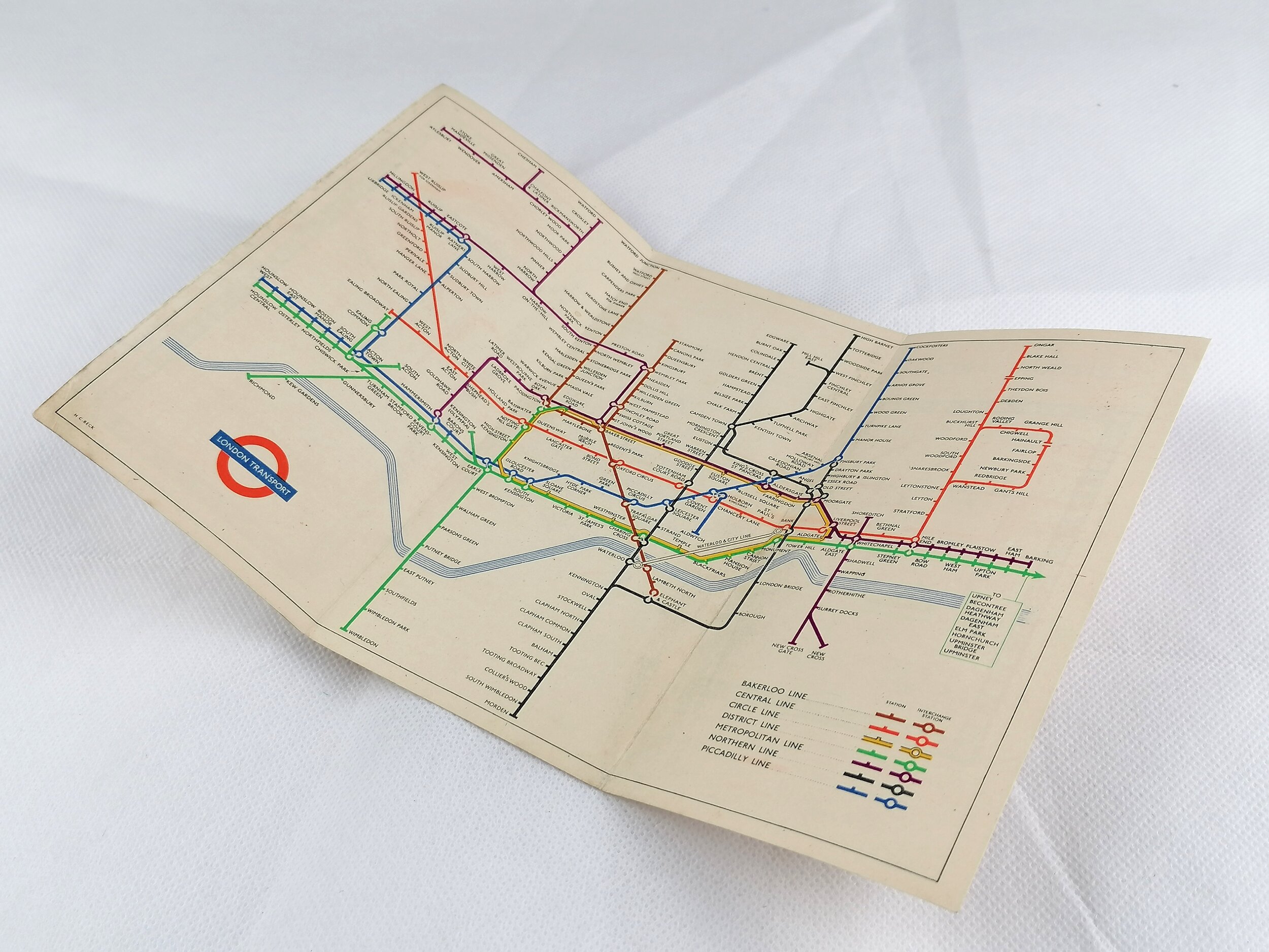
Whilst this map is strikingly similar to the first unified map of the London Underground, (issued in April 1908) this 1910 edition of the Underground map is a much cleaner design, with most street and background detail removed for clarity - leaving only the Thames and Parks. This edition was specifically aimed at the 'Excursionist' and has Theatres, parks, museums, mainline stations and other sights marked with number icons that are referenced on the rear. This issue is undated but Kingsbury & Neasden (Metropolitan) has yet to be renamed (late 1910) yet Aldersgate has been renamed (early 1910).
The early 1900s saw a rapid pace in the development of 'deep-level tubes' and by 1906, there were numerous Underground railway companies communicating with passengers in isolation to one another to the detriment of themselves and confused passengers. In 1907, the four main London Underground railway companies, unified by their dire financial situation, came together and agreed to promote their joint interests as a complete Underground railway system. In April 1908, the first all-inclusive map design of the London Underground was approved agreed to operate under a single brand - The first UndergrounD workmark was born.
Want one? let us know and we will contact you when we get another in stock.