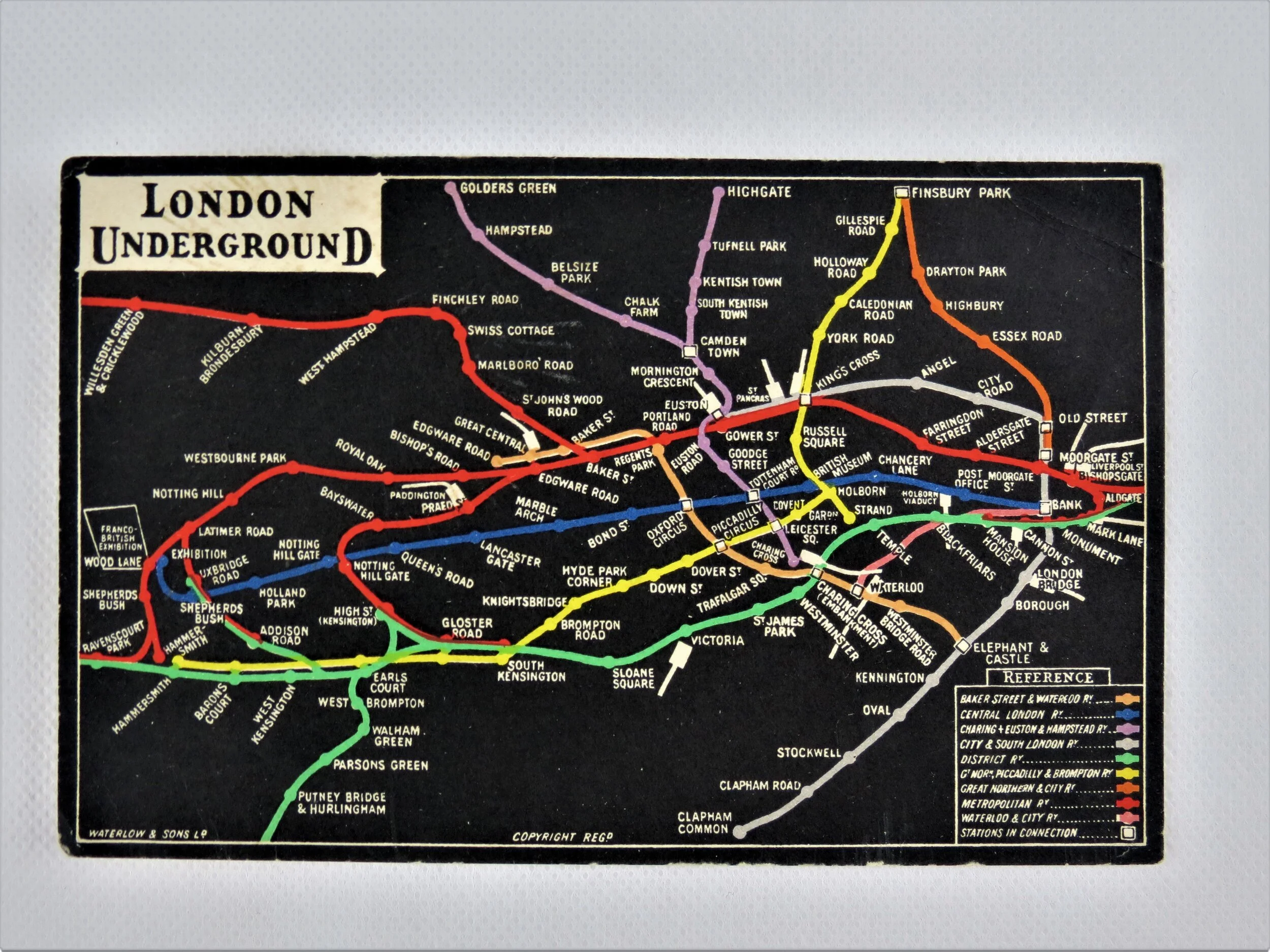
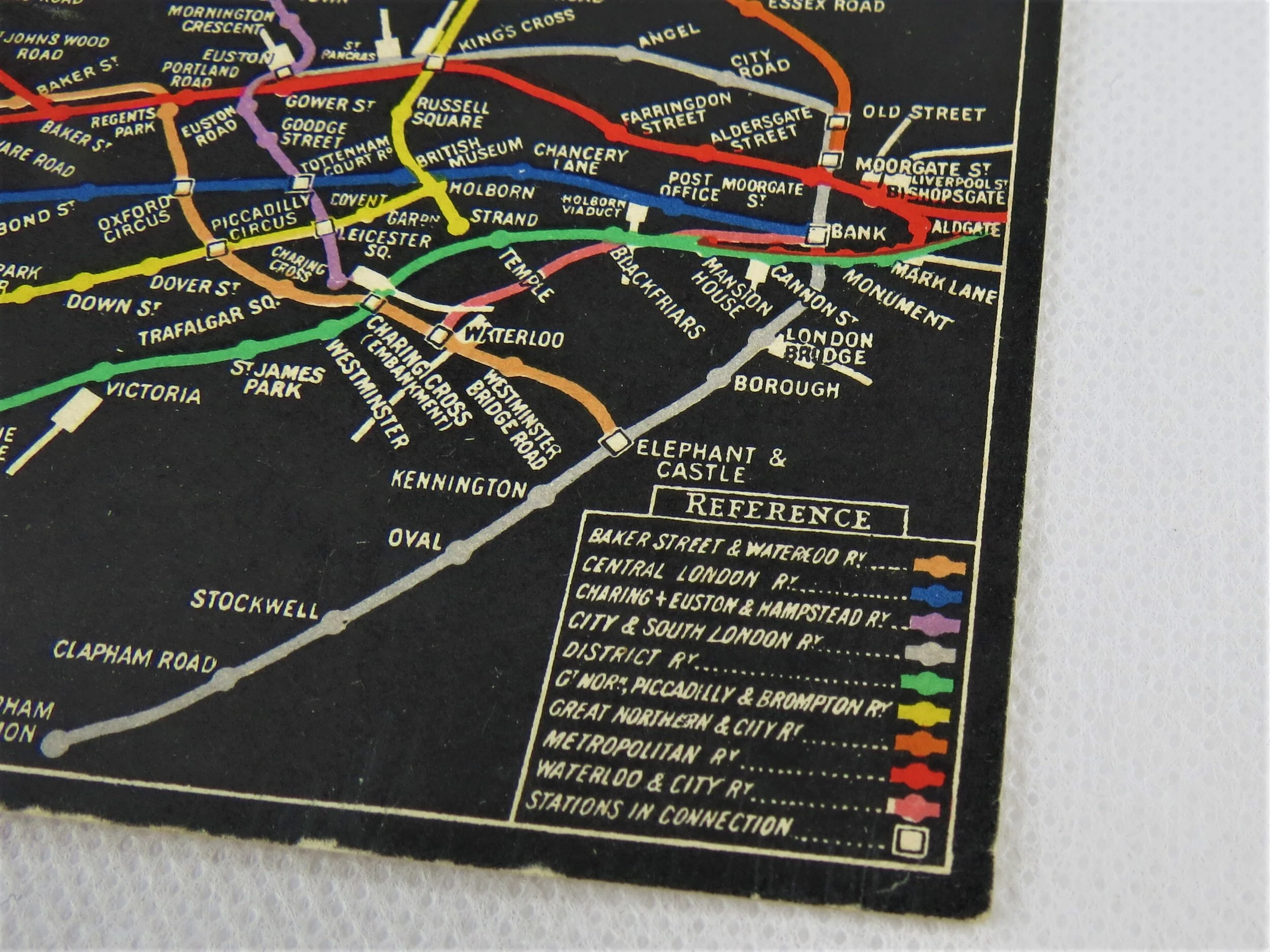
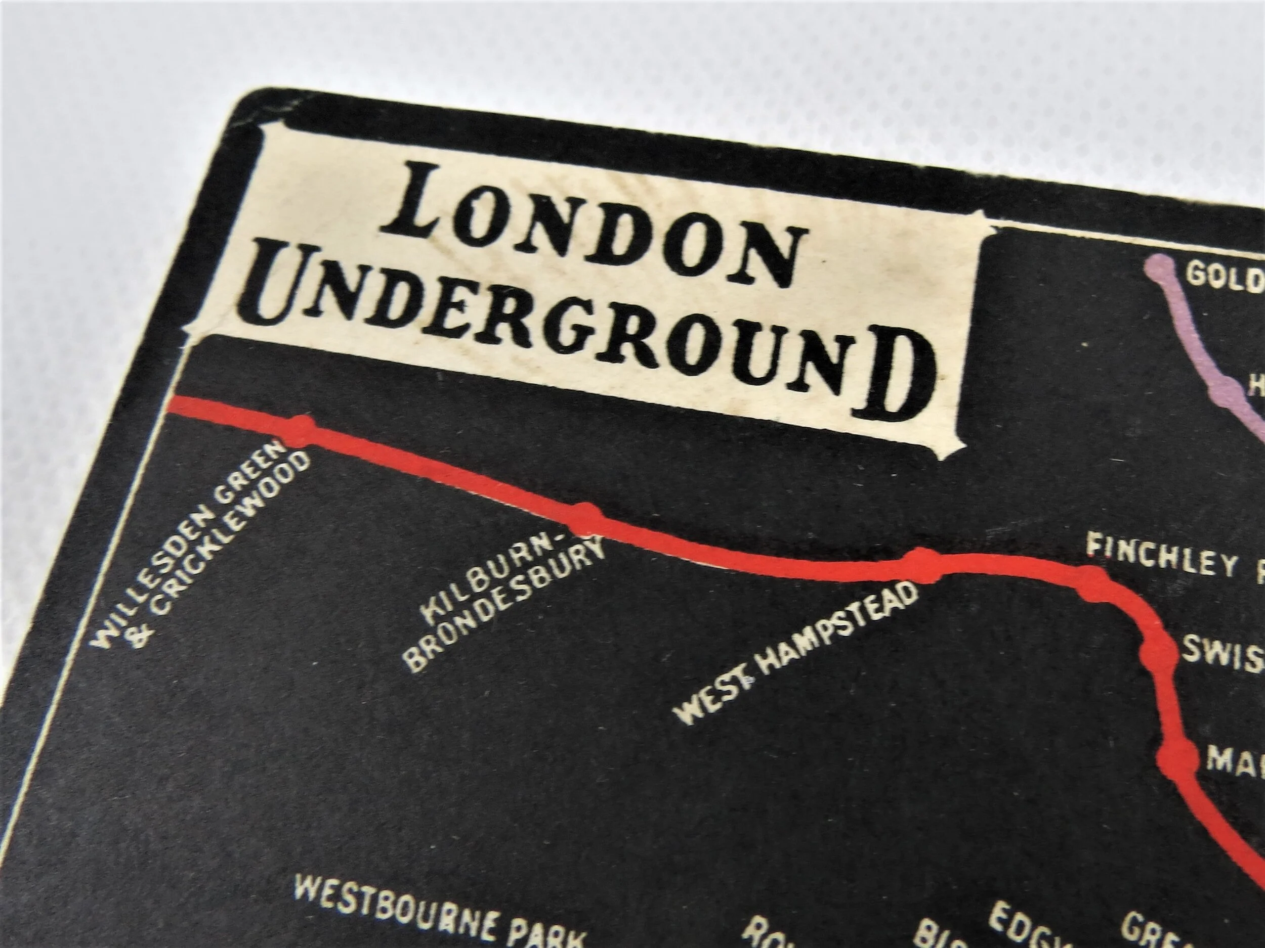
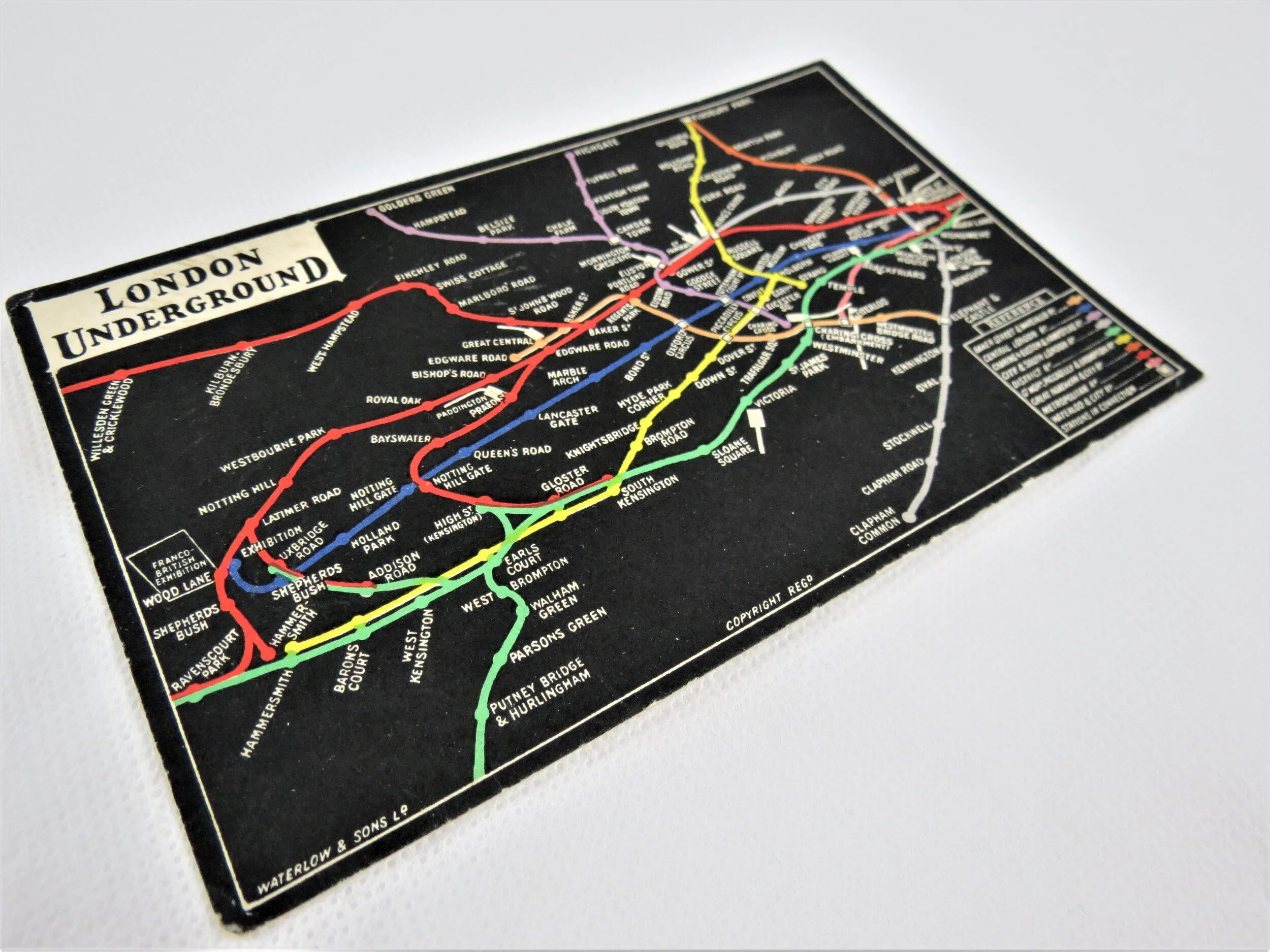
1922 London Underground Map - By Macdonald Gill
Underground - What to See & How to Travel - Map of the Electric Railways of London. 1922
Designed by Macdonald Gill. Printed by Waterlow & Sons for London Underground Electric Railways. Folded paper pocket map. Print Code 1-3-22. Measures 28cm x 35cm. Condition: Outstanding. Just a very light glue stain at fold intersection visible from both sides.
This wonderful fold-out pocket map of the London Underground was designed by Macdonald Gill who also designed maps of the Underground between 1920-1924. This was the second paper map of the Gill series. This edition saw a significant improvement in the paper used (lingering wartime austerity saw the 1921 map being printed on thin poor quality paper) meaning these editions survive the passage of time a lot better. The map also saw a change to the decorative border and use of an alternate UndergrounD logo on the map (used only briefly for the London Underground Group who, confusingly, operating the Buses and Trams under this branding).
Gill applied an elegant and decorative quality to the Underground map with ornate borders and the use of calligraphy for station names whilst removing all topographical detail including the River Thames.
Max (as he was known to his friends) was a versatile and highly sought after artist, cartographer and illustrator that worked regularly with Frank Pick and the Underground Electric Railways Company. His most notable work for the Underground was in 1913 and the remarkable pictorial map of London titled "By Paying Us Your Pennies" (later renamed the Wonderground Map of London). Whilst Gill is best known for defining a new genre in pictorial mapping he boasts an enormous and varied body of work from children’s book illustration to architecture
Want one? let us know and we will contact you when we get another in stock.