


1908 London Underground Map Postcard - by GW Bacon
London Underground Map - Postcard. 1908.
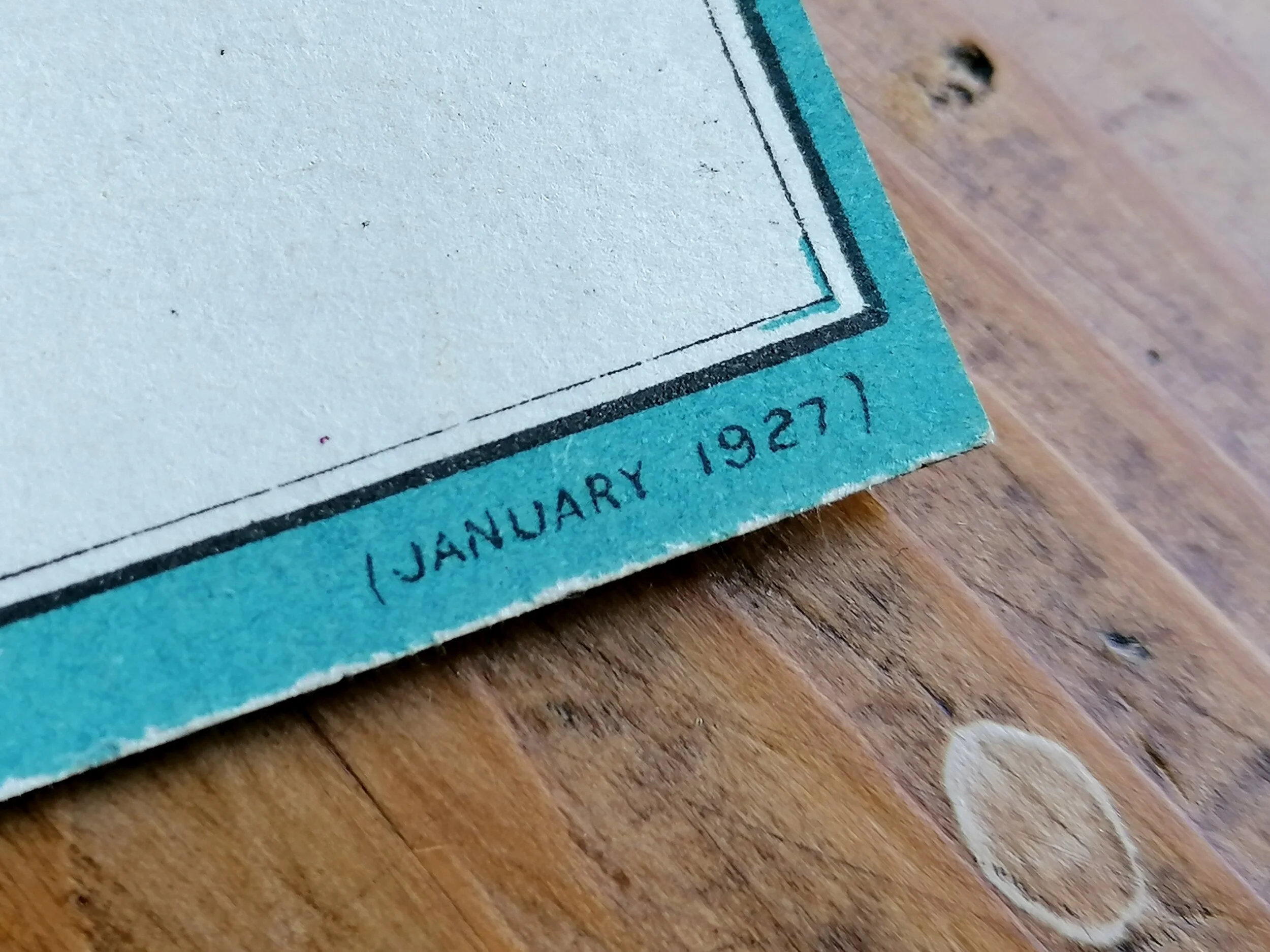
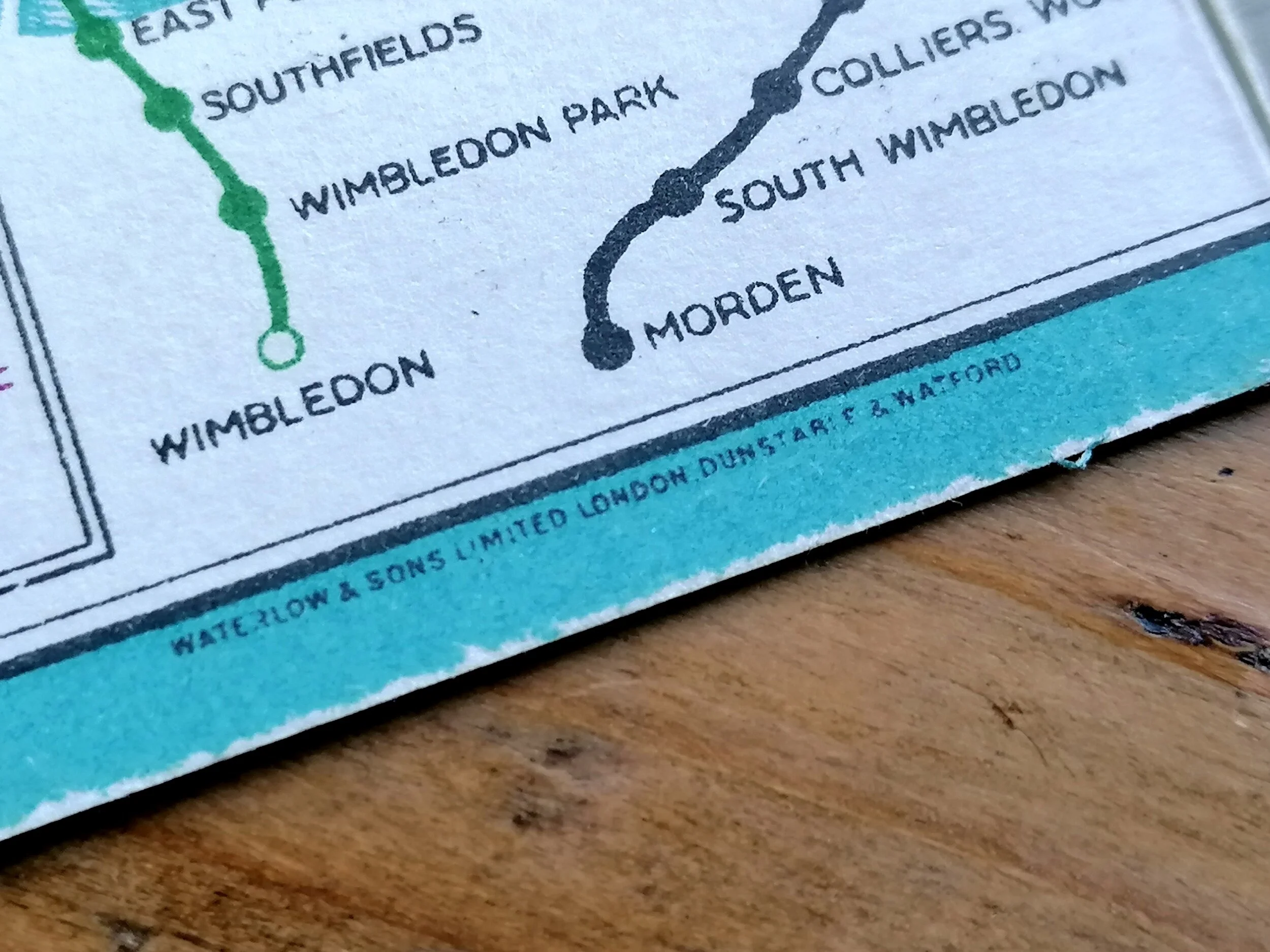
Designed by GW Bacon. Printed by Waterlow & Sons. 13.7cm x 8.7cm. Condition: Excellent unused.
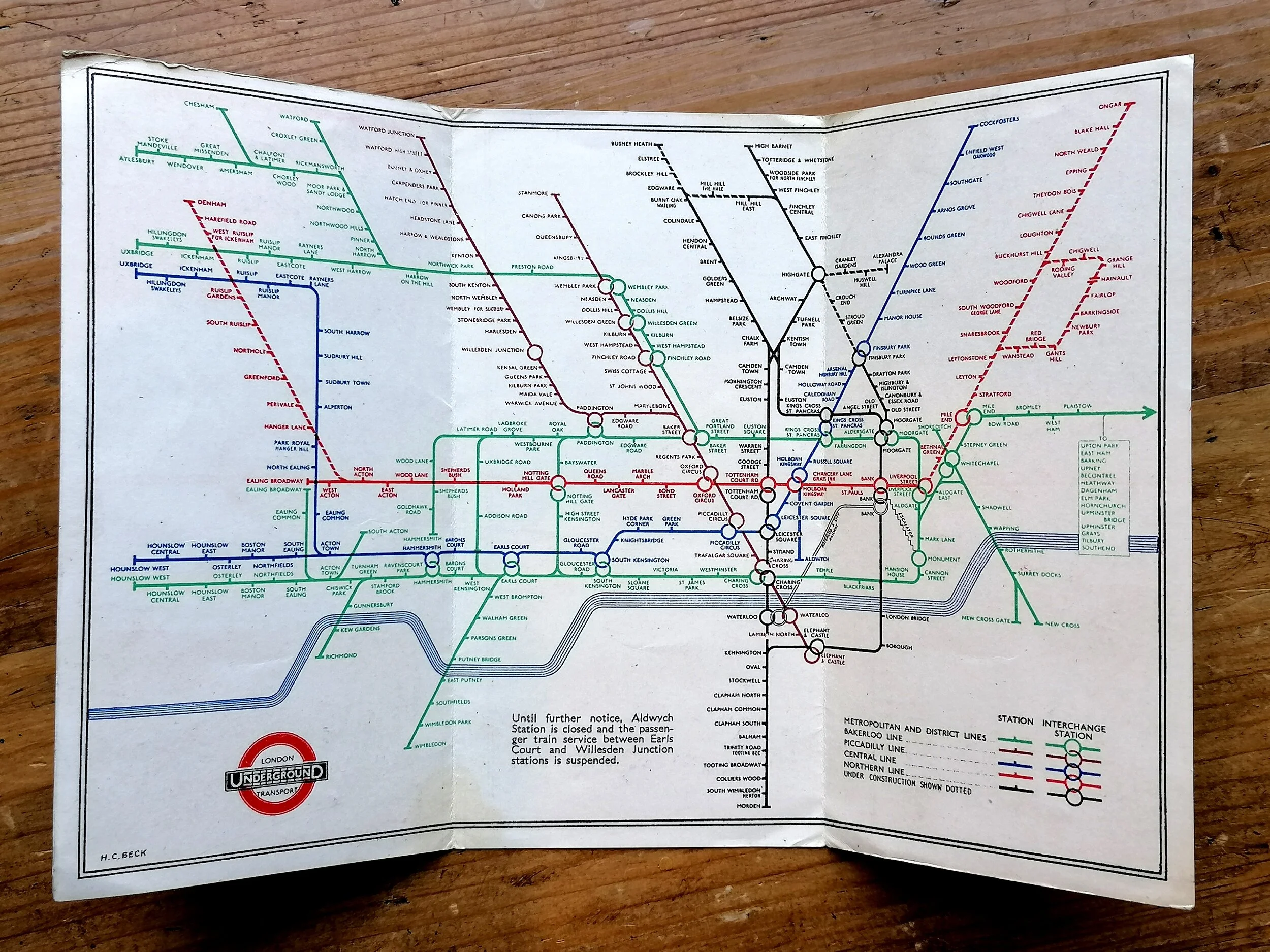
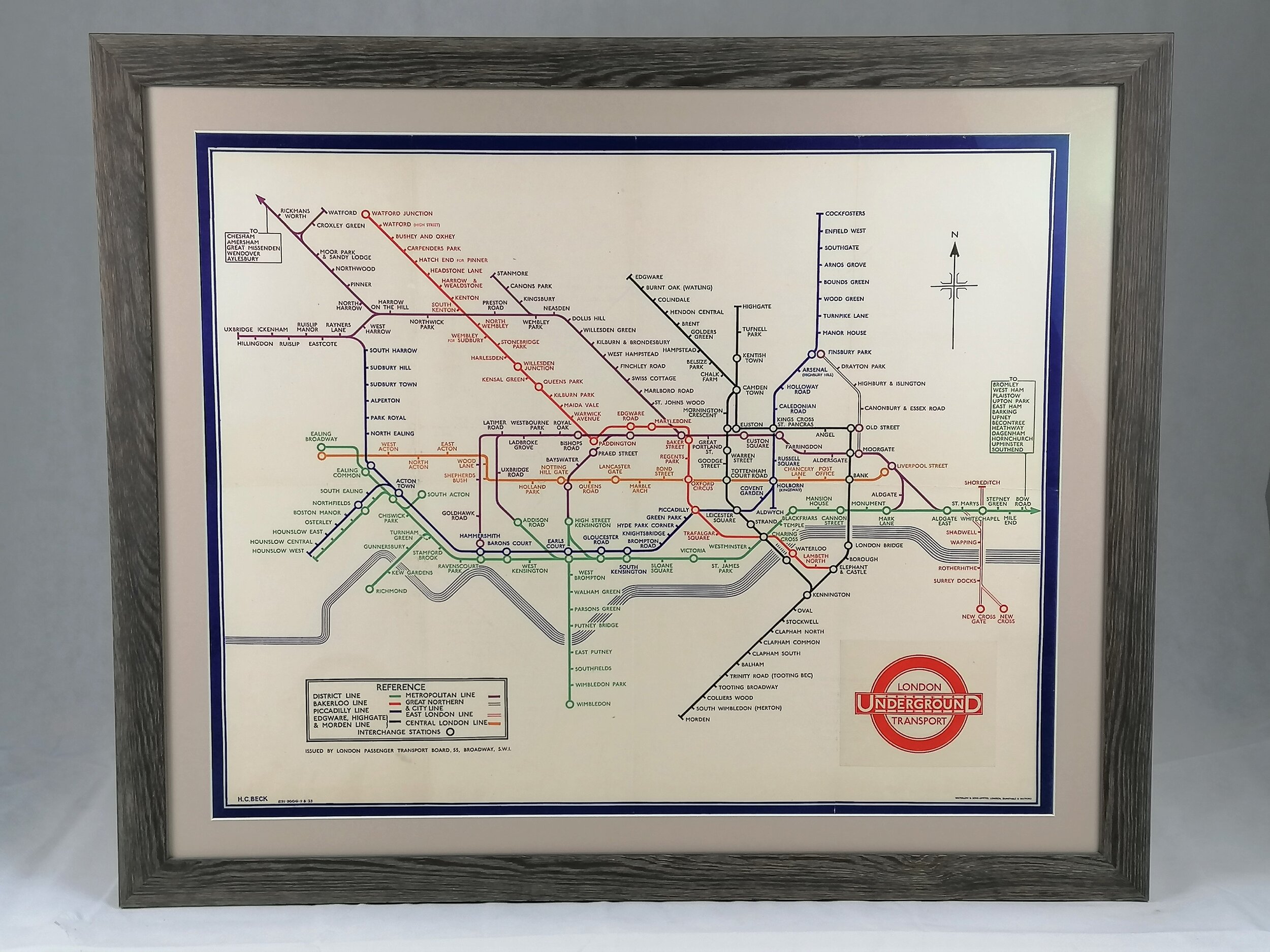
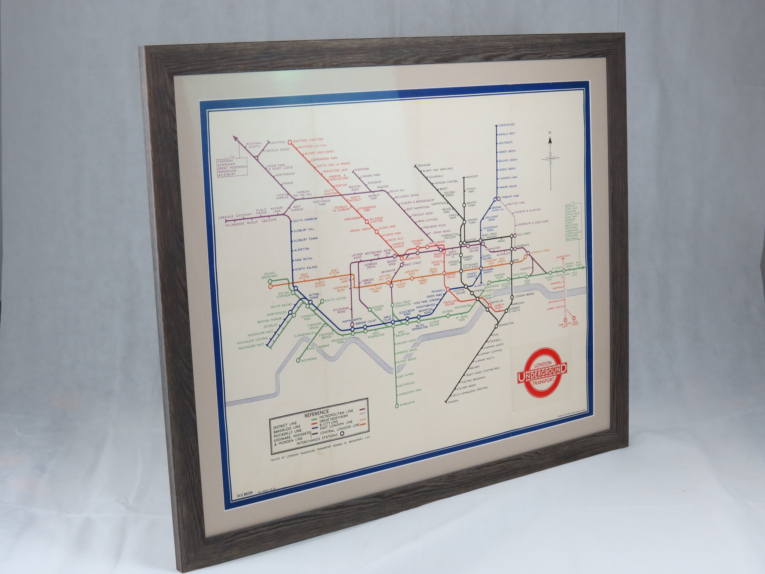
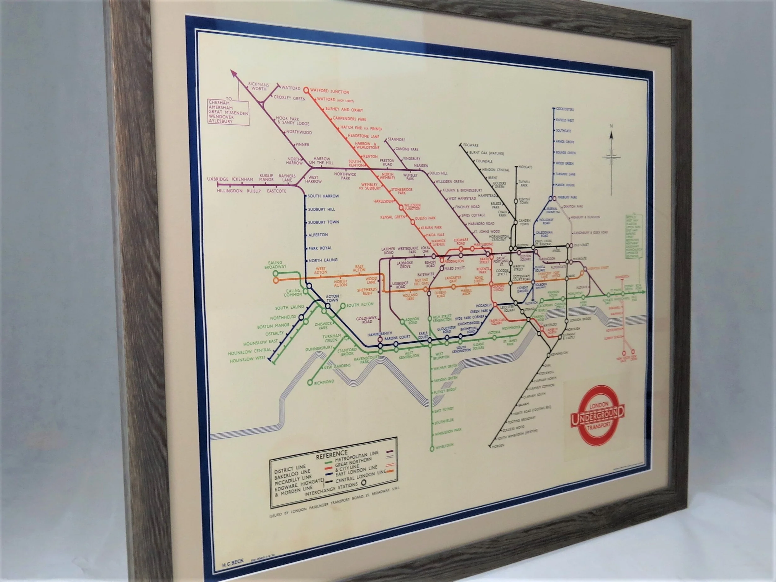
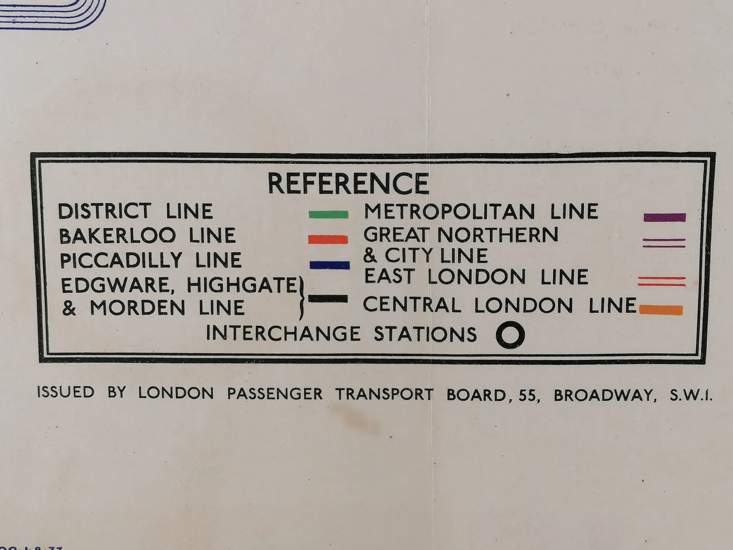
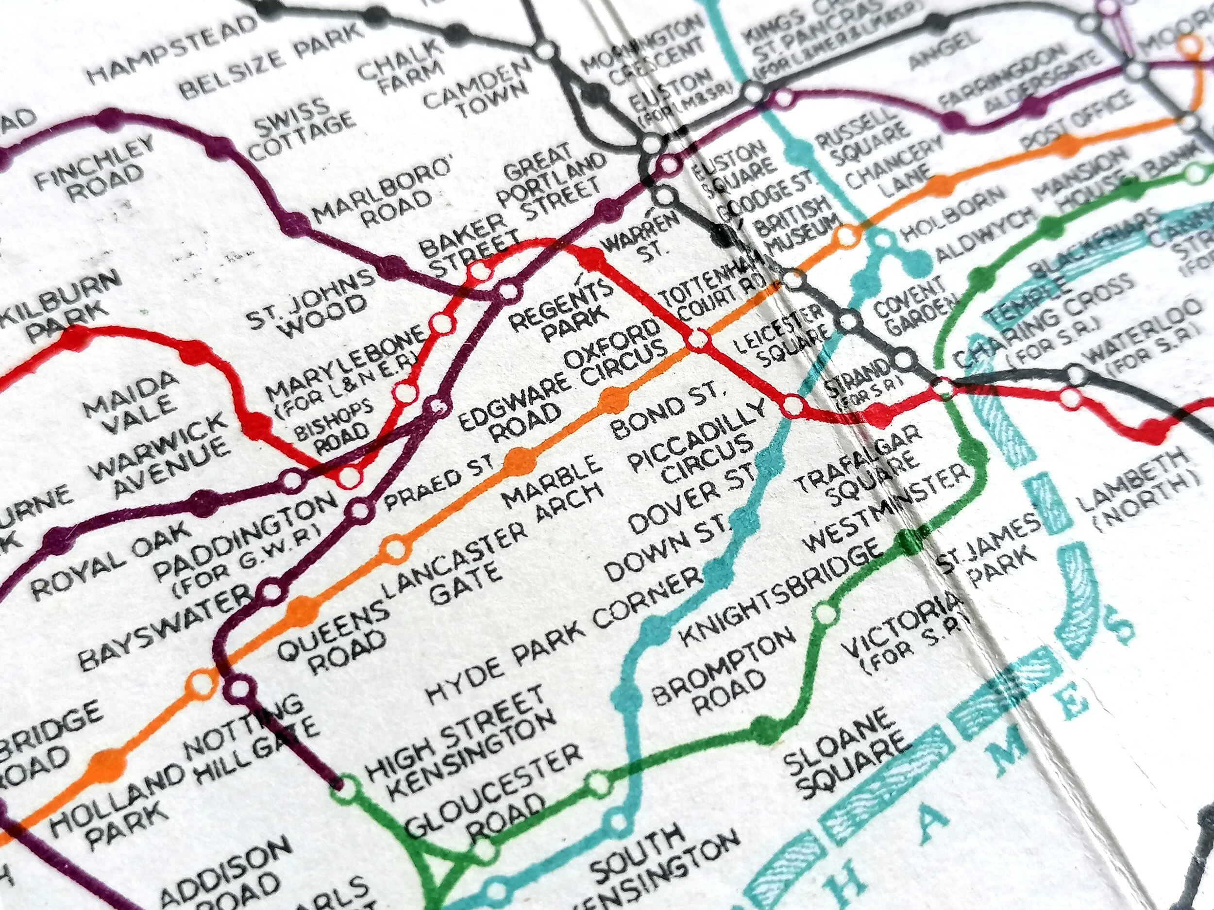
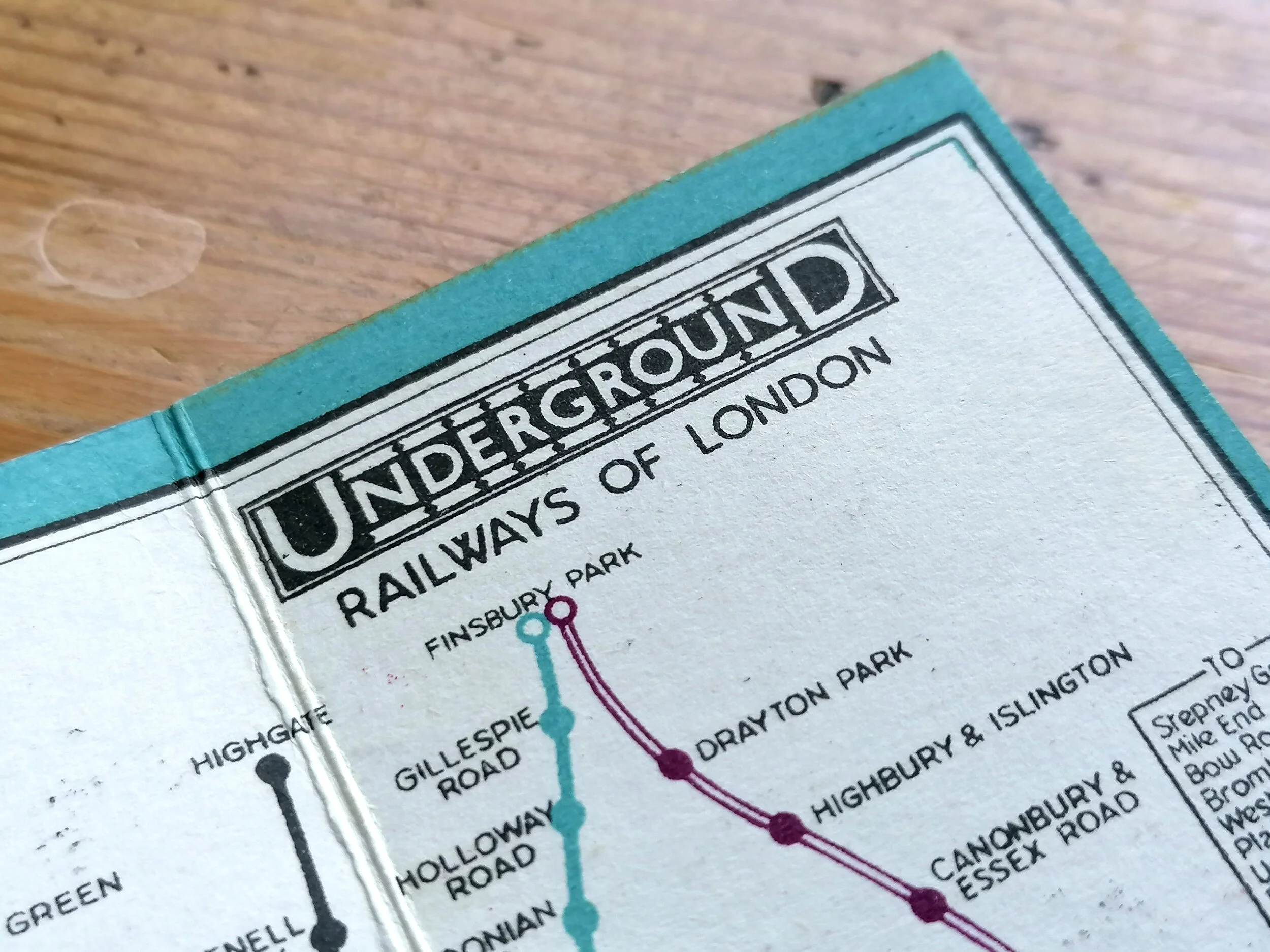
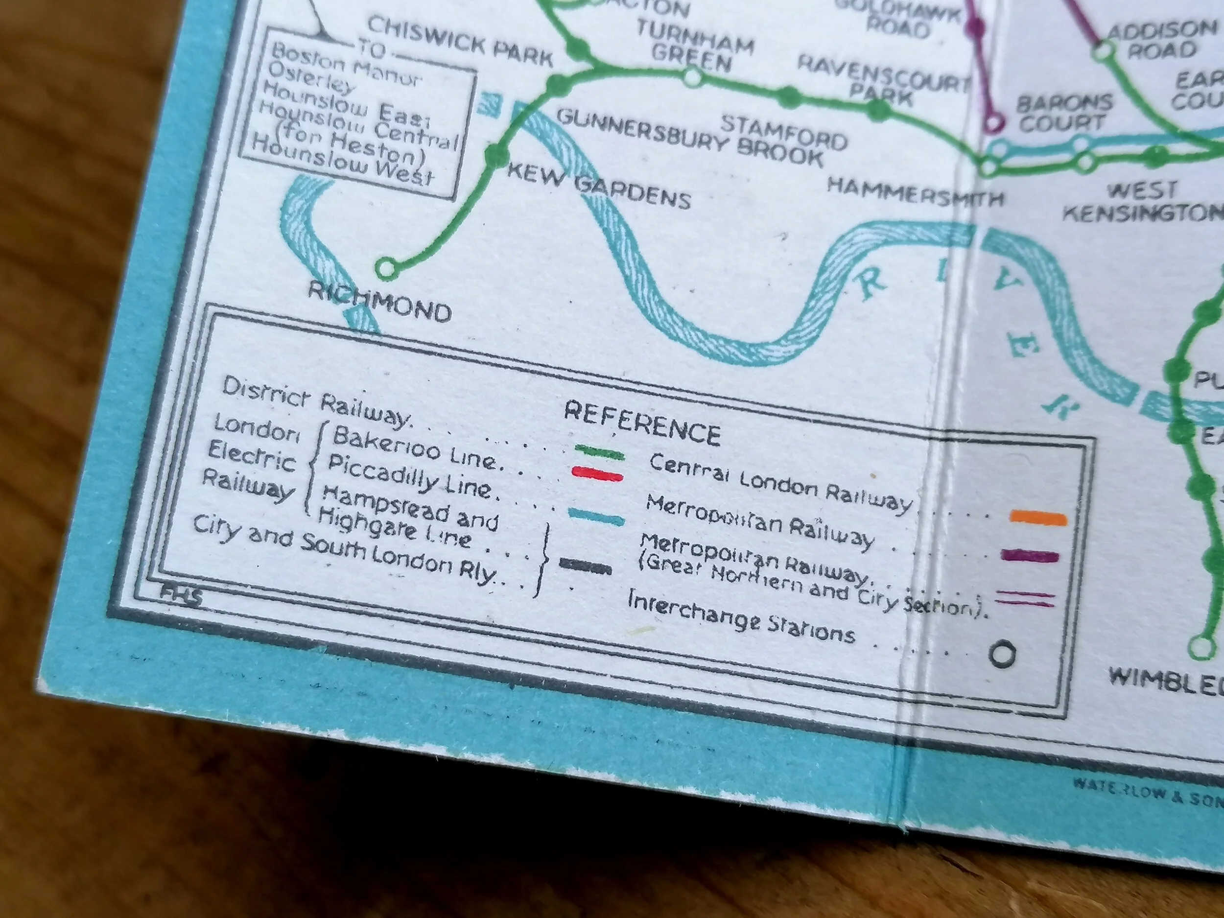
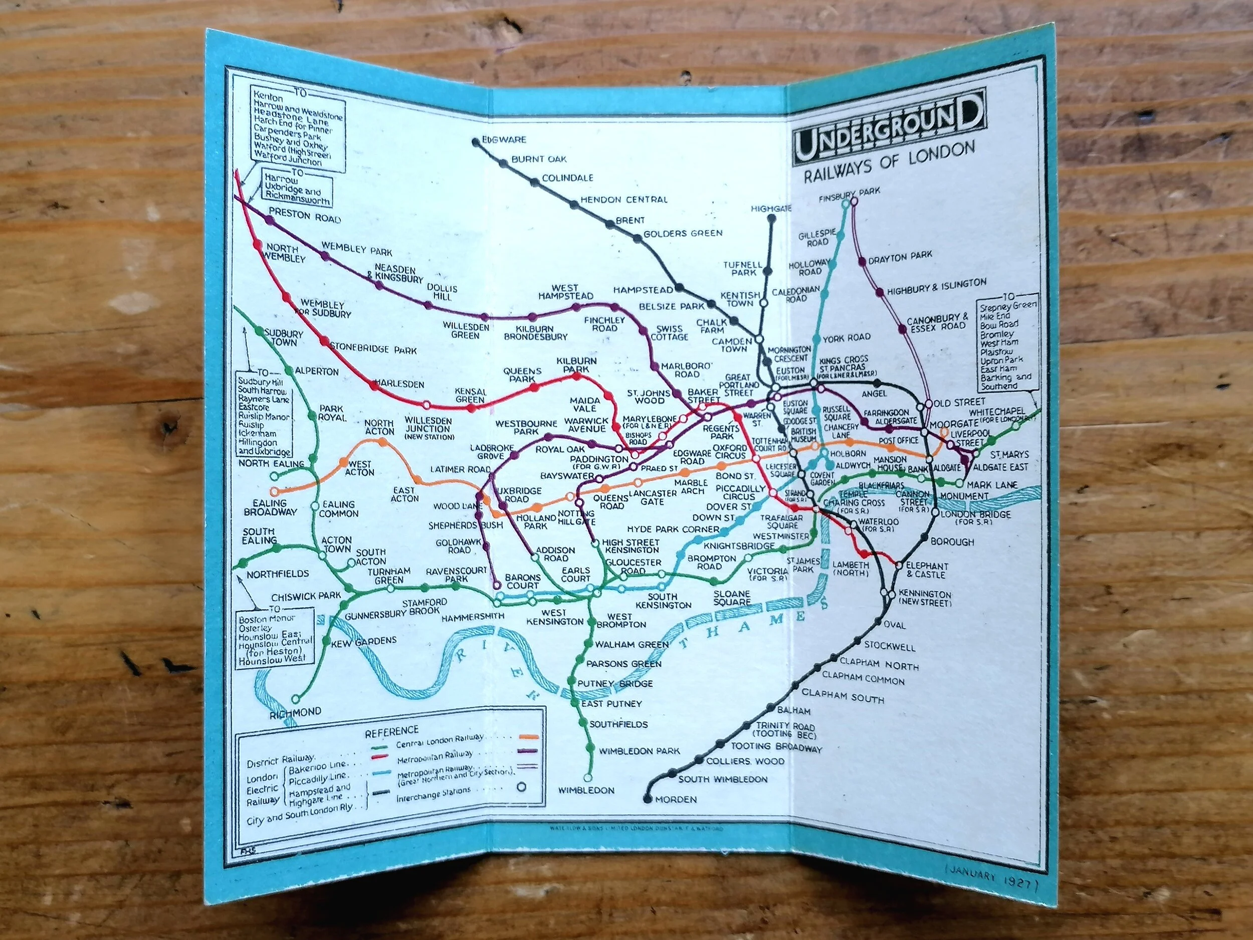
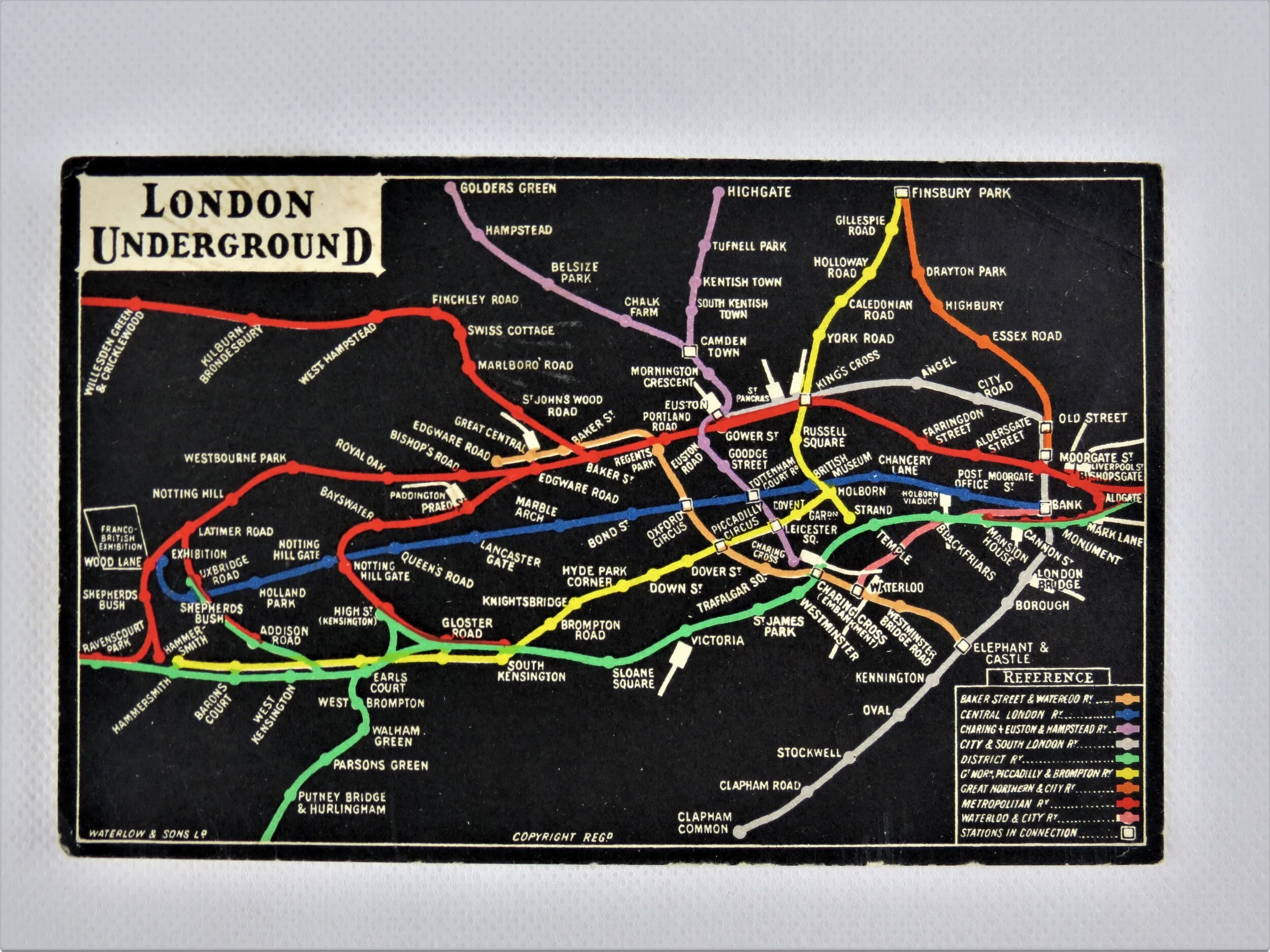
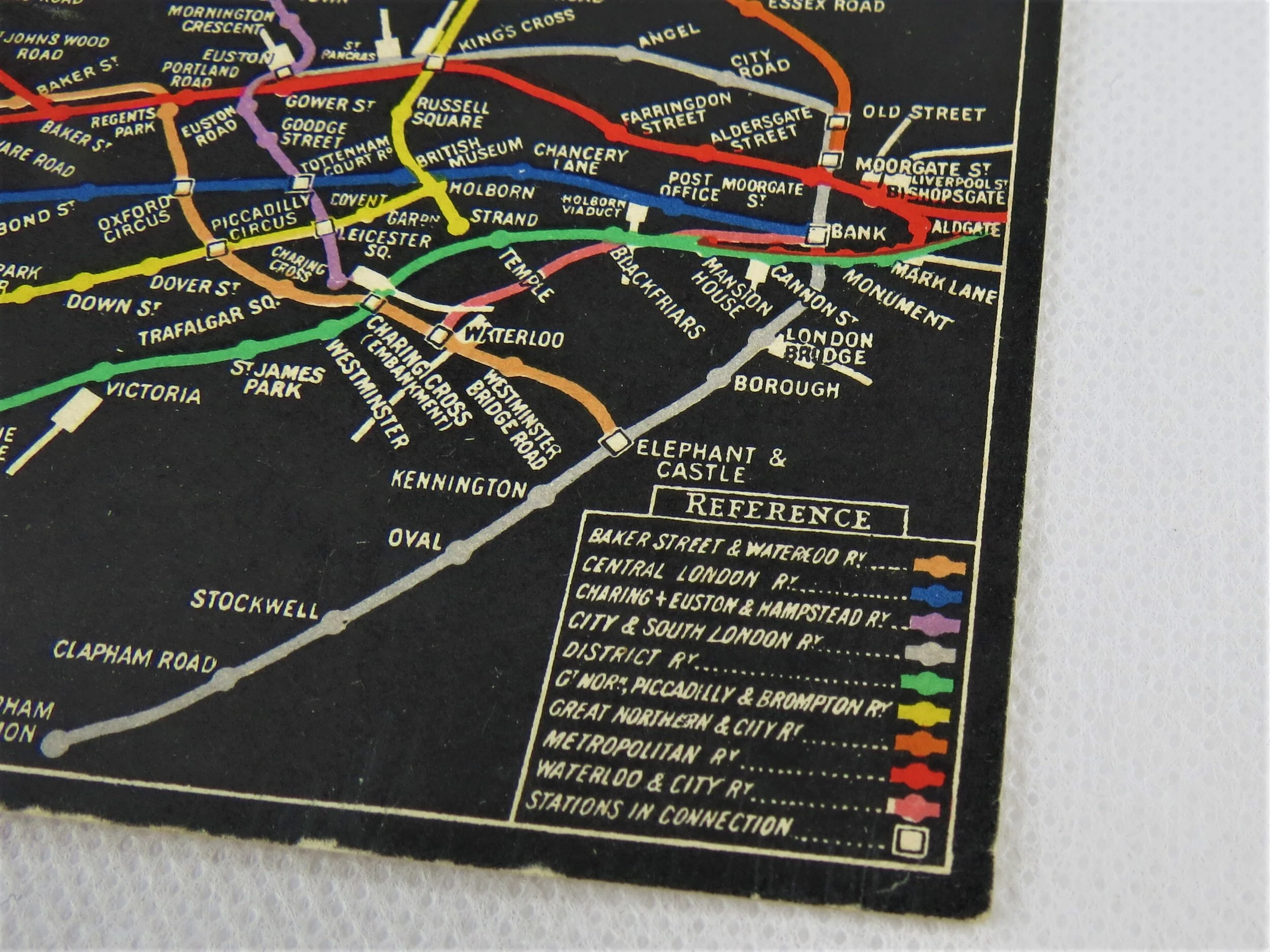
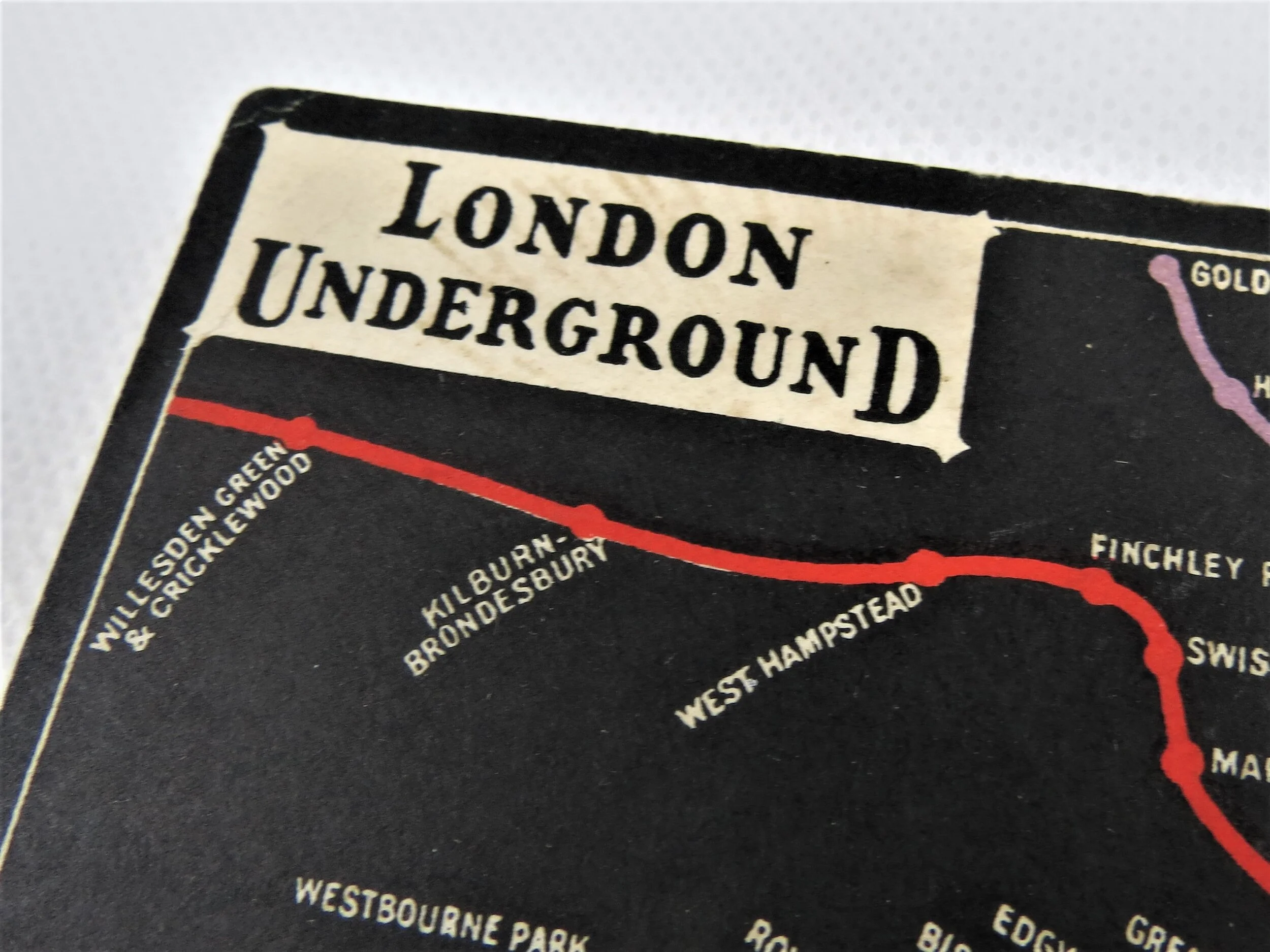
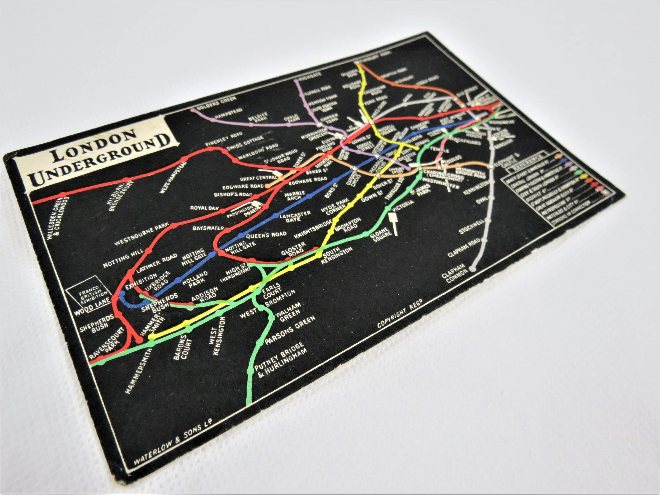
1907-1908 saw a major move towards unification of the various Underground Railway companies in London under single brand, with its first ""UndergrounD"" wordmark (logo). Whilst the managing consortium known as the Underground Electric Railways of London (UERL) developed an official 'common' map from April 1908, this postcard edition drawn up by GW Bacon is believed to pre-date the first official map. This design is therefore likely to have influenced the design of the official UERL map, in particular the use of Interchange icons, the bold colours attributed to the lines (first use of Green for the District line), the smoothing/distorting of the lines for clarity and the use of the large U and D in the title, a feature that would remain in the official Underground logo until the late 1960s.
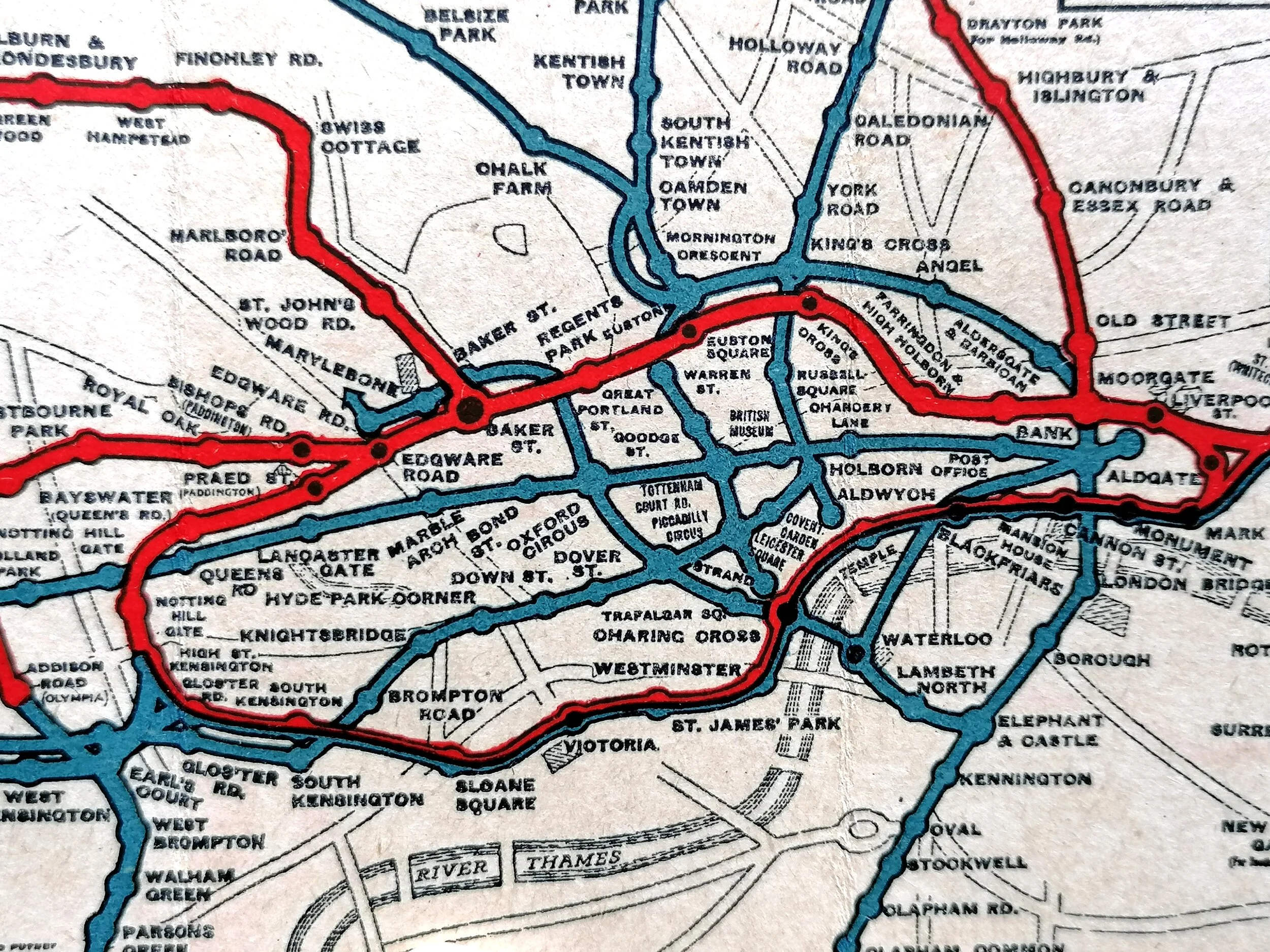
Whilst the official UERL map had background detail, this design sees all background detail removed, even the River Thames.
There are a couple of variations of this map known, this is the earliest with the Franco-British Exhibition showing at Wood lane and Bishopsgate station (which was later renamed Liverpool Street after the mainline station next door)."
FREE UK DELIVERY. Non-UK Delivery available, please request a quotation
London Underground Map - Postcard. 1908.
Designed by GW Bacon. Printed by Waterlow & Sons. 13.7cm x 8.7cm. Condition: Excellent unused.
1907-1908 saw a major move towards unification of the various Underground Railway companies in London under single brand, with its first ""UndergrounD"" wordmark (logo). Whilst the managing consortium known as the Underground Electric Railways of London (UERL) developed an official 'common' map from April 1908, this postcard edition drawn up by GW Bacon is believed to pre-date the first official map. This design is therefore likely to have influenced the design of the official UERL map, in particular the use of Interchange icons, the bold colours attributed to the lines (first use of Green for the District line), the smoothing/distorting of the lines for clarity and the use of the large U and D in the title, a feature that would remain in the official Underground logo until the late 1960s.
Whilst the official UERL map had background detail, this design sees all background detail removed, even the River Thames.
There are a couple of variations of this map known, this is the earliest with the Franco-British Exhibition showing at Wood lane and Bishopsgate station (which was later renamed Liverpool Street after the mainline station next door)."
FREE UK DELIVERY. Non-UK Delivery available, please request a quotation