1914 Wonderground Map of London Town - Quad Royal - By Macdonald Gill
1914 Wonderground Map of London Town / By Paying Us Your Pennies
A pictorial map of London. Designed by Macdonald Gill. Printed by Westminster Press for London Underground Electric Railways. Measures 127cm x 101cm (Quad Royal). Colour Lithograph, sectionalised and laid to linen. Cover on rear. Condition: Excellent. Slight creasing and age related marks. Covers a little creased with a few stains.
Not to be mistaken for the smaller 1924 or 1927 issues, this is the rare first public edition from 1914.
Macdonald Leslie Gill (1884-1947), brother of artist Eric Gill, was a versatile and highly sought after commercial artist, pictorial cartographer and illustrator that worked regularly with Frank Pick and the Underground Electric Railways Company. The Wonderground Map of London Town was both his earliest and most notable work for the London Underground and triggered a surge in the popularity of pictorial maps both among the public and as a marketing tool.
Originally known as “By Paying Us Your Pennies” and retitled the Wonderground Map of London Town for the public issue, Gill took 7 months to draw this thrilling “cartographic masterpiece”. Large Quad Royal posters of the map were displayed across the London Underground network. Frank Pick had commissioned the map in 1913, his first year as Commercial Manager for London Underground with the intention of promoting Underground travel for pleasure.
The vibrant colours and incredible detail of this map draw you in where It is quite possible to lose an hour among the whimsical characters and historical references. Indeed, it was reported at the time that those captivated by the posters were responsible for obstructing the flow of passengers at busy times.
In response to its popularity, the ‘Wonderground Map’ map would be the first London Underground poster sold commercially for homes and offices. This edition, like the station poster, was Quad Royal in size, cut into sections and laid on to linen. Decorative covers were added to the reverse side. This public edition did see one notable revision to the original station poster; the title text in the bottom right corner. It is worth mentioning that Claire Dobbin’s “London Underground Maps” dedicates many pages to the Wonderground Map and is well worth a read. There is one error in her book however, that it refers to this edition (the first 1914 public issue) with incorrect measurements (sorry Claire!).
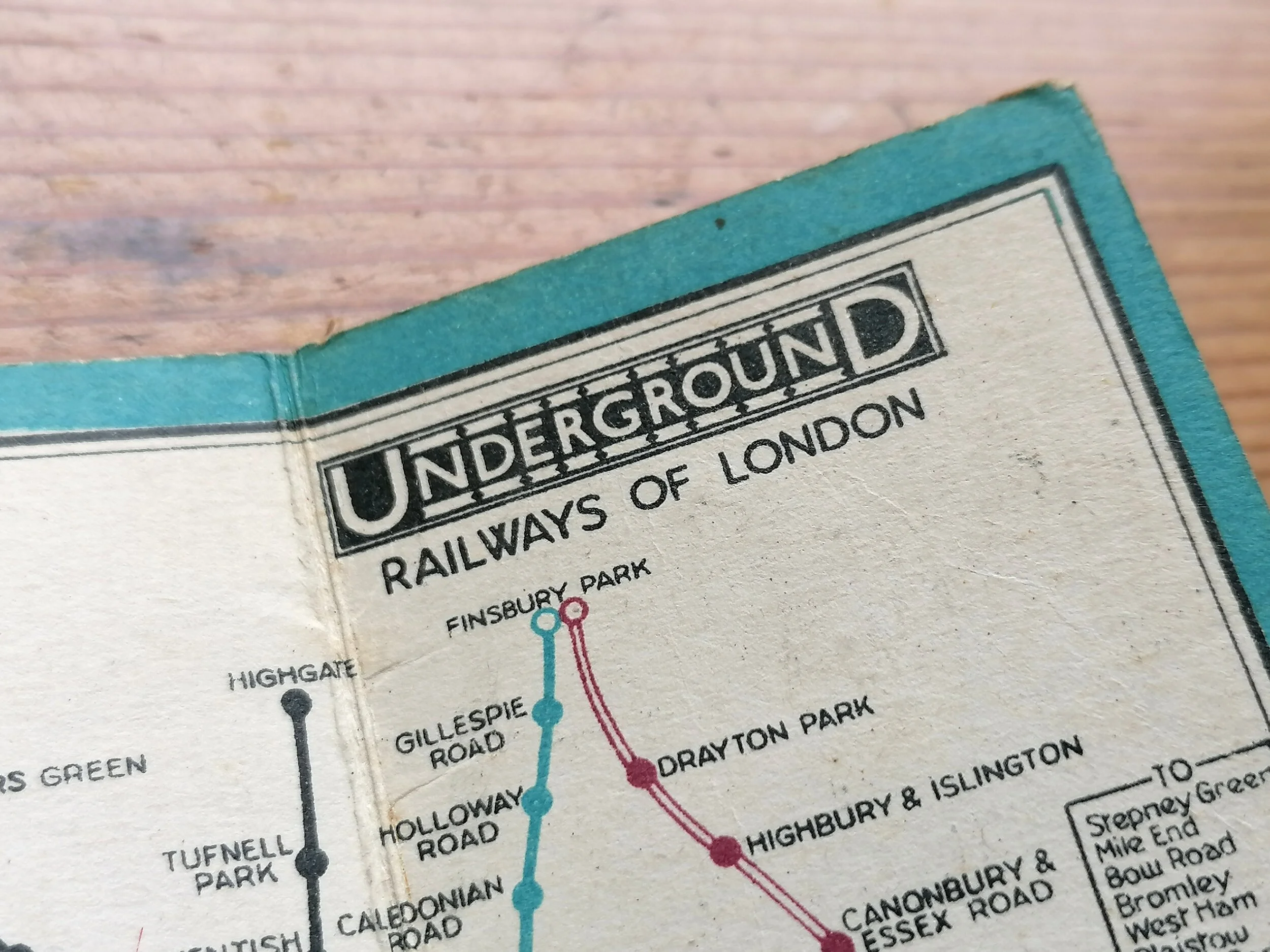
Two later (and smaller) versions were issued in 1924 and 1927. These folded paper maps account for almost all examples currently available on the market today. Apart from being smaller and not on linen, the 1924 and 1927 editions are easy to spot as they underwent changes to the border text along with some redrawing. As for telling the difference between the two later editions, you need to look in top left quarter by Harrow Road where there is either a Lion (1924) or a greyhound (1927).
FREE UK DELIVERY. Non-UK Delivery available, please request a quotation
1914 Wonderground Map of London Town / By Paying Us Your Pennies
A pictorial map of London. Designed by Macdonald Gill. Printed by Westminster Press for London Underground Electric Railways. Measures 127cm x 101cm (Quad Royal). Colour Lithograph, sectionalised and laid to linen. Cover on rear. Condition: Excellent. Slight creasing and age related marks. Covers a little creased with a few stains.
Not to be mistaken for the smaller 1924 or 1927 issues, this is the rare first public edition from 1914.
Macdonald Leslie Gill (1884-1947), brother of artist Eric Gill, was a versatile and highly sought after commercial artist, pictorial cartographer and illustrator that worked regularly with Frank Pick and the Underground Electric Railways Company. The Wonderground Map of London Town was both his earliest and most notable work for the London Underground and triggered a surge in the popularity of pictorial maps both among the public and as a marketing tool.
Originally known as “By Paying Us Your Pennies” and retitled the Wonderground Map of London Town for the public issue, Gill took 7 months to draw this thrilling “cartographic masterpiece”. Large Quad Royal posters of the map were displayed across the London Underground network. Frank Pick had commissioned the map in 1913, his first year as Commercial Manager for London Underground with the intention of promoting Underground travel for pleasure.
The vibrant colours and incredible detail of this map draw you in where It is quite possible to lose an hour among the whimsical characters and historical references. Indeed, it was reported at the time that those captivated by the posters were responsible for obstructing the flow of passengers at busy times.
In response to its popularity, the ‘Wonderground Map’ map would be the first London Underground poster sold commercially for homes and offices. This edition, like the station poster, was Quad Royal in size, cut into sections and laid on to linen. Decorative covers were added to the reverse side. This public edition did see one notable revision to the original station poster; the title text in the bottom right corner. It is worth mentioning that Claire Dobbin’s “London Underground Maps” dedicates many pages to the Wonderground Map and is well worth a read. There is one error in her book however, that it refers to this edition (the first 1914 public issue) with incorrect measurements (sorry Claire!).
Two later (and smaller) versions were issued in 1924 and 1927. These folded paper maps account for almost all examples currently available on the market today. Apart from being smaller and not on linen, the 1924 and 1927 editions are easy to spot as they underwent changes to the border text along with some redrawing. As for telling the difference between the two later editions, you need to look in top left quarter by Harrow Road where there is either a Lion (1924) or a greyhound (1927).
FREE UK DELIVERY. Non-UK Delivery available, please request a quotation