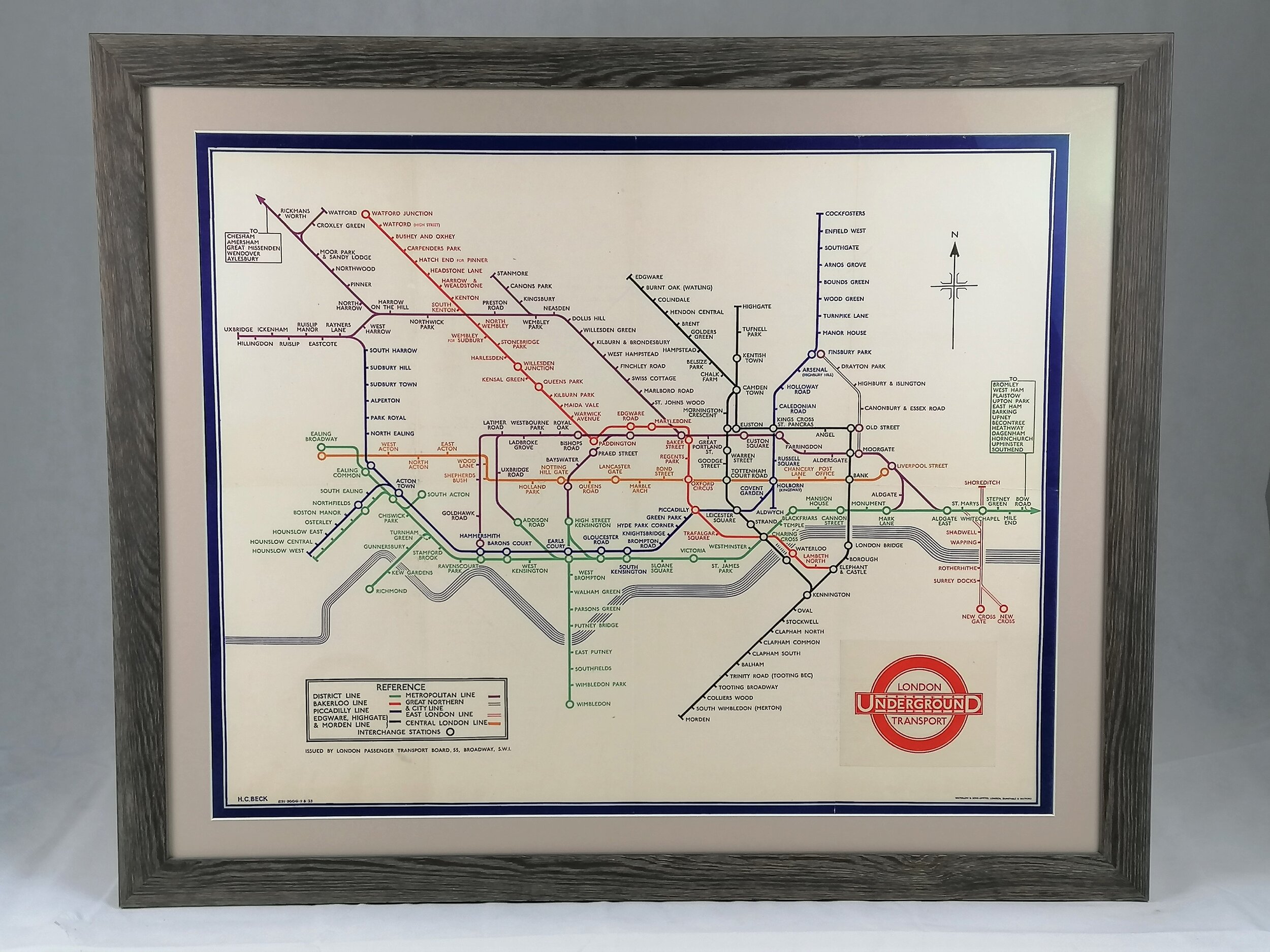
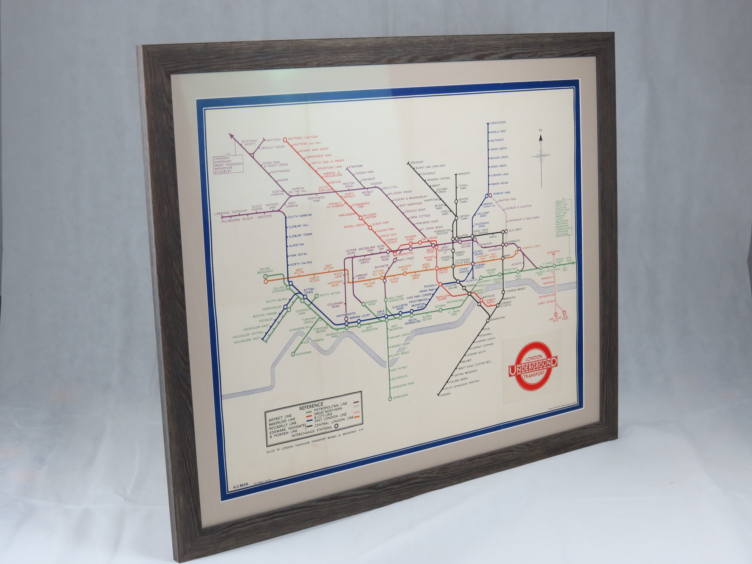
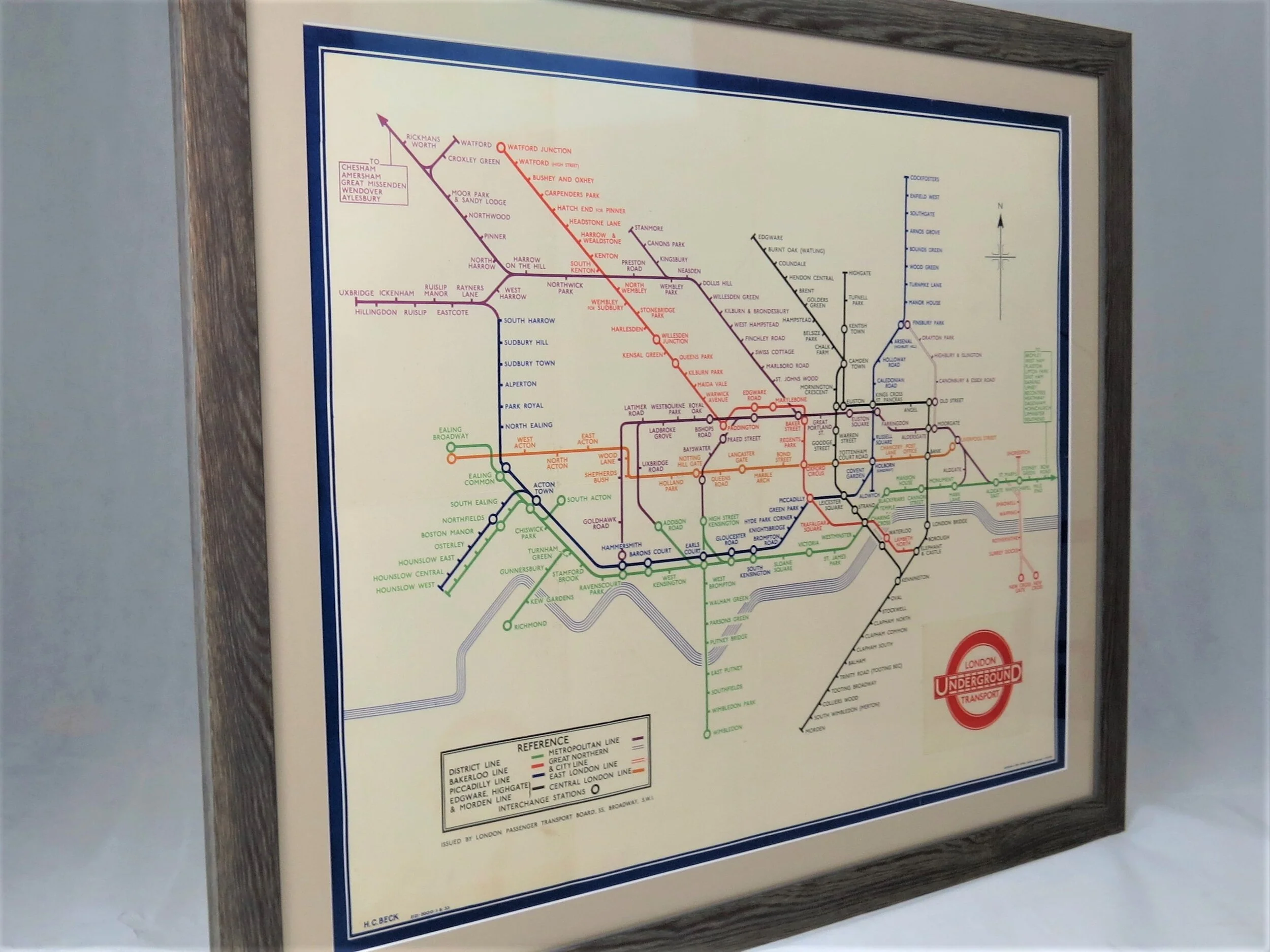
1946 London Underground Pocket Map - HC Beck
Underground - Diagram of Lines - Issued Free No. 1, 1946
Designed by HC Beck. Printed by McCorquodale & Co Ltd for London Transport. 22cm x 15.cm. Card bi-fold map. Print Code:146.214G. 250,000. Condition: Outstanding unused condition. Signs on the rear of once being attached to a guidebook.
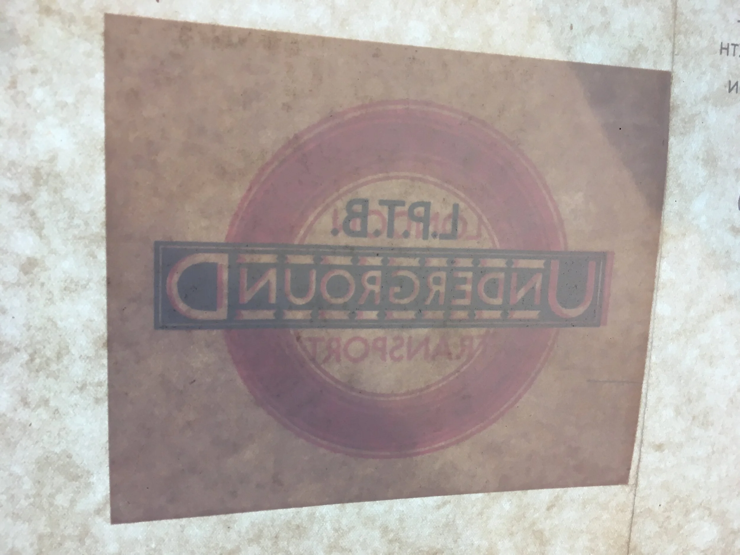
Harry Beck’s first post-war map has seen major revision inside and out and a new printing company. After 7 years of plain covers, a new and strikingly modern Underground roundel sits within a garish border designed by ‘Captain Shepard’. This is the first map to refer to itself as a diagram rather than a map.
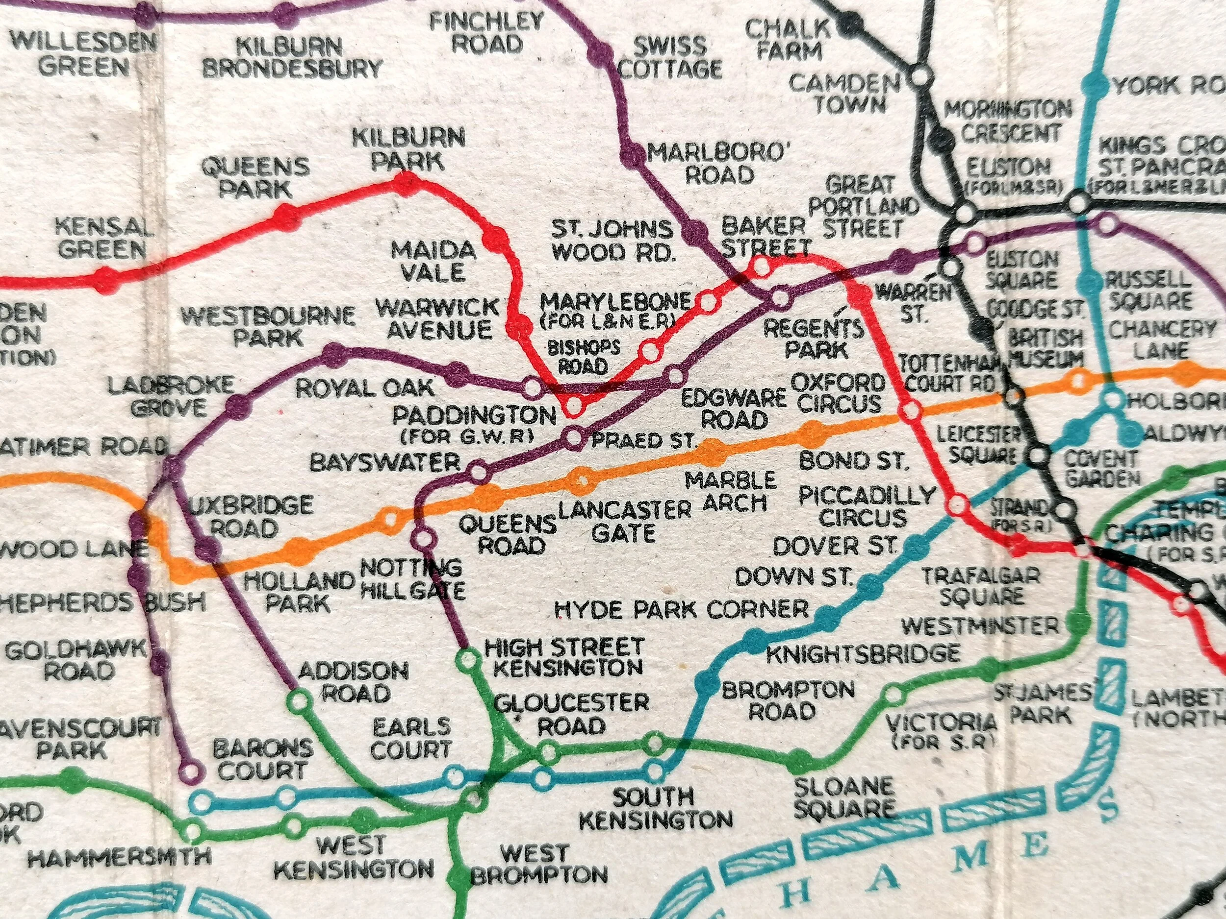
During the early 1940s, Harry Beck had experimented with 60 degree lines but settled on a ‘rectilinear’ style which saw most lines either horizontal or vertical and in so doing departed further from what was actually on the ground. For this edition, Beck has abandoned the absurd practise of duplicating station names for those who served more than one line. Now they are printed in black text making the map much clearer. This map also shows the post-war ambition to extend the return to the war-delayed Central and Northern line extensions (The famous ‘Northern Heights’ extension never happened).
Beck’s diagram would become increasing rectilinear through the 1940s and 1950s and the weakening relationship with above ground geography didn’t sit comfortably with the Underground’s Publicity Office. In the end, this is considered to be the main reason Beck was abruptly unseated as designer in 1960.
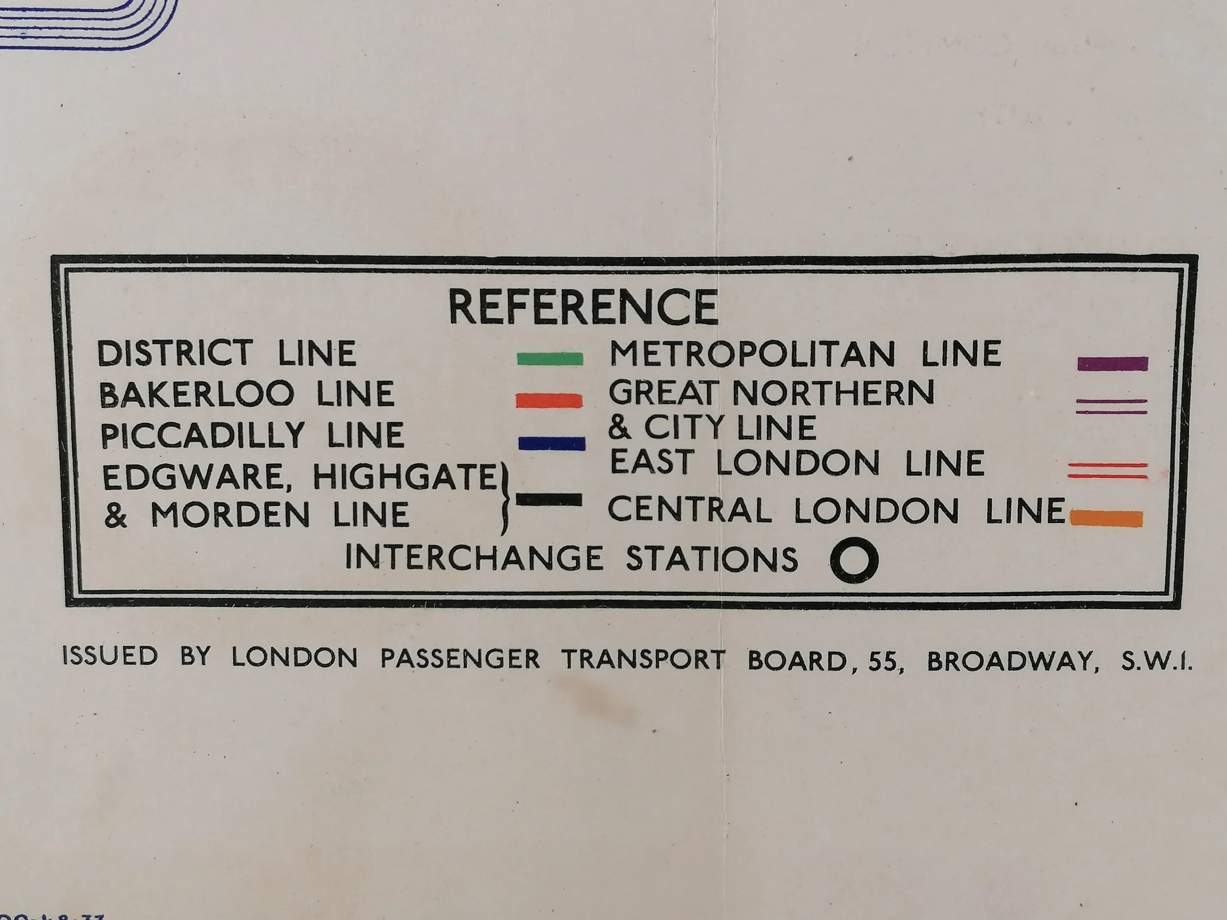
On the reserve side, there is newly redrawn “Connection with Main Line Termini” diagram which is a single colour version of the central area and was used heavily in monochrome publications.
FREE UK DELIVERY. Non-UK Delivery available, please request a quotation
Underground - Diagram of Lines - Issued Free No. 1, 1946
Designed by HC Beck. Printed by McCorquodale & Co Ltd for London Transport. 22cm x 15.cm. Card bi-fold map. Print Code:146.214G. 250,000. Condition: Outstanding unused condition. Signs on the rear of once being attached to a guidebook.
Harry Beck’s first post-war map has seen major revision inside and out and a new printing company. After 7 years of plain covers, a new and strikingly modern Underground roundel sits within a garish border designed by ‘Captain Shepard’. This is the first map to refer to itself as a diagram rather than a map.
During the early 1940s, Harry Beck had experimented with 60 degree lines but settled on a ‘rectilinear’ style which saw most lines either horizontal or vertical and in so doing departed further from what was actually on the ground. For this edition, Beck has abandoned the absurd practise of duplicating station names for those who served more than one line. Now they are printed in black text making the map much clearer. This map also shows the post-war ambition to extend the return to the war-delayed Central and Northern line extensions (The famous ‘Northern Heights’ extension never happened).
Beck’s diagram would become increasing rectilinear through the 1940s and 1950s and the weakening relationship with above ground geography didn’t sit comfortably with the Underground’s Publicity Office. In the end, this is considered to be the main reason Beck was abruptly unseated as designer in 1960.
On the reserve side, there is newly redrawn “Connection with Main Line Termini” diagram which is a single colour version of the central area and was used heavily in monochrome publications.
FREE UK DELIVERY. Non-UK Delivery available, please request a quotation