1945 London Underground Pocket Map - HC Beck
Underground Lines - 1945 London Underground Pocket Map
Designed by HC Beck. Printed by Johnson Riddle & Co for London Transport. 22cm x 15.cm. Card bi-fold map. Print Code: 245.360G.765M No.1 1945. Condition: Outstanding unused condition. Signs on the rear of once being attached to a guidebook.
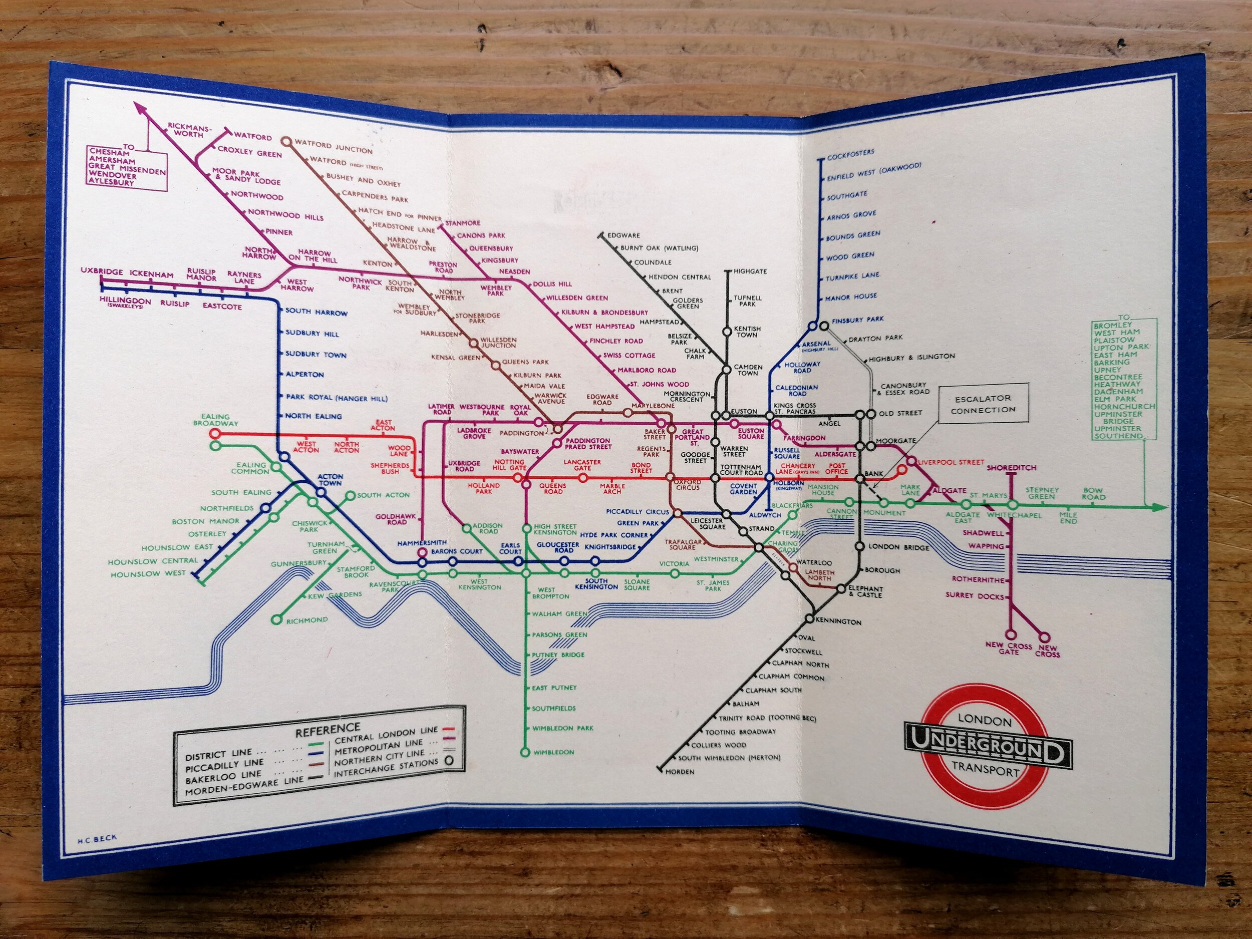
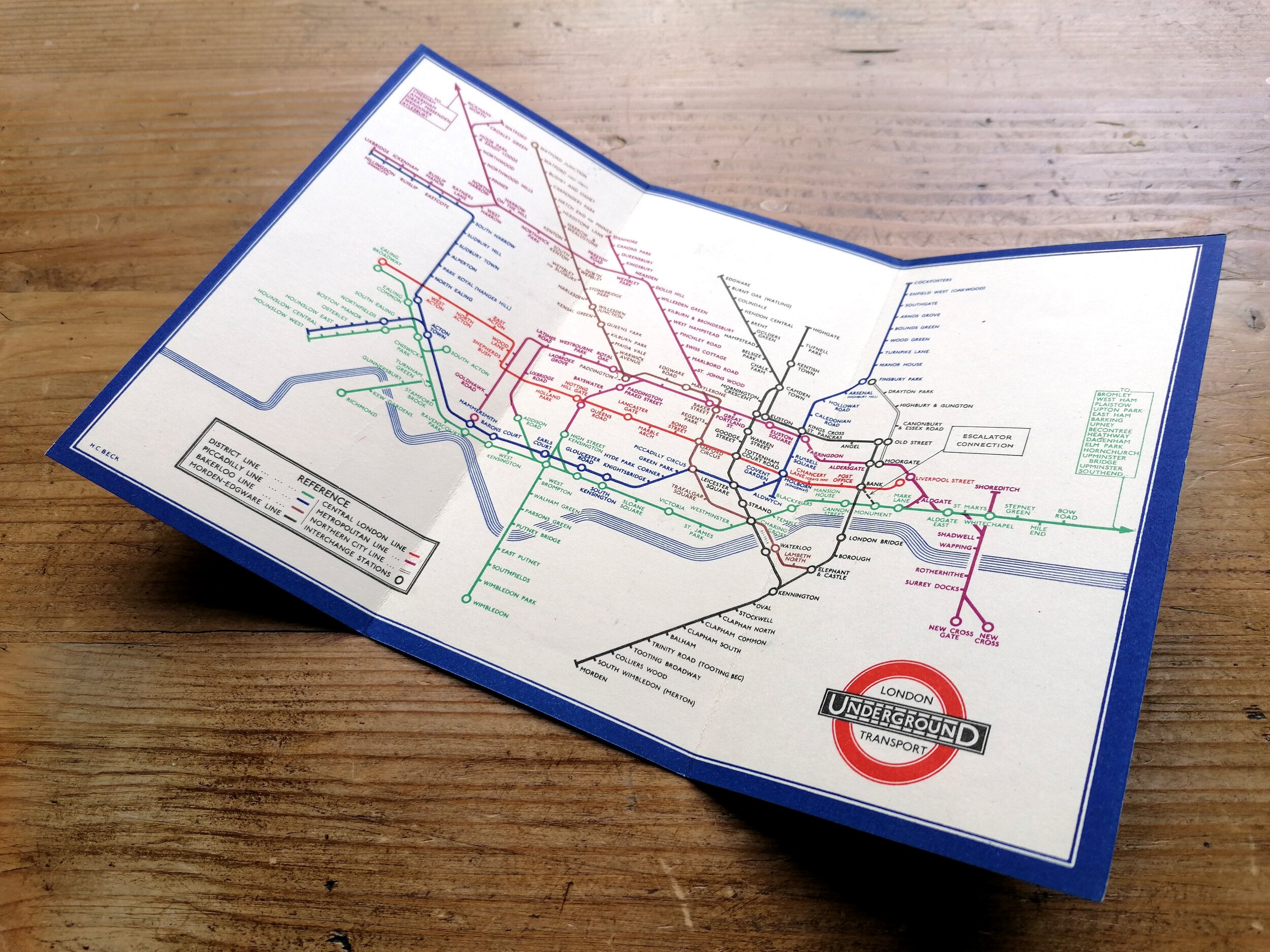
This 1945 edition of the London Underground Map was the last map printed during WWII and is nearly identical of Harry Becks 1943 design with just one difference: The Eastern terminus for the District Line shown as Upminster (Southend in 1943).
Harry Beck had wrestled back control of the pocket map design in 1941 after it was temporarily in the hands of Hans Schleger (1938-1941). Beck’s first map on his return saw a major redesign of his late 1930s diagram, using strikingly modern 60 degree angles and interlinking interchange stations. But in 1943, the 60 degree angles turned fully vertical creating what is often referred to as his ‘rectilinear’ diagram which was dominantly horizontals and vertical lines. Whilst it achieved greater clarity, this approach also saw a further departure from what was really happening on the ground.
Beck’s diagram would become increasing rectilinear through the 1940s and 1950s and the weakening relationship with above ground geography didn’t sit comfortably with the Underground’s Publicity Office. In the end, this is considered to be the main reason Beck was abruptly unseated as designer in 1960.
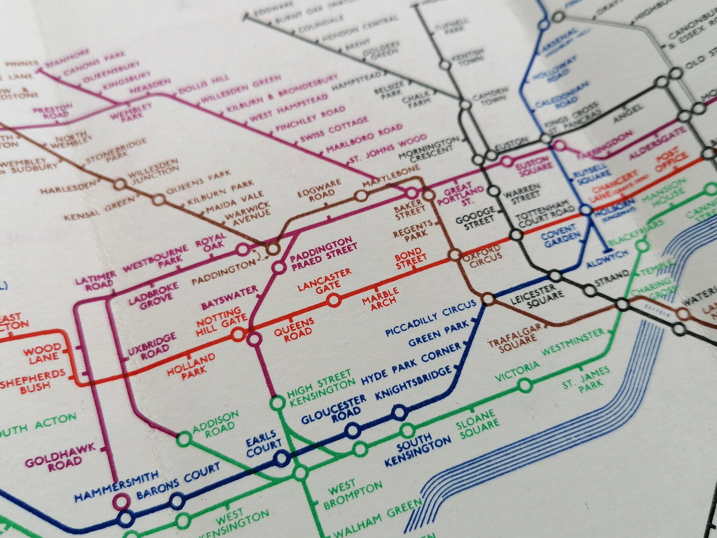
This map also sees the final appearance of the ridiculous duplication of station names at interchange/shared stations, which began in 1941 but was ceased by 1946. It also shows the Metropolitan line inner circle link between Addison Road and Latimer Road but this was destroyed in the Blitz (and its closure is mentioned in a footnote on the map). This line didn’t reopen until 2008 (as part of the Overground).
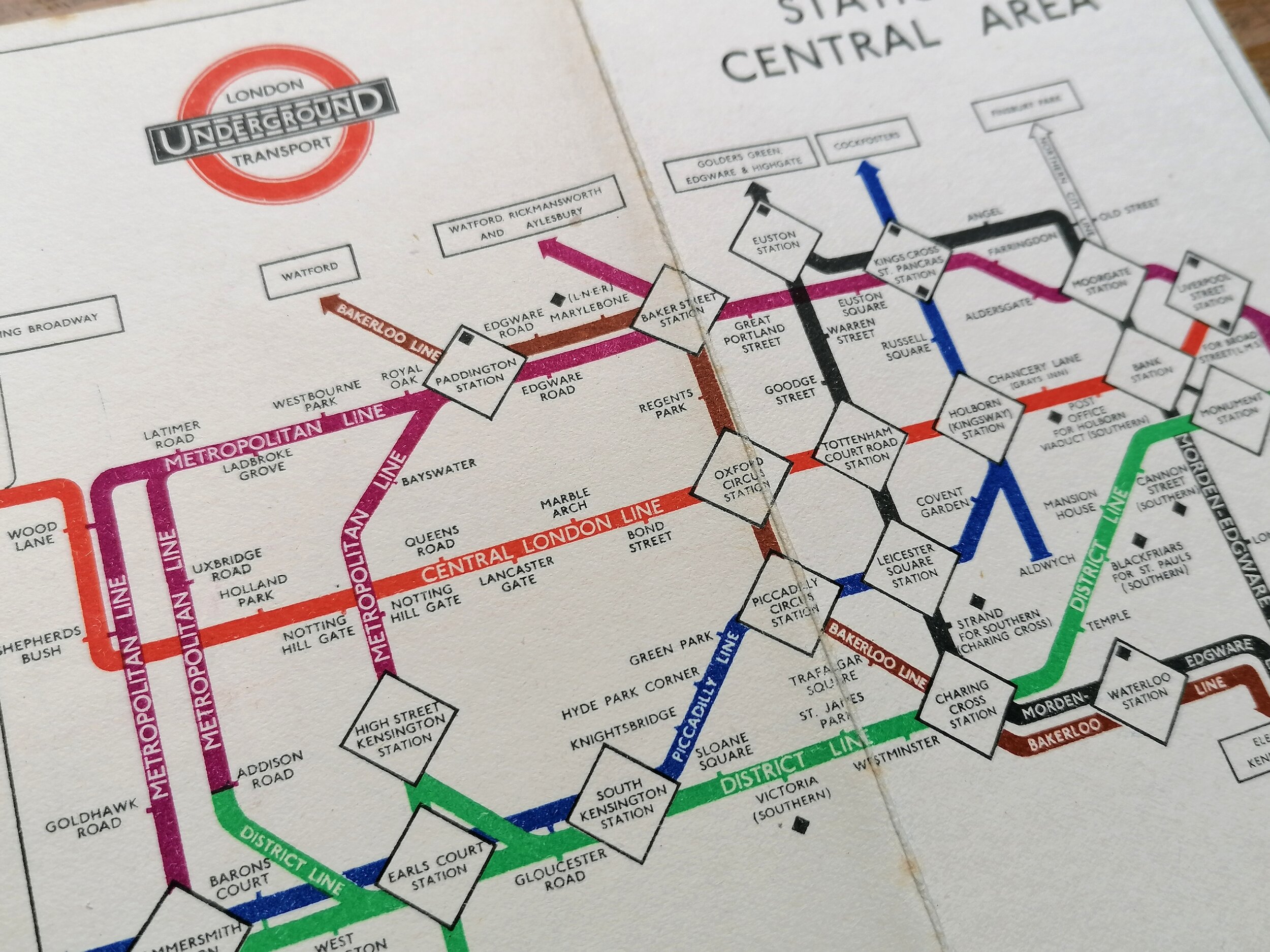
On the reserve side, there is newly redrawn “Connection with Main Line Termini” diagram which is a single colour version of the central area and was used heavily in monochrome publications.
FREE UK DELIVERY. Non-UK Delivery available, please request a quotation
Underground Lines - 1945 London Underground Pocket Map
Designed by HC Beck. Printed by Johnson Riddle & Co for London Transport. 22cm x 15.cm. Card bi-fold map. Print Code: 245.360G.765M No.1 1945. Condition: Outstanding unused condition. Signs on the rear of once being attached to a guidebook.
This 1945 edition of the London Underground Map was the last map printed during WWII and is nearly identical of Harry Becks 1943 design with just one difference: The Eastern terminus for the District Line shown as Upminster (Southend in 1943).
Harry Beck had wrestled back control of the pocket map design in 1941 after it was temporarily in the hands of Hans Schleger (1938-1941). Beck’s first map on his return saw a major redesign of his late 1930s diagram, using strikingly modern 60 degree angles and interlinking interchange stations. But in 1943, the 60 degree angles turned fully vertical creating what is often referred to as his ‘rectilinear’ diagram which was dominantly horizontals and vertical lines. Whilst it achieved greater clarity, this approach also saw a further departure from what was really happening on the ground.
Beck’s diagram would become increasing rectilinear through the 1940s and 1950s and the weakening relationship with above ground geography didn’t sit comfortably with the Underground’s Publicity Office. In the end, this is considered to be the main reason Beck was abruptly unseated as designer in 1960.
This map also sees the final appearance of the ridiculous duplication of station names at interchange/shared stations, which began in 1941 but was ceased by 1946. It also shows the Metropolitan line inner circle link between Addison Road and Latimer Road but this was destroyed in the Blitz (and its closure is mentioned in a footnote on the map). This line didn’t reopen until 2008 (as part of the Overground).
On the reserve side, there is newly redrawn “Connection with Main Line Termini” diagram which is a single colour version of the central area and was used heavily in monochrome publications.
FREE UK DELIVERY. Non-UK Delivery available, please request a quotation