


1932 London Underground Enamel Station Map - FH Stingemore - Framed
Underground Map of London - Enamel Map - 1932
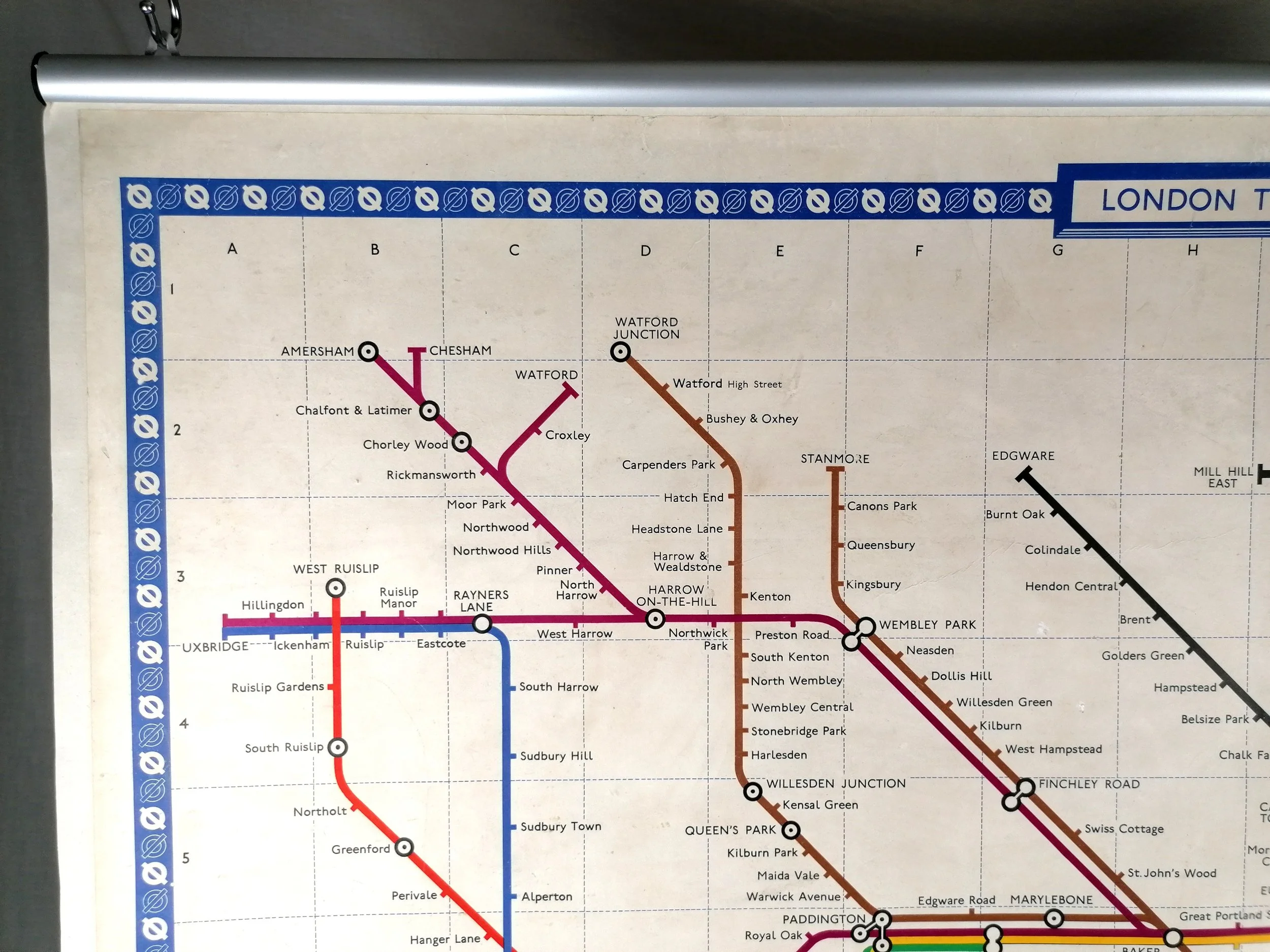
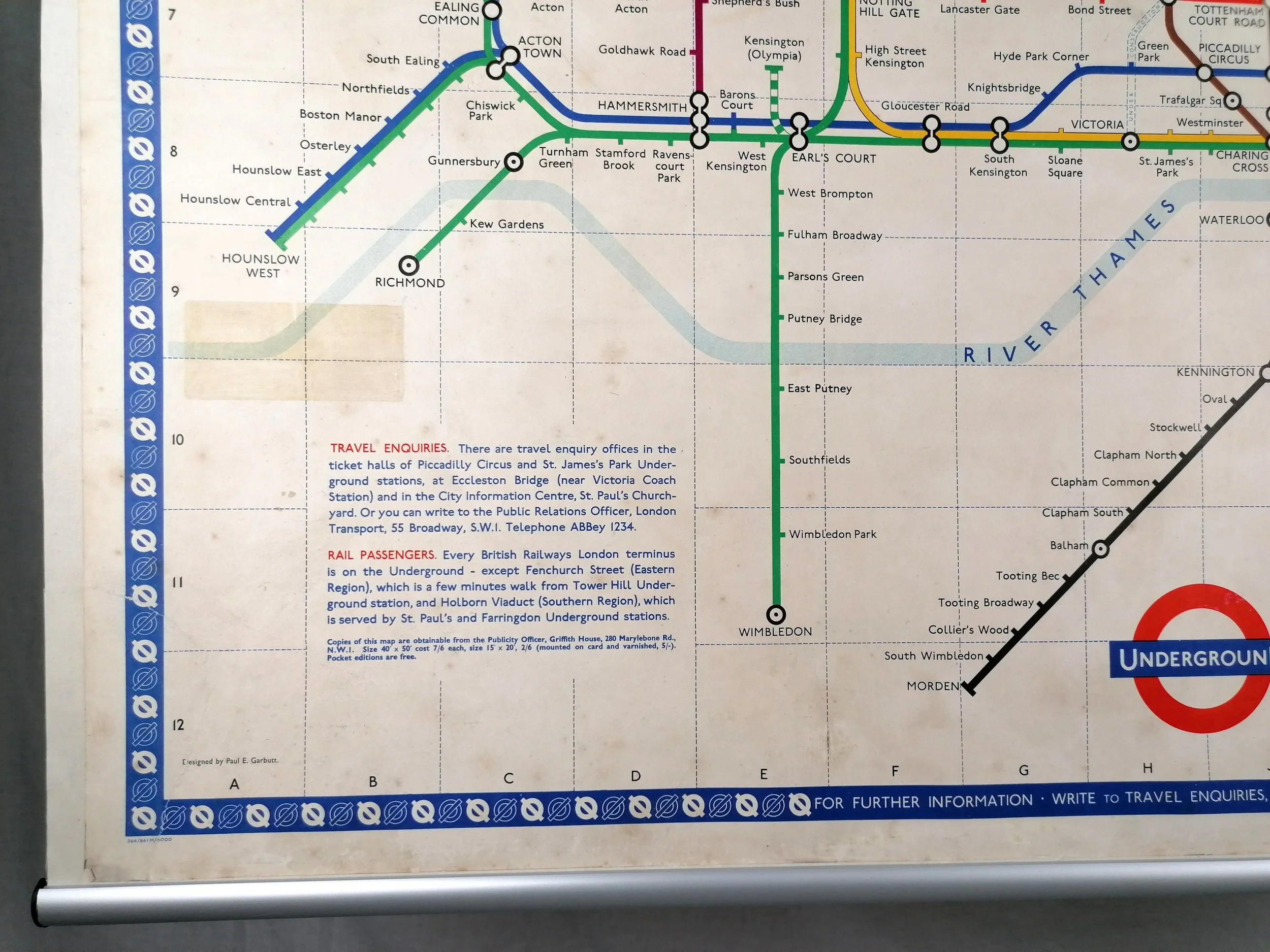
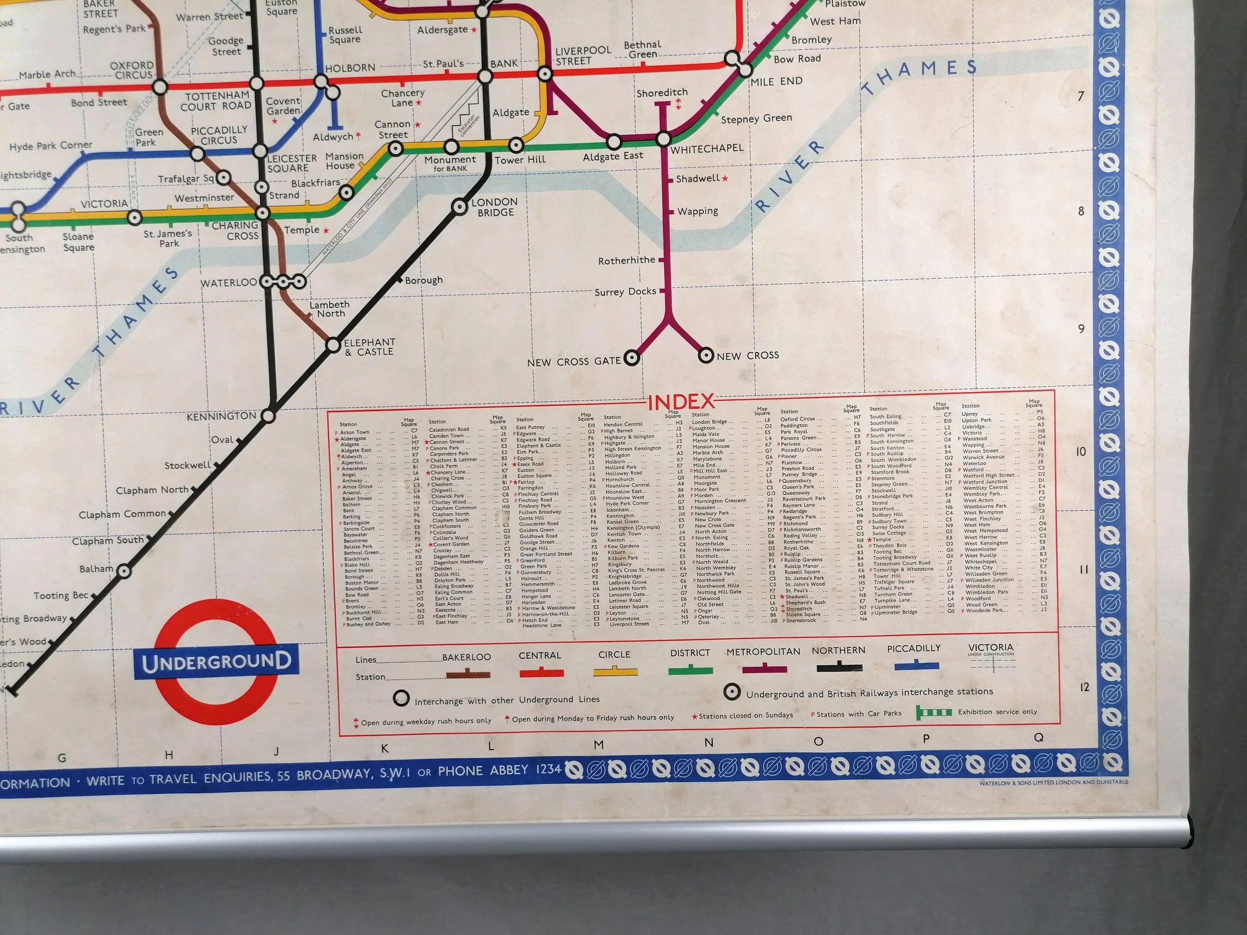
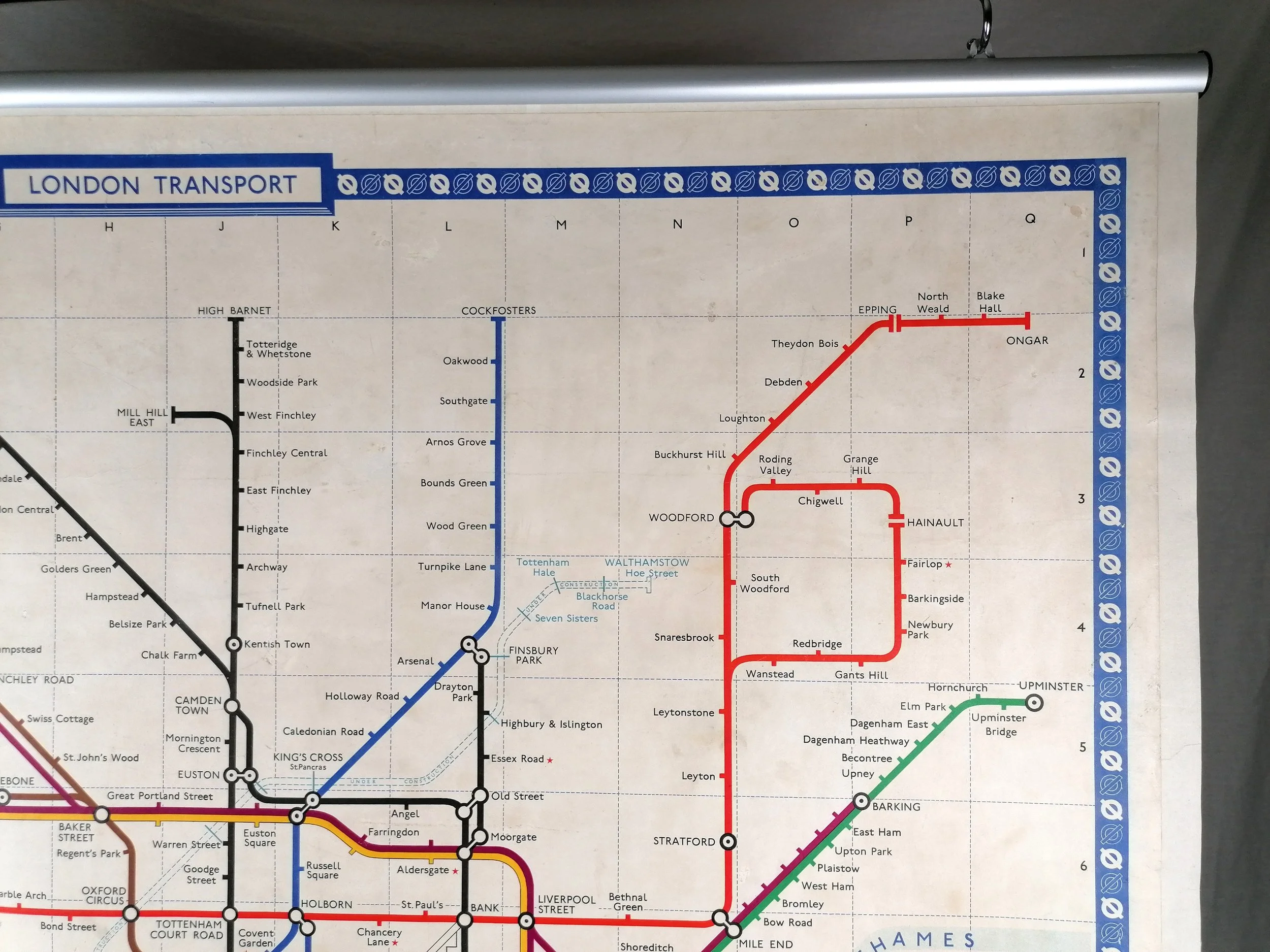
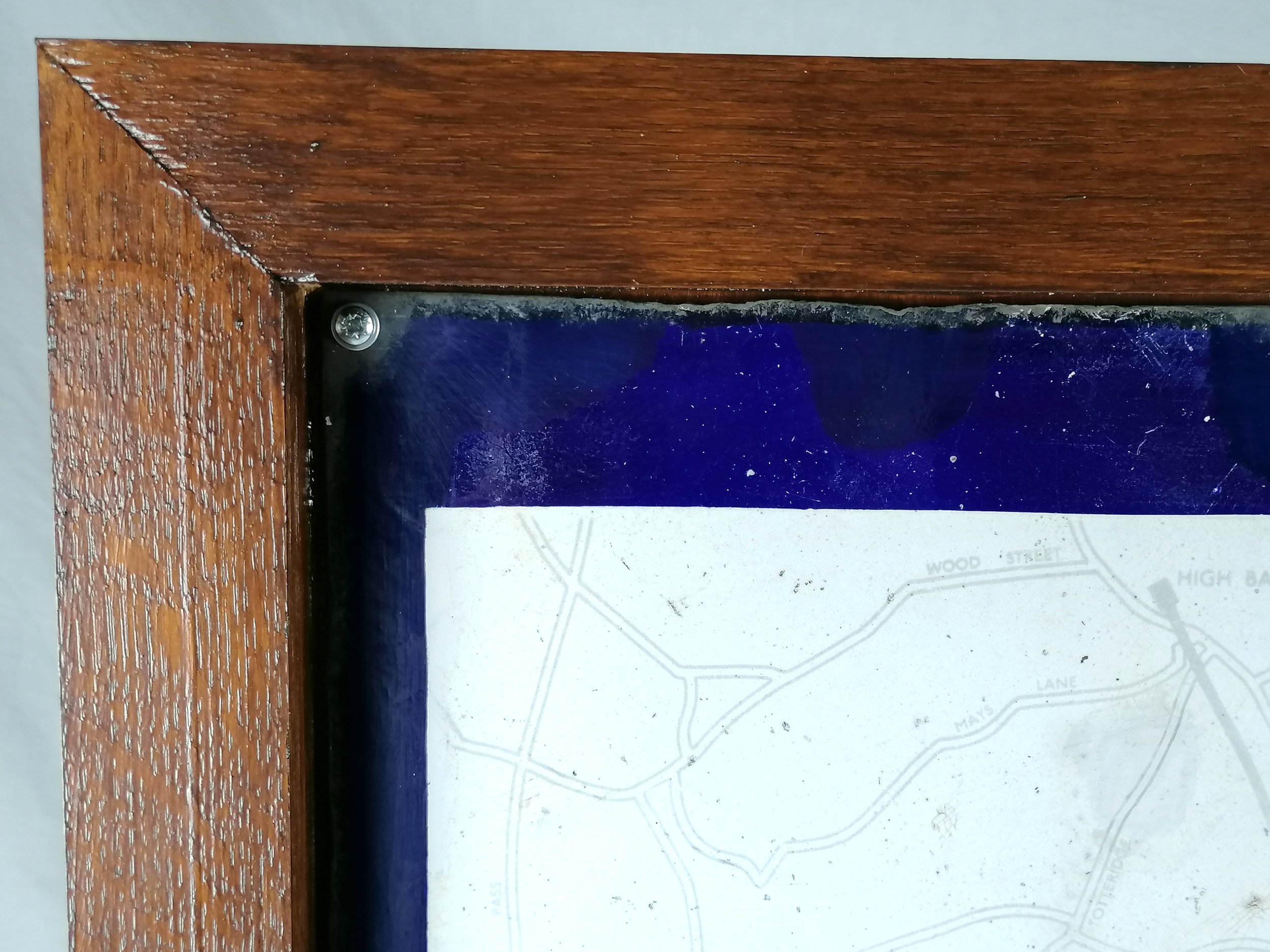
Designed Frederick H Stingemore. 1932. Produced by Chromo Wolverhampton for Underground Electric Railways of London. Vitreous Enamel on rolled iron. Presented in an custom-made oak frame. The map measures 101cm x 63cm and with the frame 112cm x 74cm. Condition: Lovely wear consistent with age and being on display outside. Some loss to the edges and signs of light restoration in places.
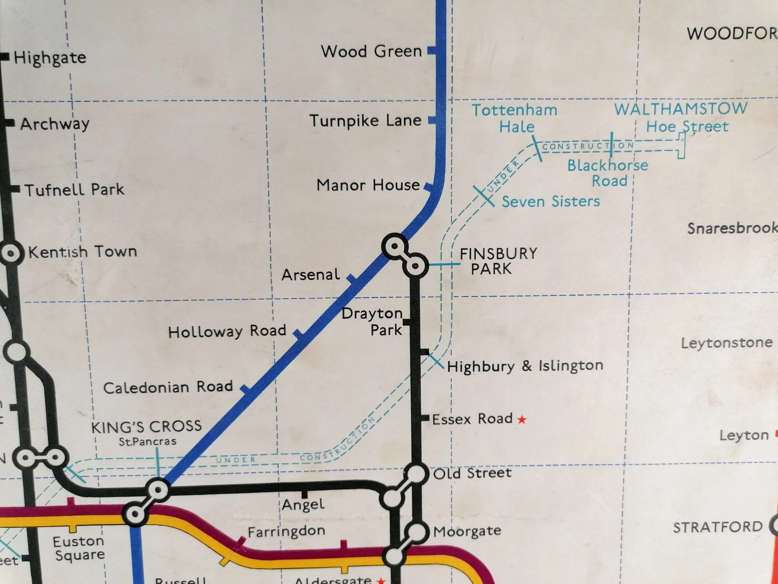
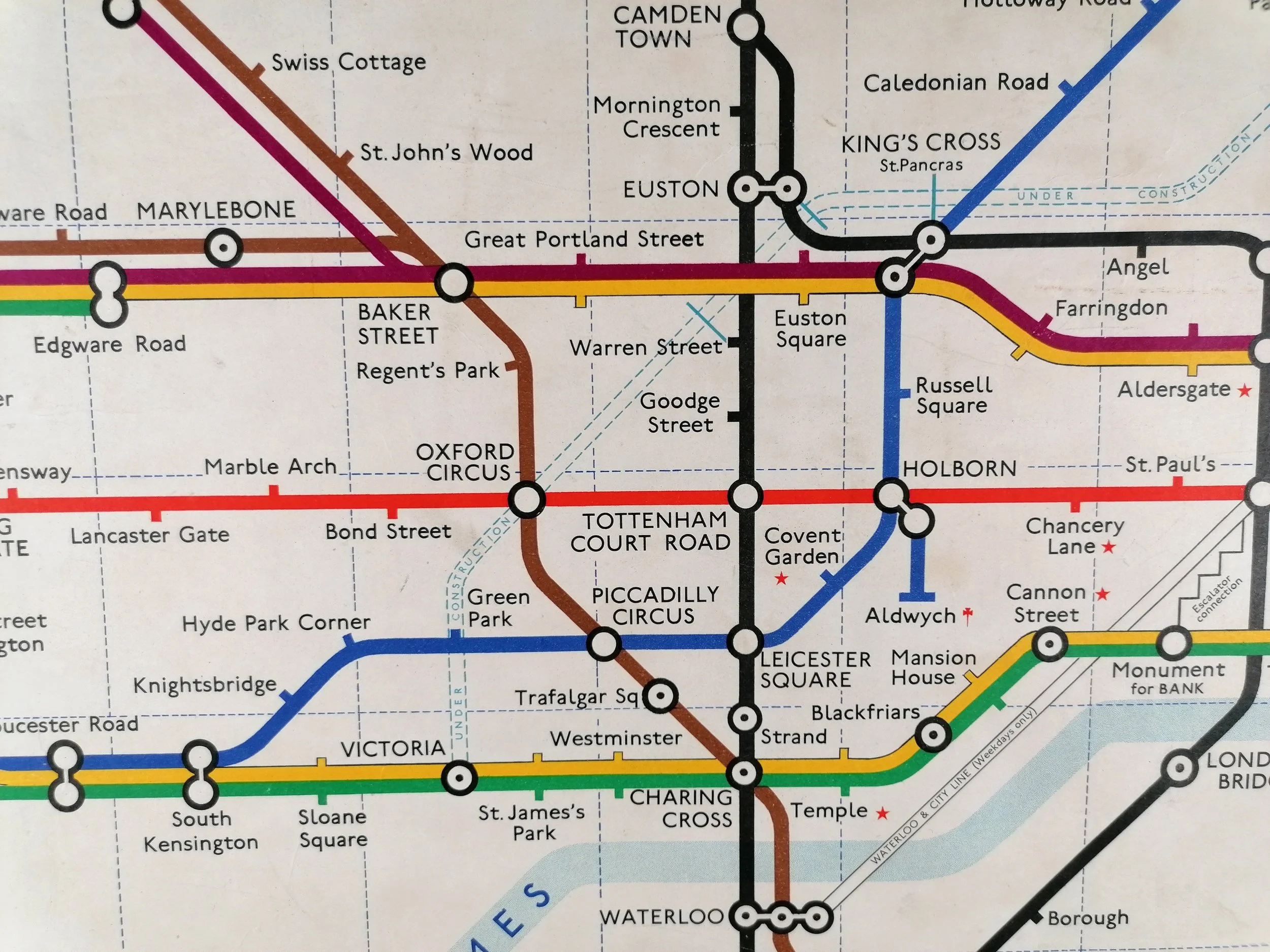
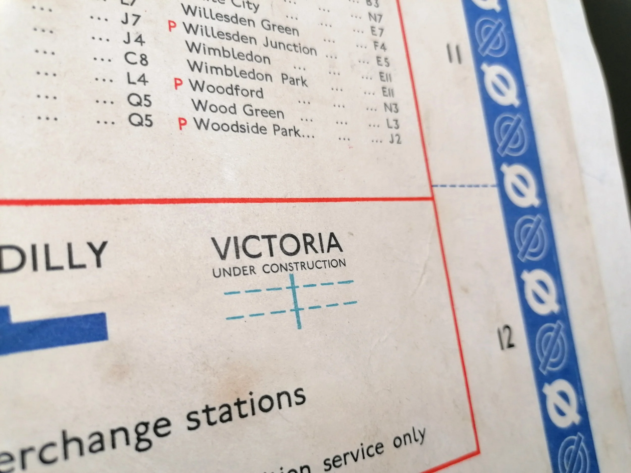
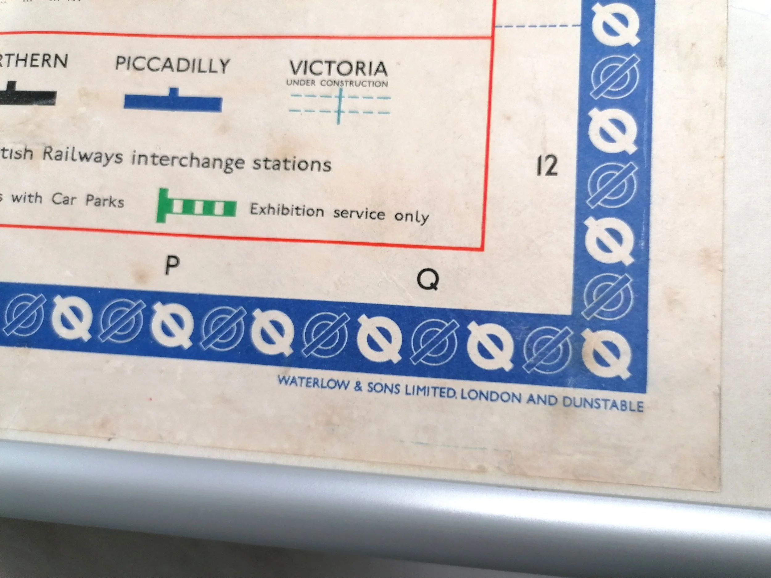
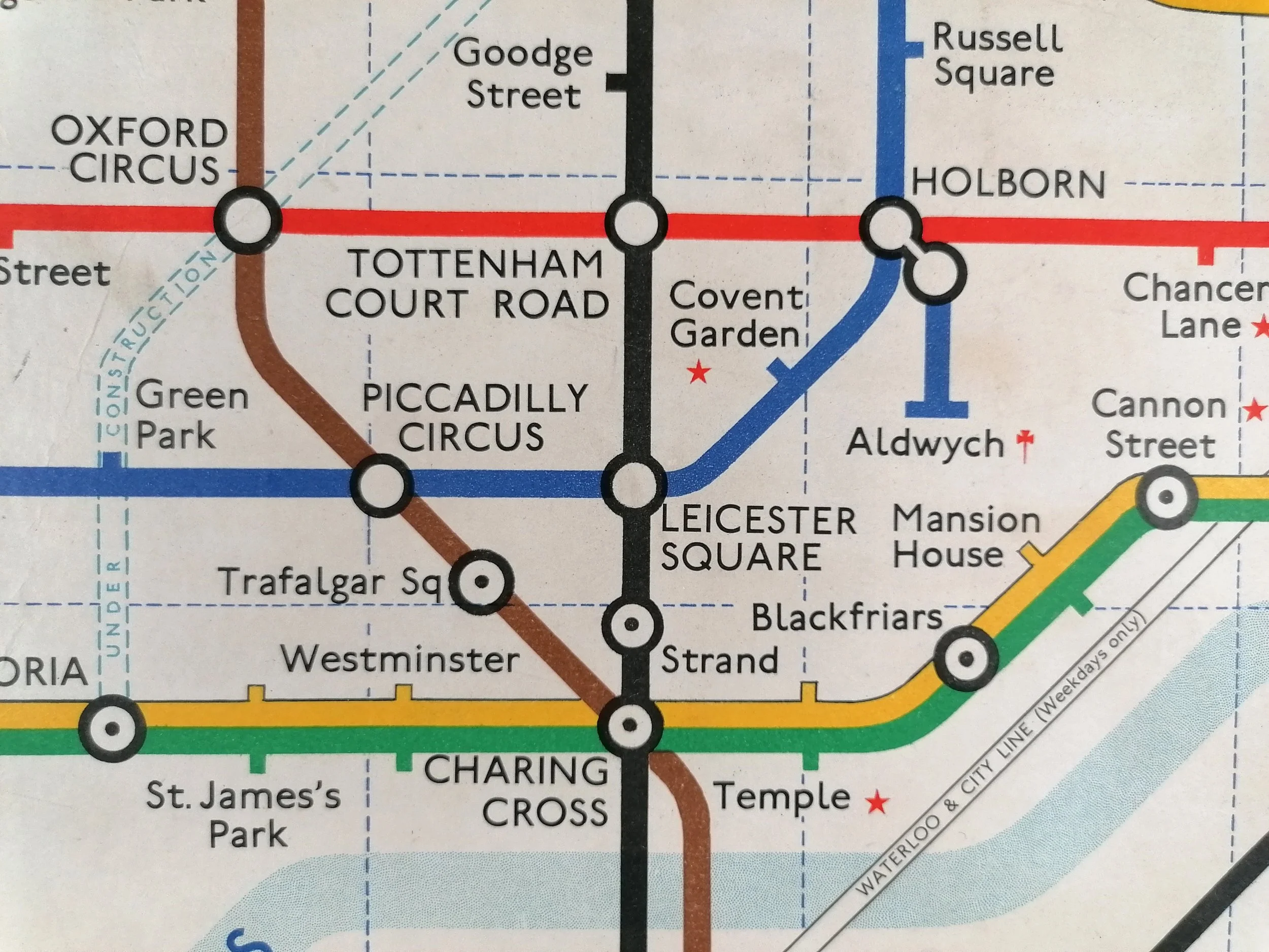
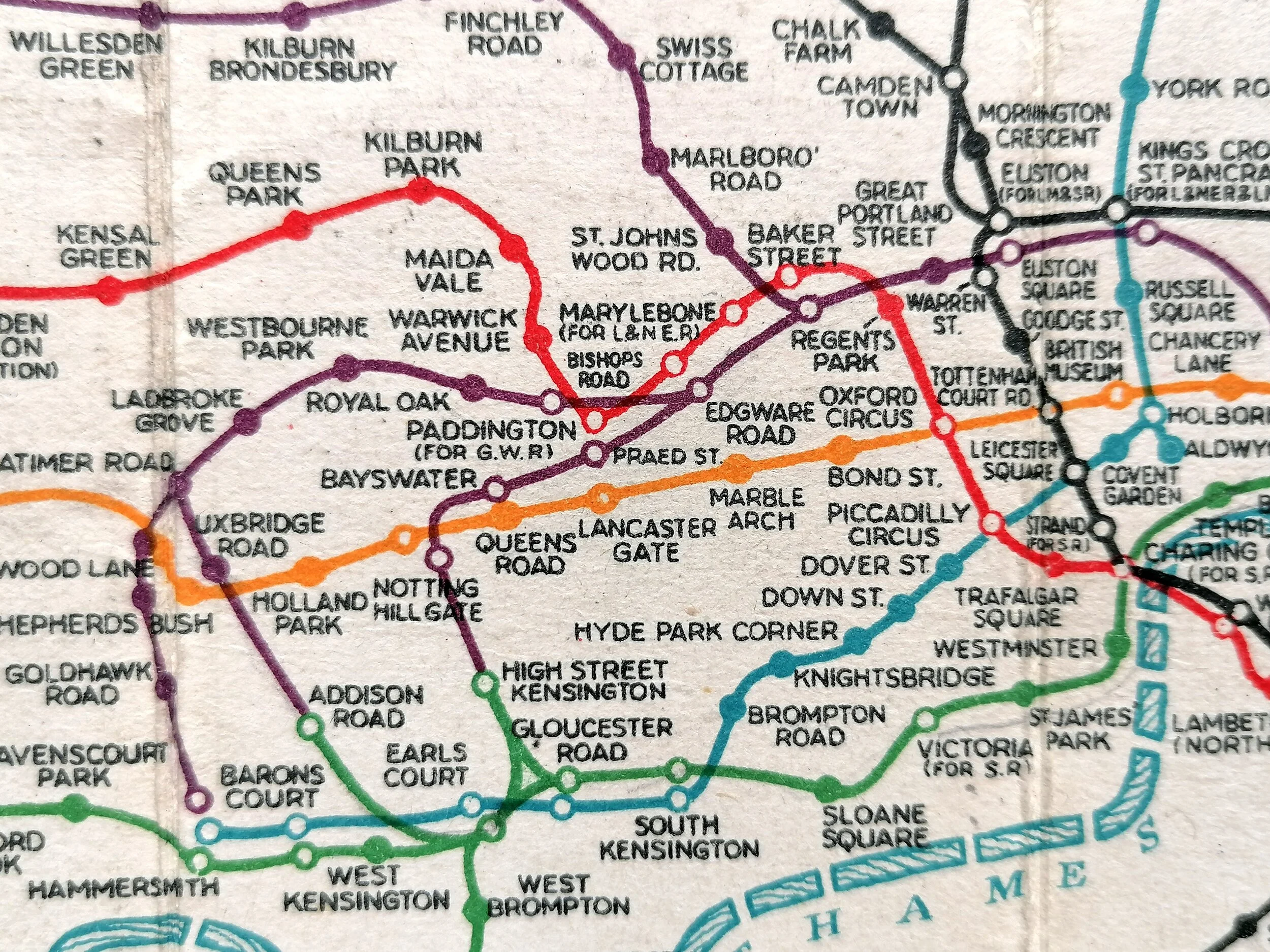
This stunning and exceptionally rare enamel map of the London Underground was design by Fred Stingemore. Unlike the paper station maps, there is no date printed but the Piccadilly line extension is shown which opened in the second half of 1932 (with the exception of Cockfosters delayed until 1933). Gillespie Road has yet to be renamed ‘Arsenal (Highbury Hill)’ (Oct 1932).
At this point in time, Harry Beck’s iconic diagrammatic map had been approved by the LPTB Executives and was issued in January 1933. Therefore this is one of the last geographical maps to be displayed at stations.
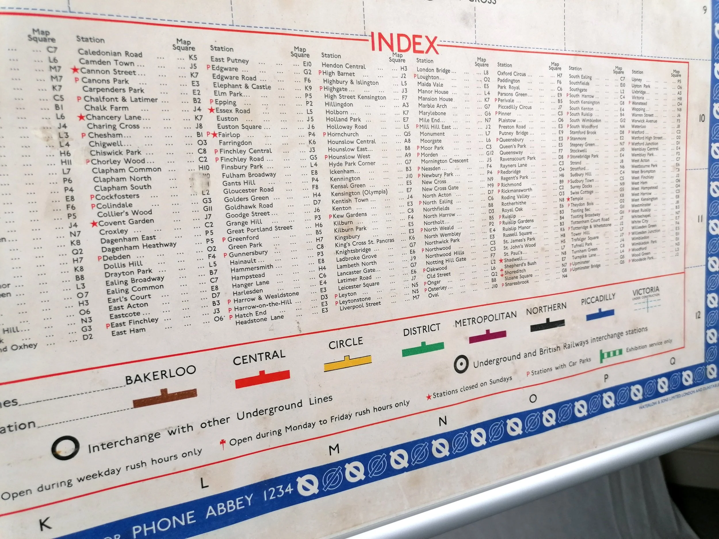
These enamel and iron maps were mounted at station entrances and were produced in very limited numbers. The display frames were introduced in 1908 to carry the first unified maps of the Underground and they varied in orientation depending on the station: they were either landscape (Quad Royal 50” x 40”) or portrait like this example (Double royal 40” x 26”). There is a surviving example on display at Temple Station.
Frederick Stingemore worked in the London Underground Drawing Office for over 40 years. He designed a broad variety of maps and posters dating back to before WWI. Most notably he designed the last series of Underground pocket maps (1925-1932) before Harry Beck's iconic diagram was introduced in 1933.
FREE UK DELIVERY. Non-UK Delivery available, please request a quotation
Underground Map of London - Enamel Map - 1932
Designed Frederick H Stingemore. 1932. Produced by Chromo Wolverhampton for Underground Electric Railways of London. Vitreous Enamel on rolled iron. Presented in an custom-made oak frame. The map measures 101cm x 63cm and with the frame 112cm x 74cm. Condition: Lovely wear consistent with age and being on display outside. Some loss to the edges and signs of light restoration in places.
This stunning and exceptionally rare enamel map of the London Underground was design by Fred Stingemore. Unlike the paper station maps, there is no date printed but the Piccadilly line extension is shown which opened in the second half of 1932 (with the exception of Cockfosters delayed until 1933). Gillespie Road has yet to be renamed ‘Arsenal (Highbury Hill)’ (Oct 1932).
At this point in time, Harry Beck’s iconic diagrammatic map had been approved by the LPTB Executives and was issued in January 1933. Therefore this is one of the last geographical maps to be displayed at stations.
These enamel and iron maps were mounted at station entrances and were produced in very limited numbers. The display frames were introduced in 1908 to carry the first unified maps of the Underground and they varied in orientation depending on the station: they were either landscape (Quad Royal 50” x 40”) or portrait like this example (Double royal 40” x 26”). There is a surviving example on display at Temple Station.
Frederick Stingemore worked in the London Underground Drawing Office for over 40 years. He designed a broad variety of maps and posters dating back to before WWI. Most notably he designed the last series of Underground pocket maps (1925-1932) before Harry Beck's iconic diagram was introduced in 1933.
FREE UK DELIVERY. Non-UK Delivery available, please request a quotation