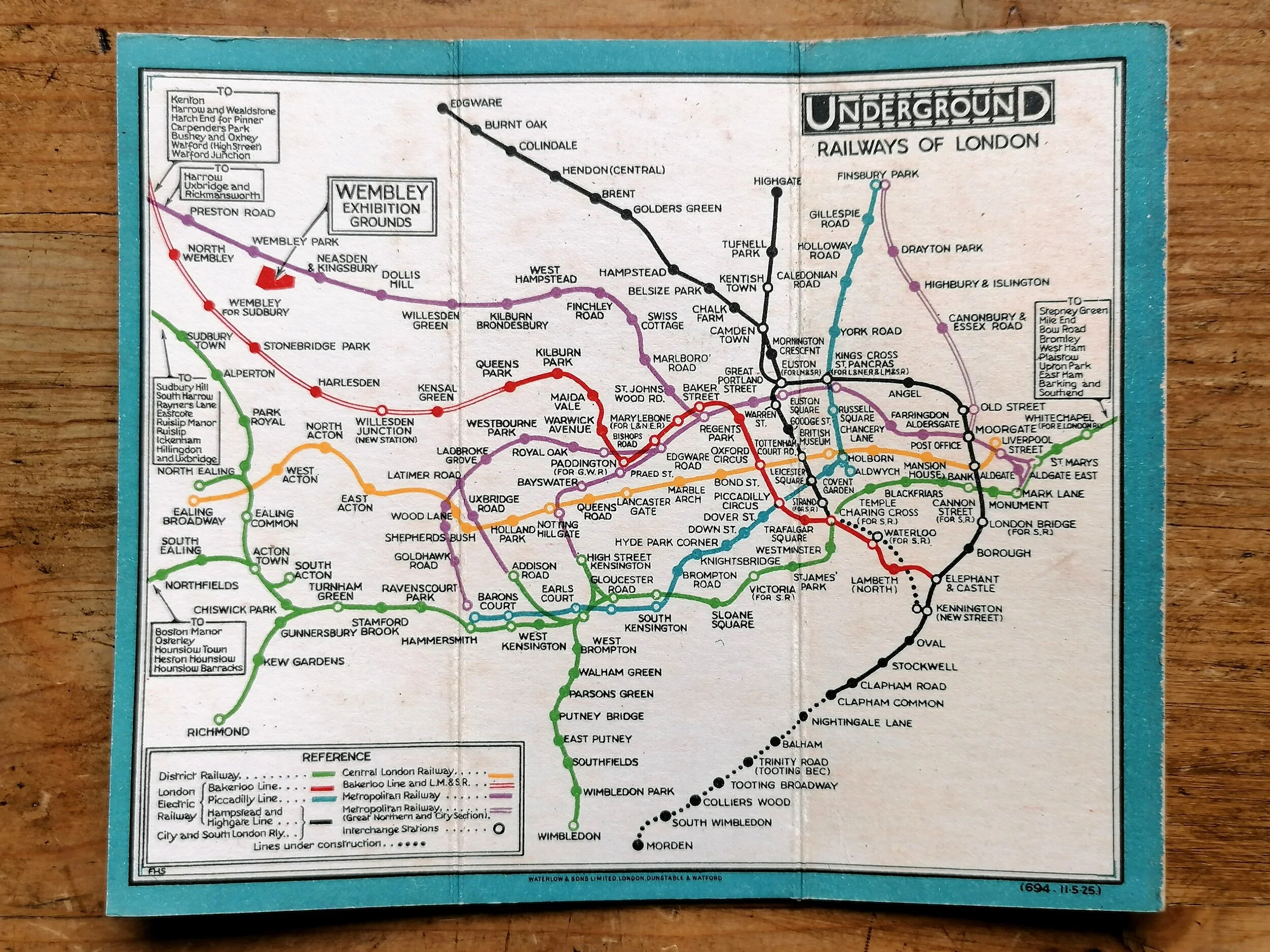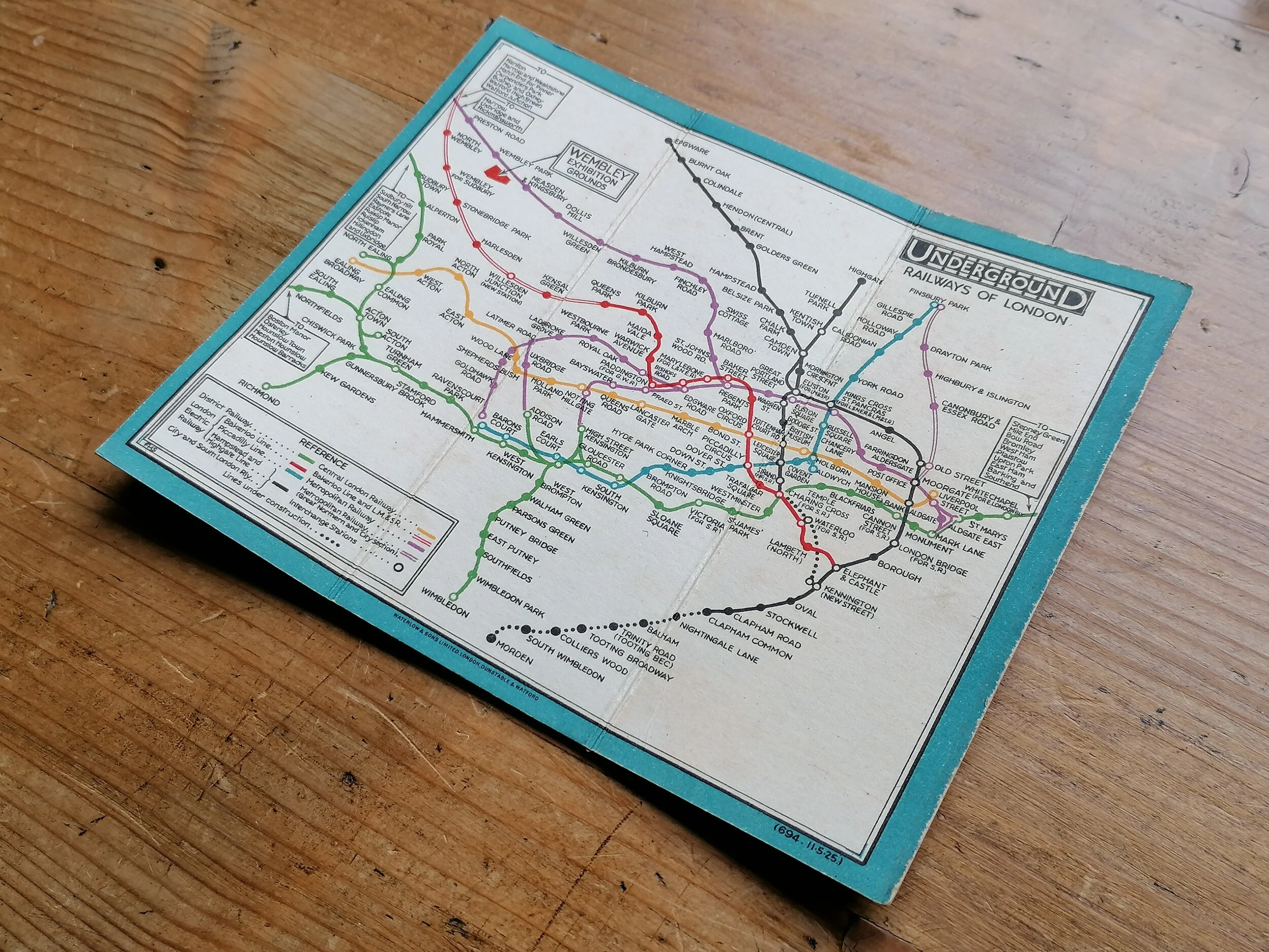


Map of London - The Queens Diamond Jubilee Procession (1897)
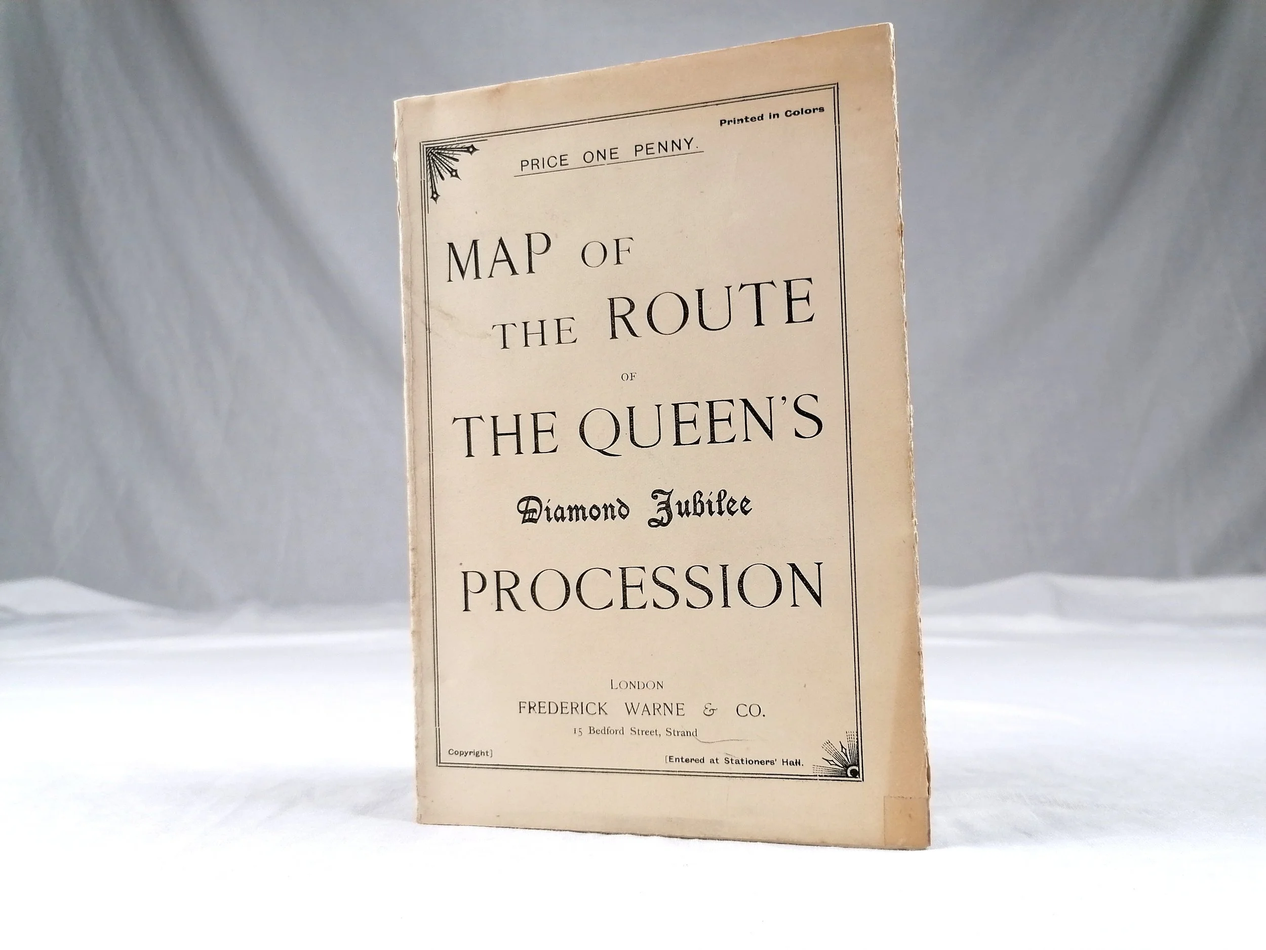
Map of the Route of The Queen’s Diamond Jubilee Procession
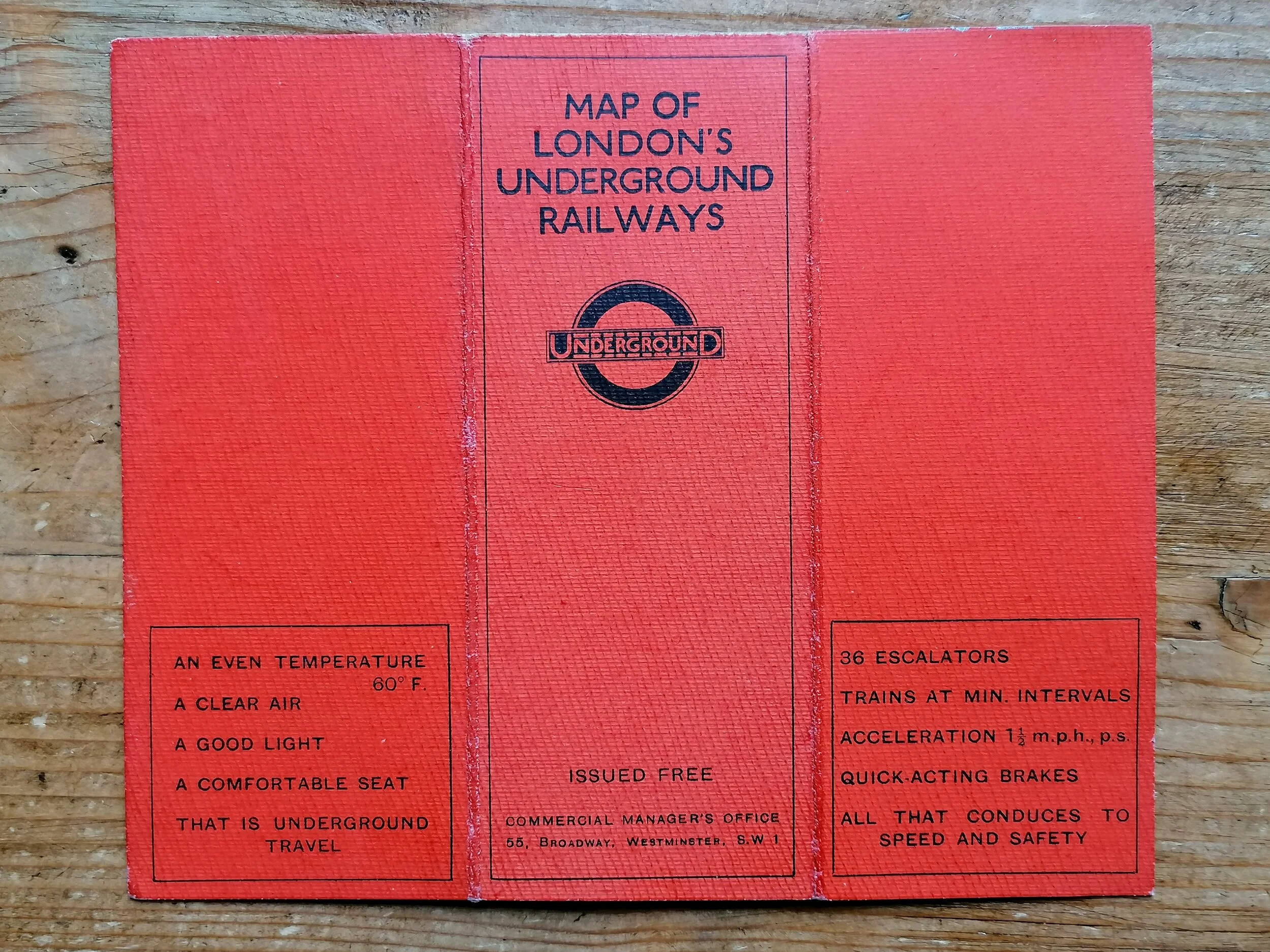
Printed by Martin Hood & Larkin Lithographers. Published by Frederick Warne & Co Ltd. Colour lithograph on thick paper stock. Measures 50.5cm x 38cm. Folded as issued. Advertisements on reserve side in 8 panels. In Very good condition. Small tape repairs at the bottom of each vertical fold. One advertisement panel on the reserve side has four brown marks (probably glue from being stuck into an album).
This exceptionally rare map shows the procession route through central London for Queen Victoria’s Diamond Jubilee in 1897. It marks the route with a beige tone and all unnecessary background detail has been omitted for clarity. The mainline railway stations are shown boldly in red with the District Railway (Underground) indicated with a dotted red line connecting small red stations. Only a few key buildings and landmarks are shown including St Pauls Cathedral.
Interestingly, William Whiteley’s stand between The Strand and Fleet Street is circled in red suggesting this map might have been produced in partnership with Whiteley’s department store as its the only commercial feature on the map.
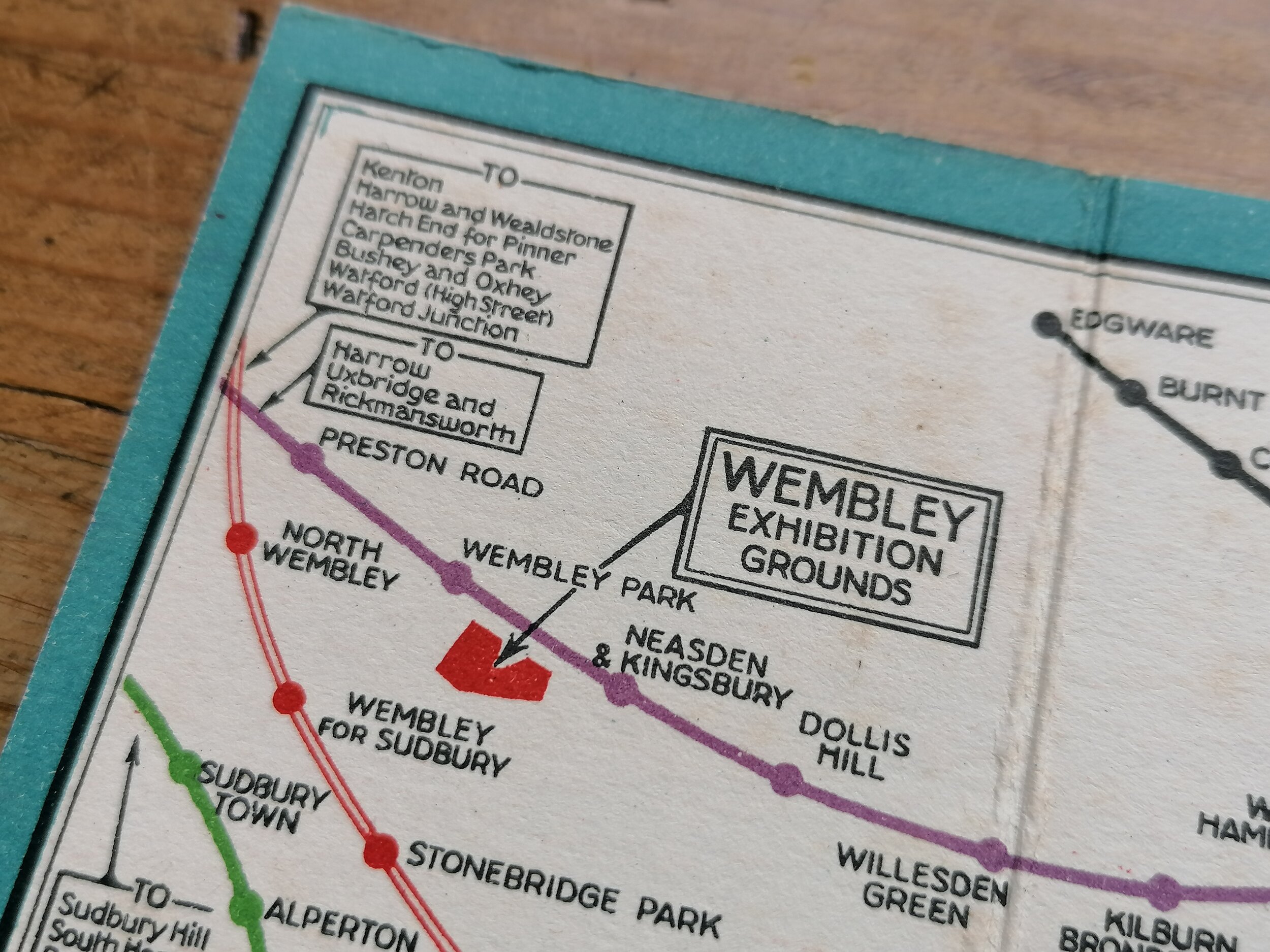
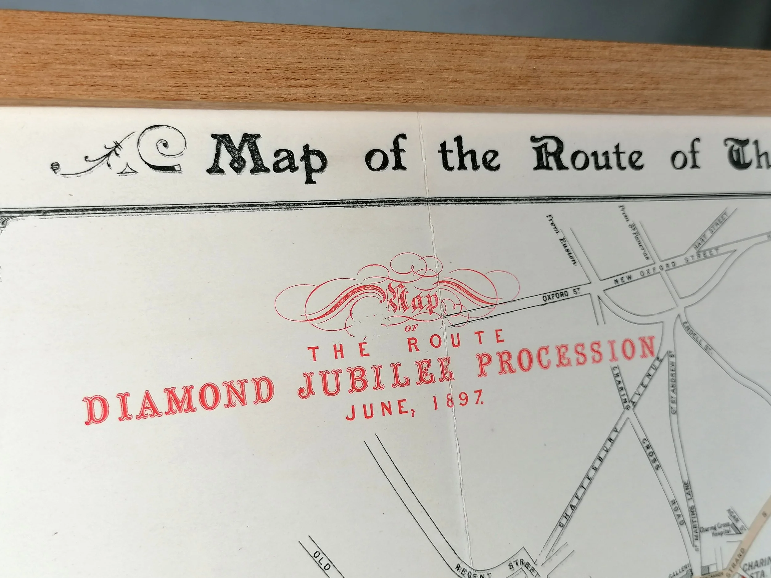
Map of the Route of The Queen’s Diamond Jubilee Procession
Printed by Martin Hood & Larkin Lithographers. Published by Frederick Warne & Co Ltd. Colour lithograph on thick paper stock. Measures 50.5cm x 38cm. Folded as issued. Advertisements on reserve side in 8 panels. In Very good condition. Small tape repairs at the bottom of each vertical fold. One advertisement panel on the reserve side has four brown marks (probably glue from being stuck into an album).
This exceptionally rare map shows the procession route through central London for Queen Victoria’s Diamond Jubilee in 1897. It marks the route with a beige tone and all unnecessary background detail has been omitted for clarity. The mainline railway stations are shown boldly in red with the District Railway (Underground) indicated with a dotted red line connecting small red stations. Only a few key buildings and landmarks are shown including St Pauls Cathedral.
Interestingly, William Whiteley’s stand between The Strand and Fleet Street is circled in red suggesting this map might have been produced in partnership with Whiteley’s department store as its the only commercial feature on the map.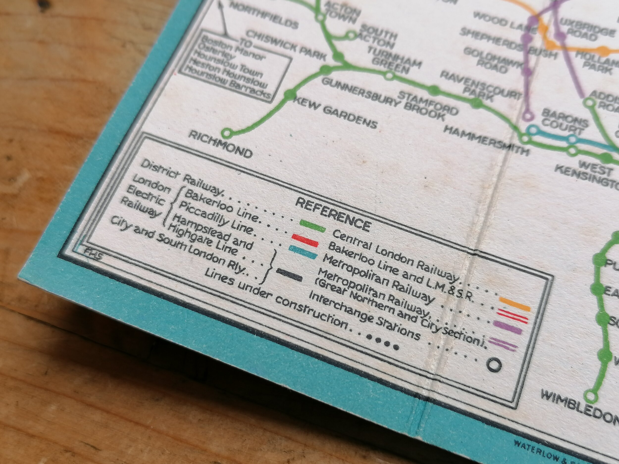