1930 London Underground Pocket Map - FH Stingemore (8th Edition)
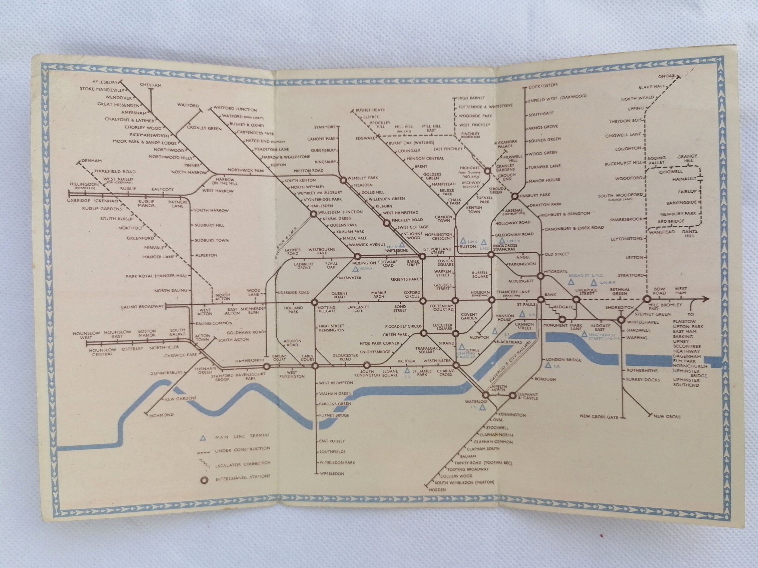
Map of London’s Underground Railways
Designed by Frederick H Stingemore (FHS). Printed by Waterlow & Sons for London Underground . 1930, 8th Edition. 16.7cm x 14.2cm Linen-card. Condition: Overall excellent. Some cover marks and wear on the cover edges. Minor age-related marks on the map face.
This is Fred Stingemore’s 8th revision of his 12-map series and was issued in early 1930. It is considered the rarest map in the series. This would be the last of Stingemore's maps printed by Waterlow & Sons (9th-12th editions were printed by David Allen Printers). Compared with the 7th edition (1929 - Mint green cover) the Piccadilly Line extensions for Northfields and Cockfosters are labelled in red. other subtle changes include: The Underground logo has moved from top right to bottom right to make space for Piccadilly extension; Thames reappears in places it was previously removed including below Richmond; 'Commercial Managers Office' replaced with 'Publicity Managers Office' on the front panel; River Thames text is has reduced in sized and repositioned.
Despite a career spanning over 40 years in the London Underground Drawing Office, it is as HC Beck’s immediate predecessor as map designer that Frederick Stingemore is most well known.
Like many before him, Stingemore grappled with the density and sprawl of the Underground railway network to draft a series of pocket maps from 1925 to 1932. The Stingemore series of pocket maps saw 12 bi-fold linen-card editions, each with a distinctive colour cover. The map design improved in clarity with each iteration whilst remaining topographical in format with some distortion applied for outlying areas. It was Stingemore that had encouraged his colleague, Harry Beck, to resubmit his radical circuit diagram design after it was initially rejected. Beck’s diagram was published in January 1933.
Free UK Delivery. For Non-UK delivery, please request quotation.
- Price does NOT include delivery.
- Delivery/collection must be purchased/organised separate to product purchase.
- Please ensure you have read and agree to the conditions within our Returns Policy (link at bottom of page)
- Please use the Enquiry Form below to request a delivery estimate, if required.
Enquire about this item