1909 London Underground Map Booklet - Double-Page Map
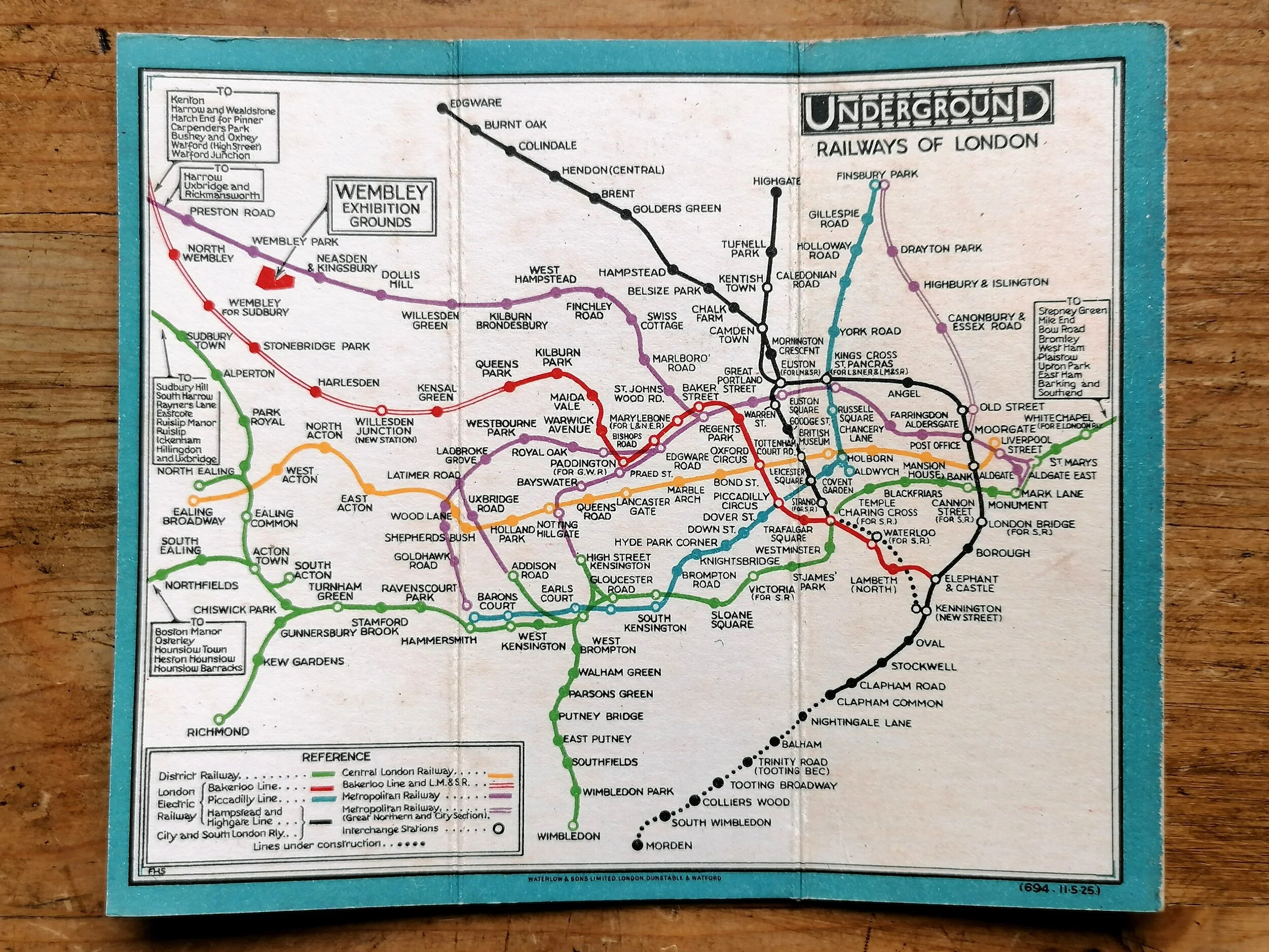
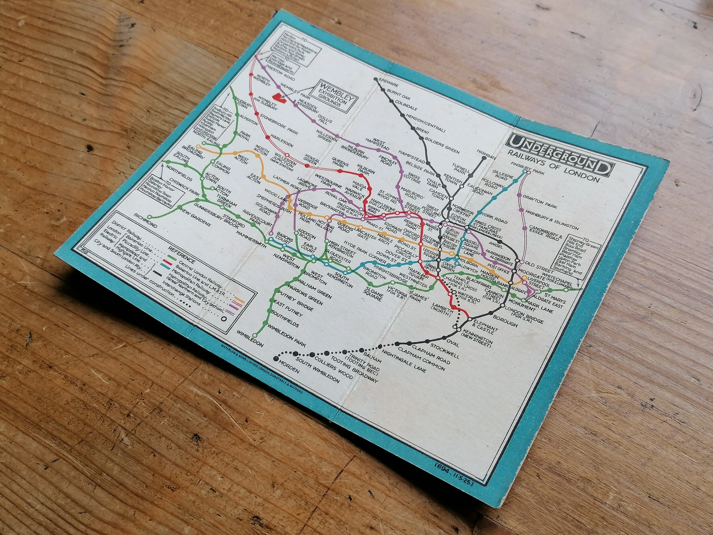
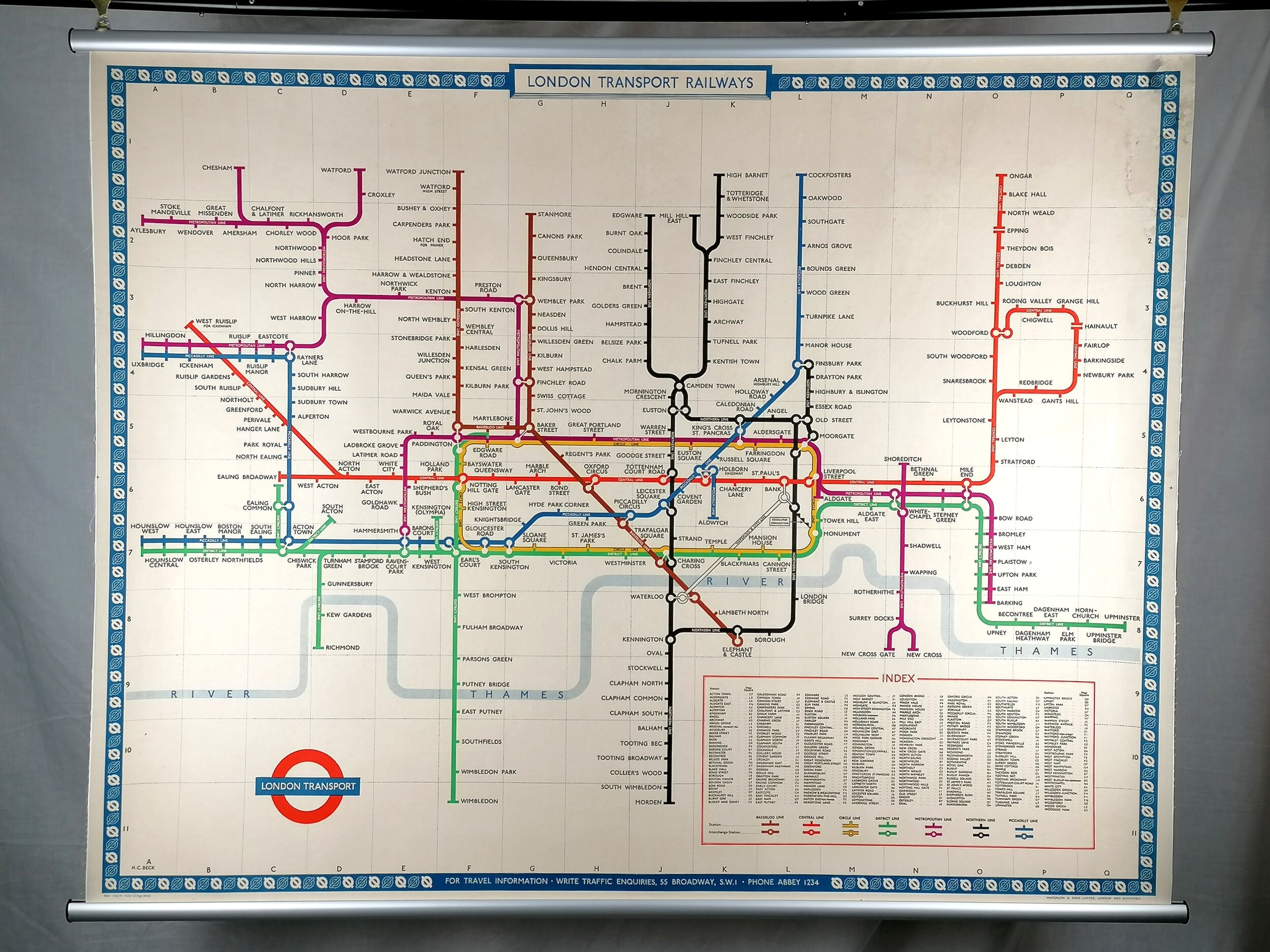
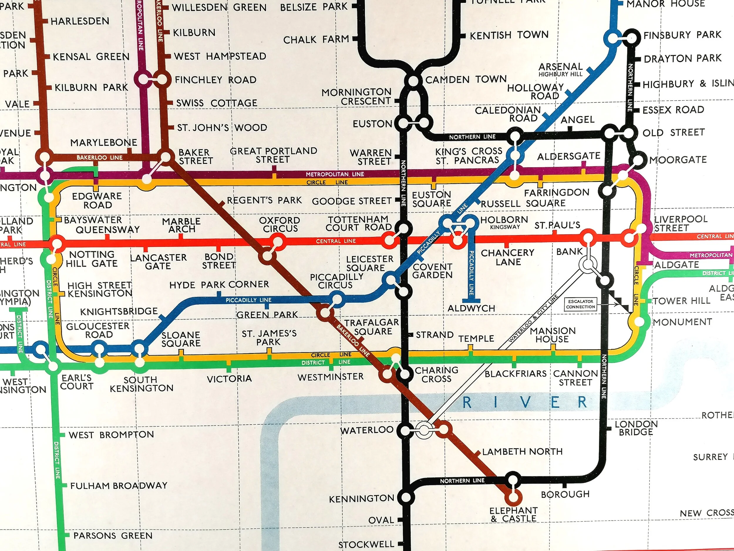
Original 1909 London Underground "Street & Railways Map in Sections" containing a double-page colour map of the London Underground & "No Need to Ask a P'Liceman" advertisement.
Printed booklet 54 pages. Lithographically printed by Johnson & Riddle for UERL. Measures 18cm x 12cm. Condition: Good. Some light water staining to cover. Staples rusted. two loose pages.
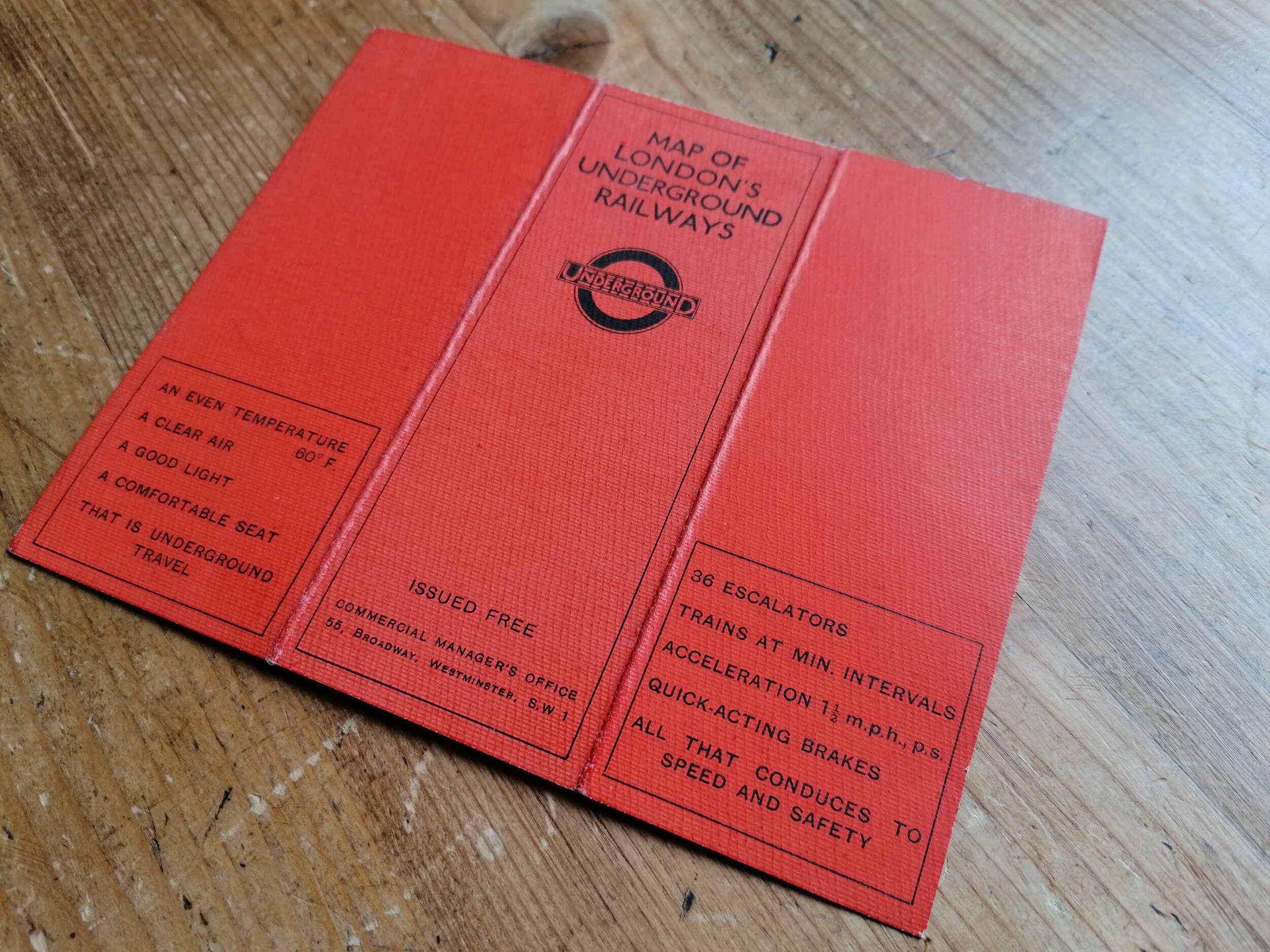
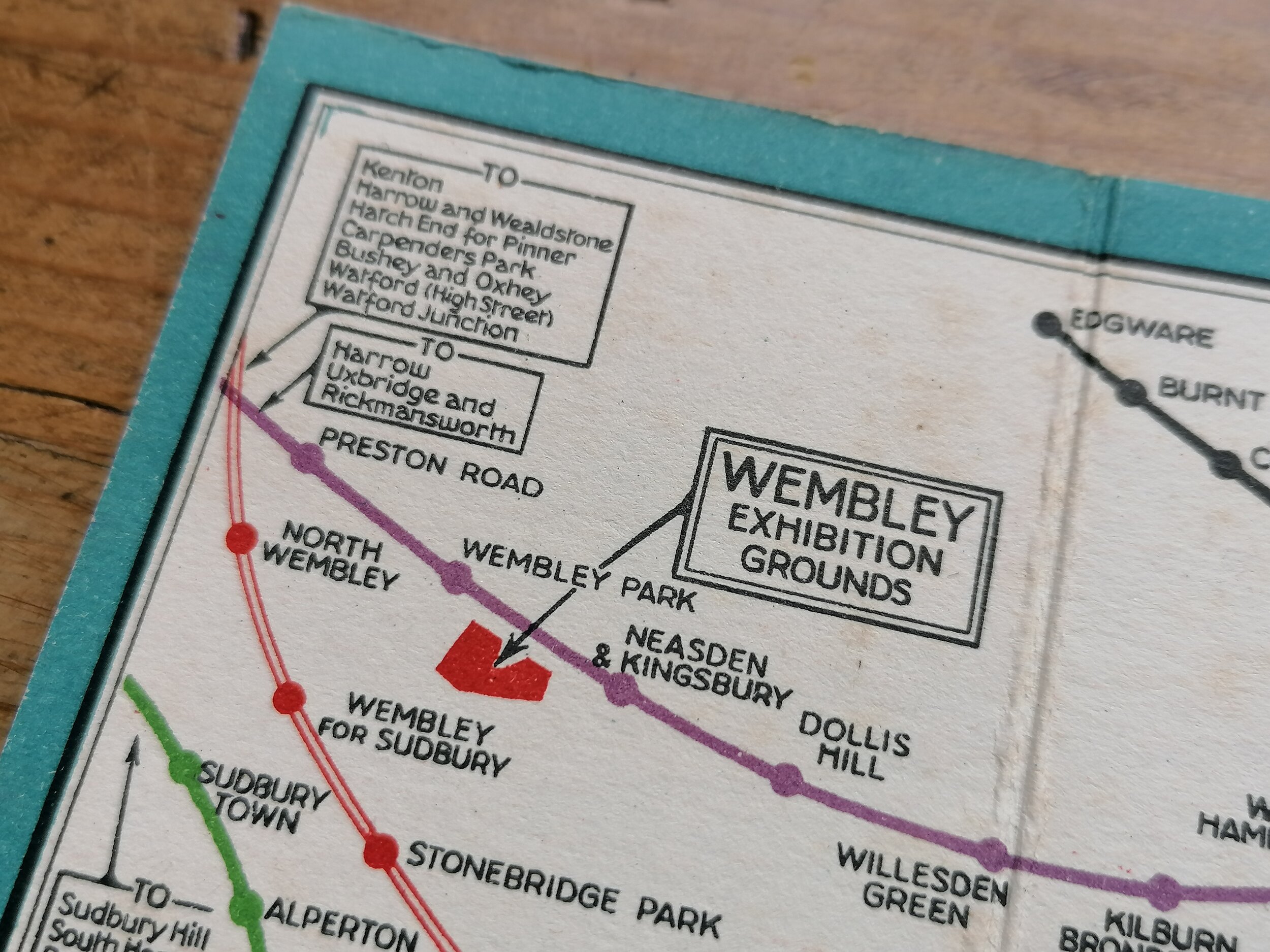
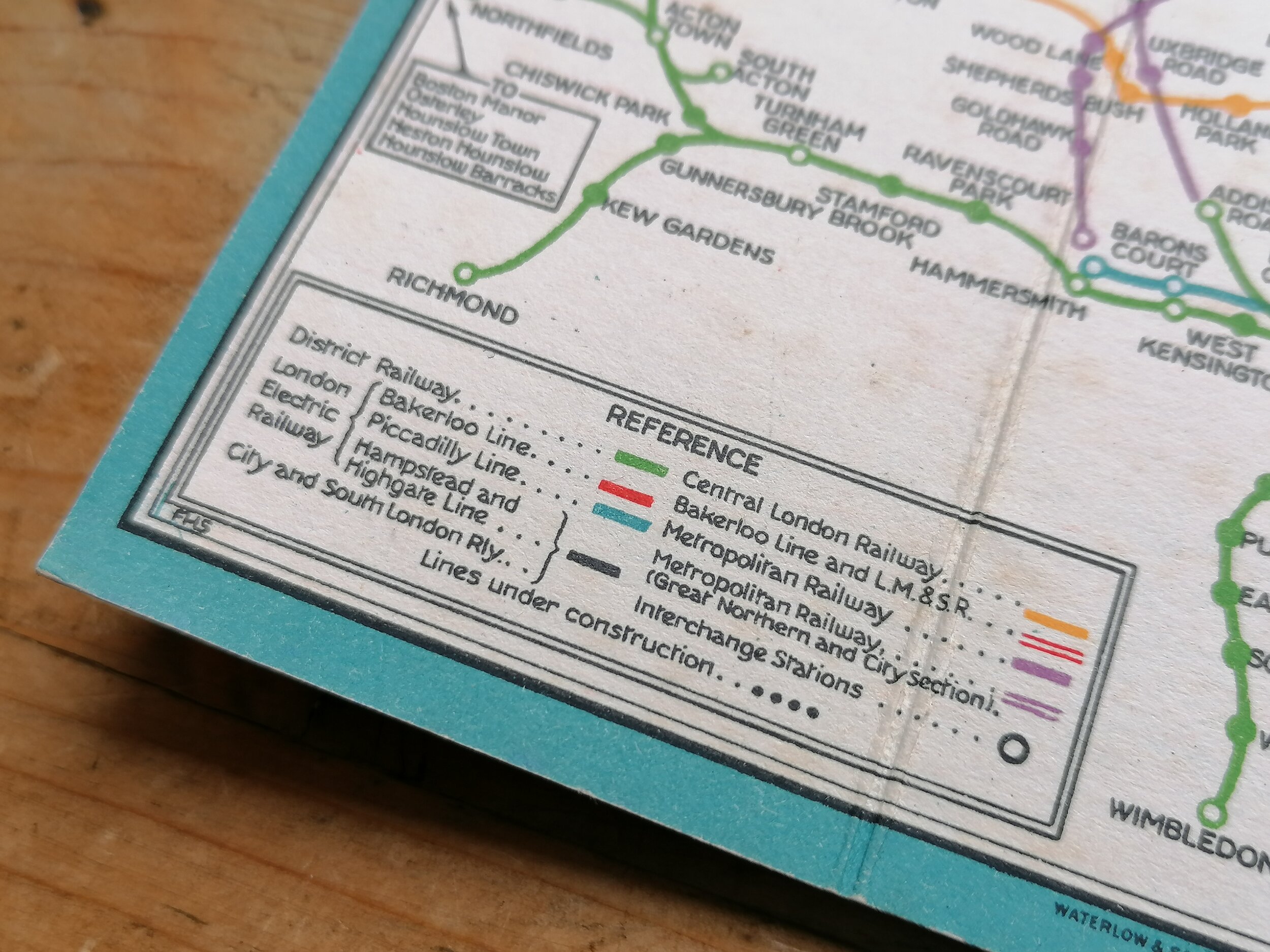
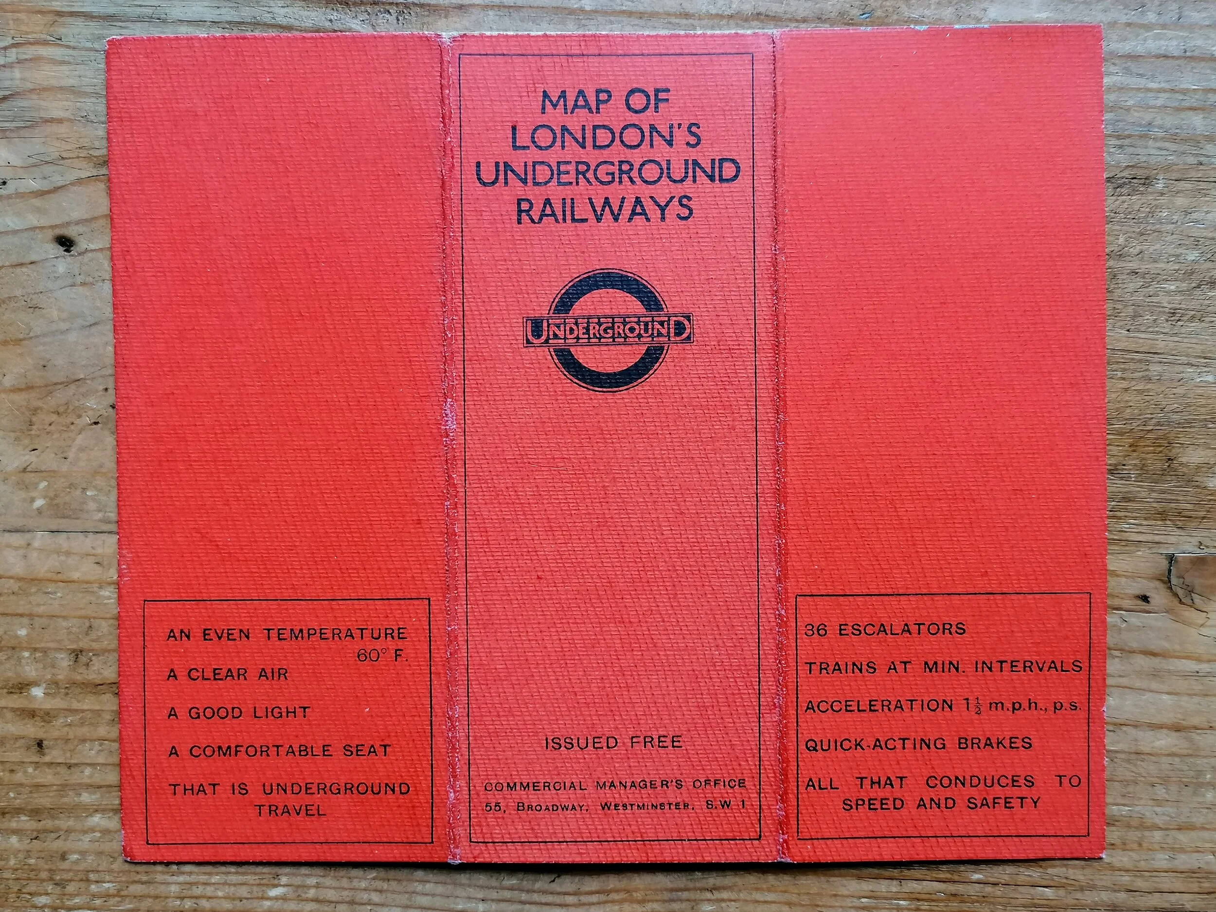
This wonderful and rare booklet was issued shortly after the unification of the Underground railway companies in 1908. Within its charmingly decorative covers bearing the (then) new "UndergrounD" branding are sectional maps covering the majority of central london in good detail and in the context of the associated Underground railways. Towards the front, across two pages, there is a lovely full colour map of the London Underground similar to the common map issued at stations but with an red overprint showing the page for each sectional map. The map can be dated to mid-1909, before Gower Street and Bishopsgate were renamed Euston Road and Liverpool Street later that year.
Also in the book is a lovely single colour illustration, originally created as a full colour poster for stations, titled "No Need to Ask a P'liceman" by John Hassel
The early 1900s saw a rapid pace in the development of 'deep-level tubes' and by 1906, there were numerous Underground raillway companies operating largely in isolation to one another to the detriment of themselves and confused passengers. In 1907, the four main London Underground railway companies, unified by their dire financial situation, came together and agreed to promote their joint interests as a complete Underground railway system. In April 1908, the first all-inclusive map design of the London Underground was approved and initially used by each Railway company under their own branding. It was later in 1908, in a bid to better present as one system, that the companies agreed to operate under a single brand - The first UndergrounD workmark was born. The streamlining of station signage, posters and publicity were all co-ordinated immediately.
FREE UK DELIVERY. Non-UK Delivery available, please request a quotation
Original 1909 London Underground "Street & Railways Map in Sections" containing a double-page colour map of the London Underground & "No Need to Ask a P'Liceman" advertisement.
Printed booklet 54 pages. Lithographically printed by Johnson & Riddle for UERL. Measures 18cm x 12cm. Condition: Good. Some light water staining to cover. Staples rusted. two loose pages.
This wonderful and rare booklet was issued shortly after the unification of the Underground railway companies in 1908. Within its charmingly decorative covers bearing the (then) new "UndergrounD" branding are sectional maps covering the majority of central london in good detail and in the context of the associated Underground railways. Towards the front, across two pages, there is a lovely full colour map of the London Underground similar to the common map issued at stations but with an red overprint showing the page for each sectional map. The map can be dated to mid-1909, before Gower Street and Bishopsgate were renamed Euston Road and Liverpool Street later that year.
Also in the book is a lovely single colour illustration, originally created as a full colour poster for stations, titled "No Need to Ask a P'liceman" by John Hassel
The early 1900s saw a rapid pace in the development of 'deep-level tubes' and by 1906, there were numerous Underground raillway companies operating largely in isolation to one another to the detriment of themselves and confused passengers. In 1907, the four main London Underground railway companies, unified by their dire financial situation, came together and agreed to promote their joint interests as a complete Underground railway system. In April 1908, the first all-inclusive map design of the London Underground was approved and initially used by each Railway company under their own branding. It was later in 1908, in a bid to better present as one system, that the companies agreed to operate under a single brand - The first UndergrounD workmark was born. The streamlining of station signage, posters and publicity were all co-ordinated immediately.
FREE UK DELIVERY. Non-UK Delivery available, please request a quotation