Enamel London Underground Map (1933) - Framed
Underground Map of London
Vitreous enamel and rolled iron. Manufactured by Chromo Wolverhampton for the Underground Group. Circa 1933. Size: Map 127 x 101cm / Framed 130cm x 105 x 6cm. Set in a custom frame with full length wall-mounting. Condition: Excellent in-situ condition. Some surface marks/stains. Minor loss and rust at edges. Professionally restoration in places.
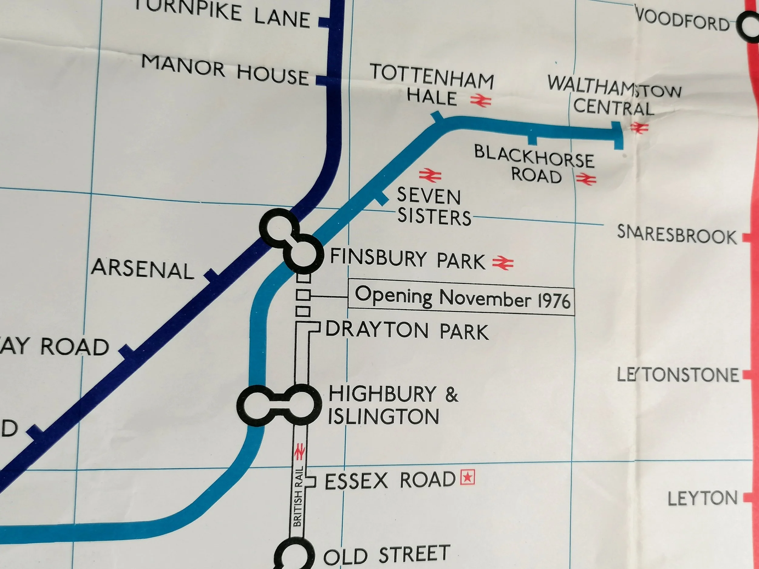
This resplendent enamel map of the London Underground can be dated to early 1933 following the opening of the Piccadilly Line extension to Cockfosters. Designed by Fred Stingemore, this was the last geographical map displayed at London Underground stations; Harry Beck's visionary diagrammatic map was already in circulation in pocket map format (Jan 1933) and station maps were replaced soon after (July 1933).
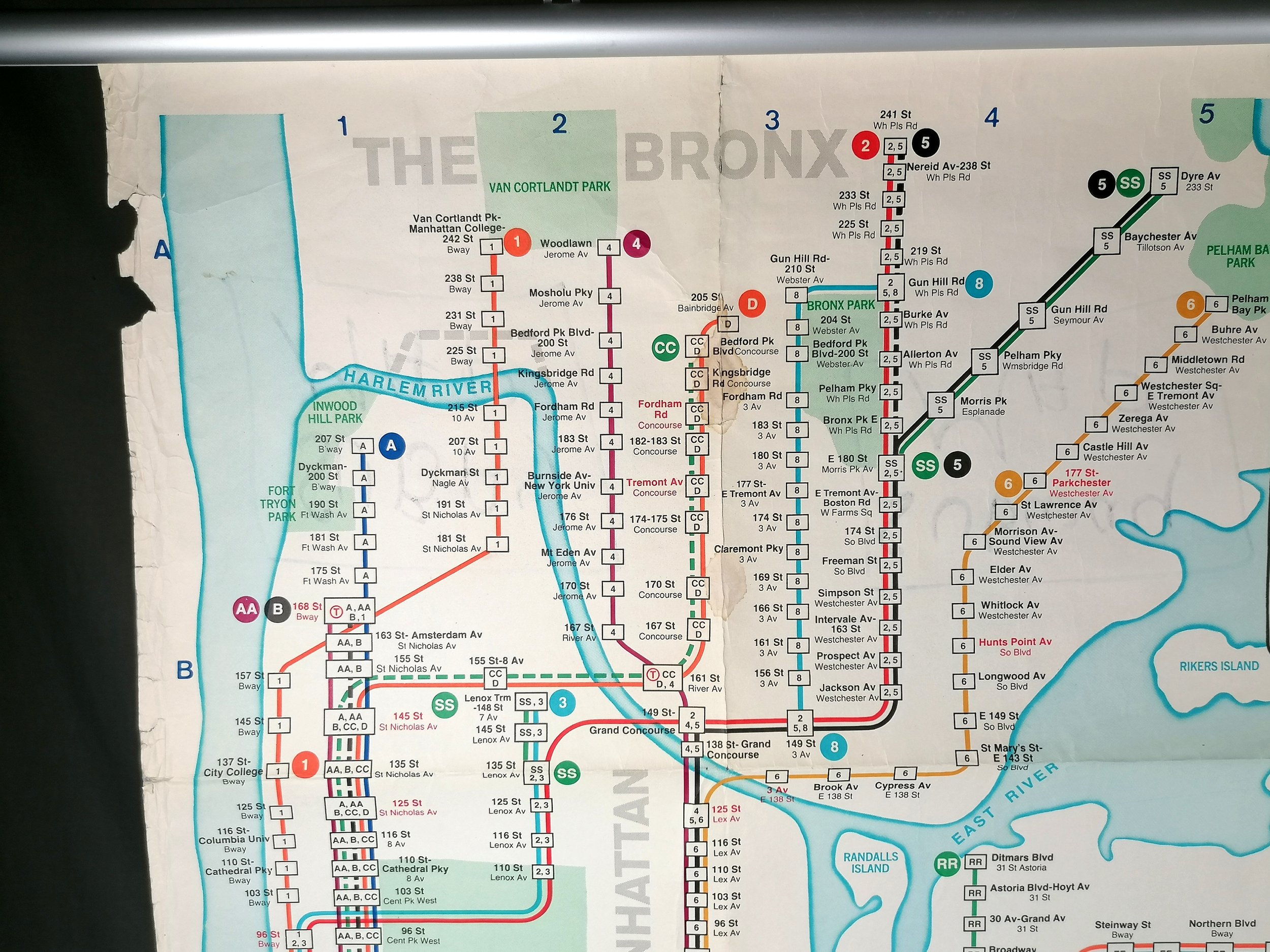
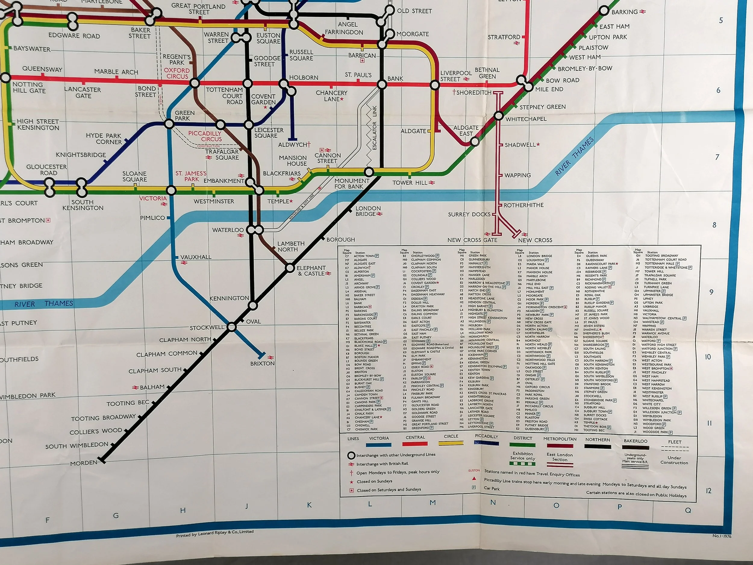
This map shows the Underground lines in their respective colours overlaid onto a topographical map with streets (grey), parks (green) and bodies of water (Blue) shown. Station names are coloured according to their line, a practise introduced from 1929. One characteristic of these enamel maps is that certain ink pigments fade - most notably the orange East London Line which on all the enamel maps I have seen have almost vanished. The Bakerloo line still has some remnants of its original bright red colour in places but it clearly knew its destiny was to be brown!
Whilst most station maps were printed on paper (with print runs usually in the low thousands), these enamel maps were produced for stations with outdoor display frames - usually at entrances. Therefore they were produced in low numbers. The bronze display frames were installed from around 1909 to carry the first unified maps of the Underground. Enamel maps continued to be issued up the mid-1930s. There are no known examples of Harry Beck's diagram on enamel but photo archives suggest there were some initially produced.
Depending on the station hardware, the enamel maps were either landscape (Quad Royal 50” x 40”) or portrait (Double royal 40” x 26”). An identical example of this map is on display at St James' Park station and there is a double royal map on display at the entrance of Temple Station.
Frederick Stingemore worked in the London Underground Drawing Office for over 40 years. He designed a broad variety of maps and posters dating back to before WWI. Most notably he designed the last series of Underground pocket maps (1925-1932) before Harry Beck's iconic diagram was introduced in 1933. Indeed it was Stingemore that encouraged Beck to submit his design again after it was initially rejected by Underground Executives.
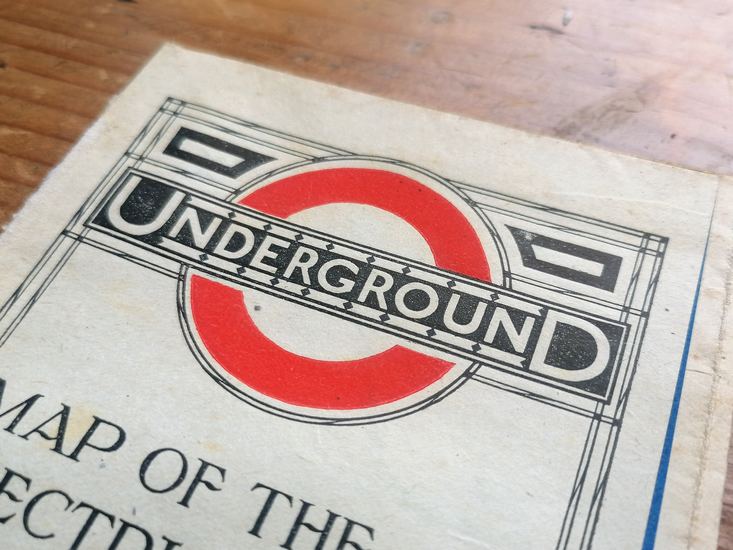
Chromo Wolverhampton (short for the Chromographic Enamel Company (Wolverhampton) Limited) were founded in 1886 and among the first manufacturers of vitreous enamel signs. They were used extensively by the London Underground railway companies from as early as the 1890s.
Free UK Delivery. For non-UK delivery please request quotation. This is a large and very heavy item (40kg+).
Underground Map of London
Vitreous enamel and rolled iron. Manufactured by Chromo Wolverhampton for the Underground Group. Circa 1933. Size: Map 127 x 101cm / Framed 130cm x 105 x 6cm. Set in a custom frame with full length wall-mounting. Condition: Excellent in-situ condition. Some surface marks/stains. Minor loss and rust at edges. Professionally restoration in places.
This resplendent enamel map of the London Underground can be dated to early 1933 following the opening of the Piccadilly Line extension to Cockfosters. Designed by Fred Stingemore, this was the last geographical map displayed at London Underground stations; Harry Beck's visionary diagrammatic map was already in circulation in pocket map format (Jan 1933) and station maps were replaced soon after (July 1933).
This map shows the Underground lines in their respective colours overlaid onto a topographical map with streets (grey), parks (green) and bodies of water (Blue) shown. Station names are coloured according to their line, a practise introduced from 1929. One characteristic of these enamel maps is that certain ink pigments fade - most notably the orange East London Line which on all the enamel maps I have seen have almost vanished. The Bakerloo line still has some remnants of its original bright red colour in places but it clearly knew its destiny was to be brown!
Whilst most station maps were printed on paper (with print runs usually in the low thousands), these enamel maps were produced for stations with outdoor display frames - usually at entrances. Therefore they were produced in low numbers. The bronze display frames were installed from around 1909 to carry the first unified maps of the Underground. Enamel maps continued to be issued up the mid-1930s. There are no known examples of Harry Beck's diagram on enamel but photo archives suggest there were some initially produced.
Depending on the station hardware, the enamel maps were either landscape (Quad Royal 50” x 40”) or portrait (Double royal 40” x 26”). An identical example of this map is on display at St James' Park station and there is a double royal map on display at the entrance of Temple Station.
Frederick Stingemore worked in the London Underground Drawing Office for over 40 years. He designed a broad variety of maps and posters dating back to before WWI. Most notably he designed the last series of Underground pocket maps (1925-1932) before Harry Beck's iconic diagram was introduced in 1933. Indeed it was Stingemore that encouraged Beck to submit his design again after it was initially rejected by Underground Executives.
Chromo Wolverhampton (short for the Chromographic Enamel Company (Wolverhampton) Limited) were founded in 1886 and among the first manufacturers of vitreous enamel signs. They were used extensively by the London Underground railway companies from as early as the 1890s.
Free UK Delivery. For non-UK delivery please request quotation. This is a large and very heavy item (40kg+).